El desecheo: Desecheo National Wildlife Refuge | U.S. Fish & Wildlife Service
Most Dangerous Destination in Caribbean
🇵🇷Puerto Rico
Steve
Uncommon travelers don’t so much laugh at danger as we’re cautious and respectful of the perils one might encounter while adventuring around the Caribbean. Hurricanes, massive surf, bush rum, crime, machete-wielding hiking guides in the dark – all can be managed with a little common sense. Desecheo Island, however, is different.
It must be avoided altogether.
Desecheo Island History
Tiny (.6 square miles), uninhabited, and remote, Desecheo lies in the Mona Passage about 13 miles west of the mainland coast of Puerto Rico. Together with neighboring Mona and Monito, the area is known as the Galapagos of the Caribbean owing to the wide variety of rare and endangered Puerto Rican flora and fauna found in these delicate and now protected ecosystems.
Things weren’t always so calm and nature-focused on Desecheo, however.
Between the Second World War and 1964, various branches of the U. S. Armed Forces held sway over the island, practicing bombing and survival training techniques. Yes, like other islands located near Puerto Rico, they turned it onto a bombing range.
Everything changed in 1976, though, when the administration of Desecheo was transferred to the U.S. Fish & Wildlife Service. By 1983, the island was designated as a National Wildlife Refuge in hopes that its rare endemic species of plant and animal would make a comeback.
So, why is Desecheo still so dangerous today?
The Most Dangerous Destination in the Caribbean
Well, the U.S. Military isn’t exactly known for employing the most thorough clean-up methods when it moves out of anywhere. In Desecheo that means you’d be liable to find unexploded ordinance laying about – a real buzzkill for any hiking or birdwatching expeditions.
To keep everyone on the safe side, the island is closed to the public. So much so, in fact, that anyone caught ashore here is subject to arrest by federal law and prosecution.
Why, then, would you want to risk venturing anywhere even close to Desecheo?
Two words: scuba diving.
Scuba Isla Desecheo
The U.S. Military may have beaten up the land portion of Desecheo pretty good back in the day, but the surrounding reefs have remained untouched, benefiting from the island’s remote location to thrive like few other undersea playgrounds around the region.
Distinctive undersea canyons, caverns, and arches combine with vibrant coral reefs teeming with life. The combination creates one of the most memorable dive and snorkel sites in Puerto Rico.
To check out the undersea wonders of Desecheo Island for yourself, contact the pros at Taino Divers in Rincon. Their motto of “Safety, Style and Dependability” suggests they won’t lead you astray… or in the case of Desecheo, ashore.
*Lead photo credit: Island Conservation via Flickr.
 uncommoncaribbean.com/puerto-rico/desecheo-island/”>Last updated by Steve Bennett on .
Related Posts
Isla de Desecheo, Puerto Rico
Skip to content
Loading…
Isla de Desecheo, Puerto RicoClaudio Uribe2017-09-13T01:26:34+00:00
¿POR QUÉ ES IMPORTANTE LA ISLA DESECHEO?
PROVEE REFUGIO A TRES ESPECIES DE REPTILES ENDÉMICOS QUE NO SE ENCUENTRAN EN NINGUNA OTRA PARTE DEL MUNDO
FUE REFUGIO DE LA COLONIA MÁS GRANDE EN EL MUNDO DEL AVE MARINA BOBA PARDA
ES UNA DE LAS TRES ISLAS MAR AFUERA DE LA ISLA DE PUERTO RICO DONDE SE ENCUENTRA EL CACTUS HIGO CHUMBO ACTUALMENTE EN PELIGRO DE EXTINCIÓN
Videos de la Operación Desecheo
Las aves de Desecheo
El Higo Chumbo
Operación Desecheo
 com/embed/iN27AtzWCD4?wmode=transparent&autoplay=0″ allowfullscreen=”” allow=”autoplay; fullscreen”>
NUESTRA MISIÓN
Restaurar las áreas de bosque en la Isla necesarias para la recuperación de las plantas y animales nativos principalmente las aves marinas.
NUESTRA VISIÓN
Que la Isla de Desecheo sea hogar para el anidaje de miles de aves marinas y que prosperen las poblaciones de plantas y reptiles.
EL PROBLEMA
Las cabras, los macacos ferales y las ratas invasoras han degradado el bosque de Desecheo severamente y han eliminado casi en su totalidad la anidación de aves marinas.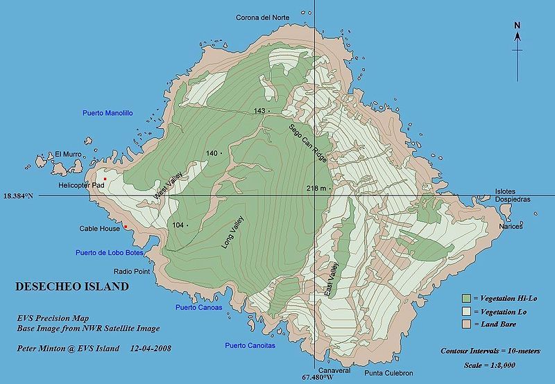
LA SOLUCIÓN
En 2012, Island Conservation y el Servicio de Pesca y Vida Silvestre de los Estados Unidos completaron la erradicación de especies invasoras que ponían en peligro la sobrevivencia de especies nativas amenazadas y vulnerables de la Isla de Desecheo.
MIDIENDO EL EFECTO
Los compañeros en este proyecto van a monitorear la anticipada recuperación de las especies endémicas y el retorno del anidaje de más de seis especies de aves marinas.
PROYECTO DE RESTAURACIÓN EN LA ISLA DE DESECHEO
A pesar de la continua degradación, la Isla de Desecheo es hogar de importantes poblaciones de plantas así como también de poblaciones de animales que no están presentes en ninguna otra parte del mundo, como lo son el lagartijo, la siguana y el geco de Desecheo. Previo a la introducción de las ratas negras, monos ferales y cabras, la Isla albergó grandes colonias reproductivas de aves marinas, incluyendo la colonia de boba parda más grande en el mundo y una colonia significativa de bobas patirroja.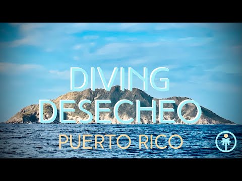 Pero, debido a la destrucción de vegetación nativa y la depredación de huevos y pichones por parte de los mamíferos invasores, actualmente las aves marinas no anidan en Desecheo y muchas plantas nativas y animales no han sido encontrados en la Isla.
En 2012, Island Conservation y el Servicio de Pesca y Vida Silvestre de los Estados Unidos completaron la erradicación de especies invasoras de la Isla de Desecheo. Con la isla libre de especies invasoras, las plantas y los animales nativos pueden prosperar una vez más en su hábitat natural. Se espera que también los arrecifes de coral en la Reserva Marina que rodea a Desecheo (manejados por el Departamento de Recursos Naturales y Ambientales) se beneficien por la restauración de la isla –el aumento de la vegetación reducirá la erosión de suelos que llegan al mar.
PROTEGIENDO UN TESORO DE PUERTO RICO
1¿QUE TIPO DE VIDA SILVESTRE NATIVA SE PUEDE ENCONTRAR AQUI? Para su tamaño, Desecheo tiene un número significativo de endemismos – especies que no están presentes en ninguna otra parte del mundo.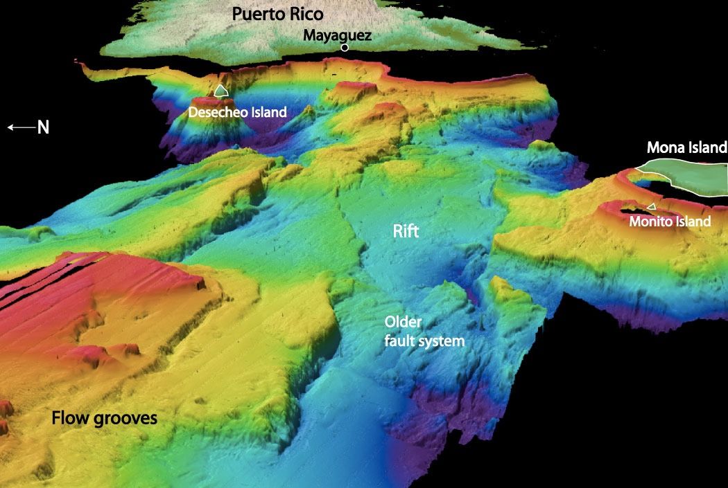 La Isla es hogar de tres especies de lagartos endémicos, el cactus higo chumbo considerado como amenazado de extinción, dos especies de arañas endémicas y una especie endémica de escorpión.
2¿CUAL ES EL META DE LA RESTAURACIÓN? Este proyecto promoverá la recuperación de miles de aves que anidan en la isla, así como de plantas y lagartijas. En ausencia de especies invasoras, se espera un regreso dramático de especies nativas. Este proyecto también ofrece una gran oportunidad para informar de los esfuerzos de restauración en otras islas del Caribe.
3¿COMO SE PODRÍAN MEDIR LOS RESULTADOS? Los colaboradores en este proyecto llevan a cabo un programa de evaluación y monitoreo llamado Medidas de Conservación. El personal de Medidas de Conservación diseña e implementa estudios de investigación que miden los cambios en poblaciones de animales y plantas de alta prioridad, como resultado de la erradicación de especies invasoras.
4¿HAY ALGUNA ESPECIE DE PLANTA RARA EN LA ISLA? El cactus en peligro de extinción Higo Chumbo fue redescubierto en Desecheo en el 2010 y actualmente se está recuperando después de la remoción de macacos ferales.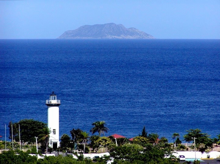 Únicamente existen poblaciones silvestres del cactus en solamente otras dos islas mar adentro: Islas Mona y Monito.
5¿QUE OCURRIÓ CON LAS COLONIAS DE AVES MARINAS DE LA ISLA? A principios de los años 1900, Desecheo fue un gran territorio para el anidaje de miles de aves marinas: aproximadamente 15,000 bobas pardas, 2,000 bobas patirroja, 2,000 cervera pardas, 1,500 charrán monja y cientos de tijeretas, gaviotas gallegas y charranes oscuros anidaron en la Isla.
Go to Top
Best Country: Geography of Puerto Rico
Puerto Rico is located in the West Indies, in the north of the Caribbean Sea, on the island of the same name. With an area of 9.1 thousand square meters. km is the smallest of the Greater Antilles. In the north it is washed by the waters of the Atlantic Ocean, and in the south by the Caribbean Sea. Neighboring countries: the British Virgin Islands (in the northeast), the Dominican Republic (in the west), and the Netherlands Antilles (in the southeast). nine0003
Territory of the country of Puerto Rico – 13.7 thousand sq. km, it includes the island of Puerto Rico itself and other small islands of the Caribbean (Vieques, Culebra, Mona, Culebrita, Palomino, Mona, Monito, Deseceo and Caja de Muertos). The largest width of the island is 65 km, and the length (from west to east) is about 180 km.
The climate of Puerto Rico is warm, even, without sharp temperature changes (winter is somewhat cooler than summer – in winter it is up to 24 degrees, and in summer it warms up to 30, and the temperature of day and night is almost constant). From the point of view of geography, such a climate is called a tropical trade wind. The temperature in the southern regions is usually slightly warmer than in the northern territories, and in the center it is always noticeably cooler than on the coast. This is due to the fact that the central part of the island is mountainous. nine0003
Most of the country is occupied by the mountain system of the Central Cordillera with the highest point – Cerro de Punta , 1339 m).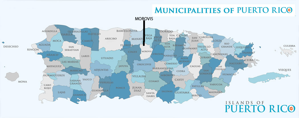 The massif of the island is composed of rocks of the Cretaceous and Eocene (the “oldest” sites were found in the southwestern part of the island – 190 million years).
The rocks that form the upper layers of the soil are highly weathered, so the areas located on the outskirts are rich in fertile river valleys and flattened hilly areas, and in the green northwestern part of the island there are quite a lot of caves and sinkholes. The amount of annual precipitation depends on the part of the island, and significantly – fluctuations from 900 in the south and west of the country to 2000-2500 mm in the area of El Yunque peak.
Very often such natural disasters occur in the territory, such as hurricanes with a wind speed on the periphery of a typhoon up to 150 km/h. If I may say so, they are quite common. It is assumed that the word “hurricane” comes from the name of the Puerto Rican god of evil Huracan. The season of heavy rains, gusty winds and hurricanes falls from May to November. The weather during this period is quite hot, very humid and windy. nine0003
Parallel to the northern coast of the island stretches the Puerto Rico Trench (length 1070 km, depth up to 8742 m) – one of the deepest underwater trenches in the Atlantic Ocean.
The water resources of Puerto Rico are quite extensive, for such a small island – there are 17 lakes (although most of them, even almost all of them are artificial) and more than 50 rather full-flowing rivers running down the slopes of the Central Cordillera. The rivers in the northern part of the island are much more full-flowing than in the south. nine0003
Due to the fact that in previous years and decades the nature of Puerto Rico has been heavily damaged, mainly by human activities. Therefore, the government allocates sufficient funds for the conservation and restoration of nature. About 5% of the country’s territory is reserved for wildlife sanctuaries and national parks.
More than 230 species of plants found only here , about 20 species of birds, including the rarest Puerto Rican parrot, and about 40 endangered species of reptiles can be found in them. The country’s natural rainforests are its true pride, and here you can find both the humid rainforests of the northwestern part of the country and the dry coastal forests of the southern region. nine0003
The amazing island of Puerto Rico
An island located in the Caribbean Sea Puerto Rico always attracts tourists with its incredibly beautiful nature with a wonderful climate, the weather here always sets you up for a vacation, regardless of the time of year.
The largest city and capital of the country is San Juan, it was founded by the Spanish colonialists in the 16th century, now it is a modern city with high multi-storey buildings, but it also has old houses. The city has preserved several important historical buildings. In ancient times, many buildings were erected in it, which served as protection from pirate raids. The city has a large port, industrial and financial centers, many cultural, historical, and its coastline is famous for its white sandy beaches. nine0043 Another large city of Ponce, the second after the capital, it was founded by the Spaniards at the end of the 17th century, it is often called the pearl of the country, it is located in the southern part of the island. The territory of the city is built up with cathedrals, colonial houses, there are many squares, beautiful fountains, and its Museum of Art is considered the best among the Caribbean countries. A trip to the island is undeniably amazing, but if you can’t plan such a long and extensive trip, Ankara Moscow flights will help – Turkish resorts have long been loved by Russians. nine0043 Picturesque San Germán is spread among gentle hills, it is the oldest city in Puerto Rico, back in the early 16th century the Dominicans built the Porta Coeli church here, it was also used as a prison, after which it was restored. Near the city there are famous beaches and the bay, they are recognized as the best on the island.
Surfers are always attracted by the city of Rincon, located on the west coast, from October to April, lovers of high waves come here, since the entire coastline is famous for the surf and the wave layer of 5 points. Experienced surfers prefer to relax here in the winter, because it is in winter that the most stormy.