El yunque hiking: Best Kid Friendly Trails in El Yunque National Forest
Best Hikes in El Yunque National Forest in Puerto Rico
The only tropical forest on U.S. soil, El Yunque’s four distinct forest zones are laced with some of the most accessible hiking trails in the Caribbean.
Pretty much unchanged since the Spanish first arrived in Puerto Rico in 1493, El Yunque harbors a spectacular array of flora and fauna. Part of the Sierra de Luquillo on Puerto Rico’s East Coast, the 28,000-acre tropical rainforest has 13 well-maintained hiking trails that attract hikers of all levels. Short paved trails in the north and more primitive dirt paths in the south lead hikers through a magical realm of serrated peaks, cloud-laced mountains, frothy cascades and colossal boulders.
El Portal Visitor Center
On January 20, 2022, El Yunque’s visitor center, El Portal, reopened for the first time since Hurricane María caused extensive damage in 2017. After investments of some $20 million, the state-of-the-art space is fresh from a major overhaul and is well worth allowing an hour or two, at least.
The 40,000-square-foot space (3,716 sq. m) was built using wood from trees felled by the hurricane and is emblematic of Puerto Rico’s spirit of reclamation and renewal. The center mounts a series of interactive exhibits that promote close encounters with resident wildlife, including the endangered Puerto Rican parrot, and reveal ongoing conservation efforts. There are also multimedia displays by local artists, a restaurant and a movie theater. Visits begin with a stirring documentary—produced by Puerto Rican filmmaker María Falcón and narrated by Benicio del Toro—which educates visitors on El Yunque’s distinct ecosystems. A new, accessible trail winds through the surrounding area with interpretative panels that speak to a renewed focus on sustainability, conservation and community engagement—in its previous incarnation, El Portal catered to mass tourism rather than the local community.
Trail system
Most trails are less than a mile long and do not require any scrambling, technical skills or advanced fitness. The epicenter of visitor activity is the north side of the forest, where mostly paved trails create the best hikes in El Yunque for families. The southern recesses are the preserve of more experienced hikers. A challenging 8-hour hike connects the north and south sides of El Yunque.
If hiking is not your thing, you can drive along PR-191 into the mountains where observation areas and picnic spots afford spectacular views.
Flora and fauna
The forest is located high above sea level—El Toro its highest peak at 3,524 feet (107m)— and it comprises four forest zones: some 65 percent is tabonuco forest, which gives way to Palo Colorado forest, sierra palm forest and, at the top, cloud or dwarf forest. El Yunque is home to more than 200 species of tropical trees and an incredible inventory of flora and fauna, including the raucous greenish blue, red-fronted Puerto Rican parrot, once practically extinct but now growing in numbers. Extremely rare sightings include the Puerto Rican boa, which grows to 7 ft (2./images/2022/10/14/hiking_guide_showing_senior_group_surrounding_mount.jpg) 1m). Prepare for rain during your visit; the annual rainfall here exceeds 100 billion gallons.
1m). Prepare for rain during your visit; the annual rainfall here exceeds 100 billion gallons.
Watercourse in the rainforest El Yunque National Forest, Puerto Rico / Getty Images
Best Hiking Trails
El Yunque Peak
The park’s signature El Yunque hike is doable for anyone in reasonable shape. It’s well worth the climb for the incredible views from the summit. The 4-km (2.5-mile) paved trail weaves amidst a medley of flora and fauna—gorgeous wildflowers, brightly colored bromeliads, huge ferns, cacophonous birdlife and sonorous tree frogs.
Traversing each of El Yunque’s four forest zones, you’ll slowly ascend through Palo Colorado forest, sierra palms, misty rainforest and cloud forest where dwarf vegetation rarely tops 10 ft (3m). From the summit you can view the snaking coastline of the North Coast and Puerto Rico’s easternmost tip.
If you have the time and energy, it’s worth taking the short out-and-back Los Picachos trail for its beautiful views. The trail intersects with El Yunque trail; take the right fork for Los Picachos, left fork for El Yunque. From here, El Yunque trail is not as well maintained and, at this point, it justifies its official classification as “moderate to challenging.”
With a total elevation gain of 1,500 ft (457m), the 8km (5 mile) round trip takes about four hours. It’s best to hike the trail in the morning to maximize your chance of a clear view from the peak.
Mount Britton Trail
A rewarding short hike, the paved Mount Britton trail is one of the park’s most popular hikes. Accessed from a loop road (PR-9938), located off the upper (southern) end of PR-191, the 1.3km (0.8 mile) out-and-back trail ascends through cloud forest to an altitude of 3,000 ft (914m). The hike’s namesake Mount Britton tower was built in the 1930s by the Conservation Corps. Technically rated an advanced trail, it’s steep in some places and can become very slippery in wet and humid conditions. If the conditions are clear, panoramic views from the tower’s observation deck extend across the Atlantic Ocean, the Caribbean Sea and the eastern coastal plain. Along the trail, keep a lookout for El Yunque’s abundant orchid and fern species which share their habitat with millions of tiny tree frogs, or coquí (pronounced “ko-kee“).
The Mount Britton trail connects to El Yunque trail—one of the island’s highest peaks at over 3,500 ft (1,070m). To reach El Yunque summit, it’s around another mile (about an hour’s hike).
Rio Sabana Trail
Located in the wild and primeval southern recesses of El Yunque, the Rio Sabana trail offers challenging terrain for experienced hikers. Located on PR-191, the 4.6km (2.9 mile) trail begins to the right of the picnic tables. With an elevation gain of some 1,000 ft (304m), it takes around 90 minutes each way to reach the trail’s intersection with the Tradewinds trail, which leads to El Toro Peak. Be mindful that dense, encroaching vegetation and hazardous landslides between the Tradewinds/Rio Sabana junction and El Toro Peak may require alternate routing.
A short hike along the lower section of Rio Sabana trail, provides immediate insight into the park’s primordial aura and staggering biodiversity. This lower section is in much better condition than at the higher elevations. To ascend along the dirt track, you may have to negotiate fallen trees and other detritus resulting from landslides and hurricanes. Regardless of the season, you should prepare for muddy, slippery conditions.
The route climbs through a spectacular profusion of tree, plant and orchid species—flora and fauna that is rarely seen on the busier trails. You’ll pass through sierra palm forest, traverse trickling streams and often clamber over giant boulders. After around one hour, you’ll reach a river crossing with a picnic area. Once you cross the river, the trail becomes densely overgrown and much harder to follow.
Waterfall Hikes
Angelito Trail
El Yunque’s most memorable hikes culminate in beautiful views, picturesque waterfalls and refreshing swimming pools. One of the park’s most family-friendly (and heavily trafficked) trails, Angelito provides great rewards for little effort. Located on PR-988, to reach the trailhead take the first left after entering El Yunque from the Rio Grande entrance. The short and sweet 0.8km (0.5 mile) trail quickly immerses hikers in El Yunque’s magical scenery. A relatively flat, out-and-back, gravel path weaves provides families with a perfect initiation into the wonders of the rainforest. After around 40 minutes, the trail ends with a series of small waterfalls which cascade into an idyllic swimming spot on the Mameyes River. Note that after rain, the path can become muddy and uneven.
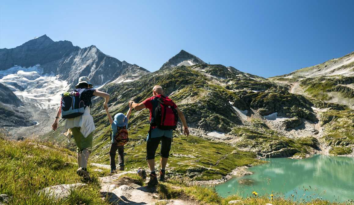
A family spends time at El Yunque National Forest / Omark Reyes / Discover Puerto Rico
La Mina Falls
At less than one mile in length, this crowd-pleasing hike in El Yunque provides instant gratification. It’s El Yunque’s most sought after trail—and for good reason—it traces the course of La Mina River. A well-maintained path weaves through beautiful foliage, in every conceivable shade of green, before concluding at the photogenic La Mina waterfall. Hiking time is approximately 40 minutes (each way) and the trail is rated as advanced; the only tricky part is a series of steps which can be physically demanding. The photogenic waterfall cascades over 35 ft (11m) into an enchanting pool where you can either take a dip in the cool water or just relax and enjoy the view.
Make sure you wear sturdy shoes; the rocks to get to the swimming pool are slick. As this trail gets very busy, it’s best to arrive when the park opens at 7:30am before the tour groups descend.
Juan Diego Falls
This short, easy to navigate trail leads to a series of ever more impressive waterfalls. As you drive up the mountain (southwest on PR-191), you’ll find the trail entrance tucked behind a barrier, at approximately KM 9.8. A steep path along the right-hand side of the stream leads to the first of “Lower Juan Diego falls” (around 6.5 ft/2m tall). The larger (20 ft/6m tall) and more impressive waterfall can be seen behind and above and is fronted by a picnic area. On the right-hand side of the falls, a narrow path along a muddy bank leads to “Upper Juan Diego Falls.” At the top, head left to access the 40ft (12m) waterfall which cascades into a lovely swimming pool. This is not technically part of the official trail and so it’s not advised for novice hikers or young children. If you want to access this spot and other unofficial park highlights, it might be worth recruiting the services of a local guide.
A car drives through Puerto Rico’s El Yunque National Forest / Dukas / Universal Images Group / Getty Images
Driving through El Yunque
If you’re not a hiker but would love to experience the rainforest from the comfort of your vehicle, you can follow PR-191 and drive through El Yunque. Even from a car window, you’ll get a good sense of the scale and majesty of the park. From designated observation areas you can have a picnic and take in breathtaking panoramas of the forest and the North and East Coast of the island.
Before you go
Note that El Yunque currently requires reservations. If you know the date you’re visiting, book as early as possible. If you’re a day-of planner log into the reservation system early— spots open up every day at around 6am.
Practical information
Entry: El Yunque is free to enter; a $2 processing fee is applied to credit card bookings. Currently (due to COVID-19), advance reservations are required. Visit the USDA Forest Service for more information on recreational passes and permits.
Getting there: El Yunque is a 45-min drive from San Juan. With a reliable rental vehicle and GPS, tours aren’t necessary.
Getting around: One main road, PR-191 winds through El Yunque providing access to hiking trails and waterfalls.
Suitable for: There are novice to advanced rated hikes, suitable for all ages and abilities.
What to wear: El Yunque experiences some 200 inches of rain each year. Prepare for muddy and slippery hiking conditions; gym shoes and light raincoat recommended.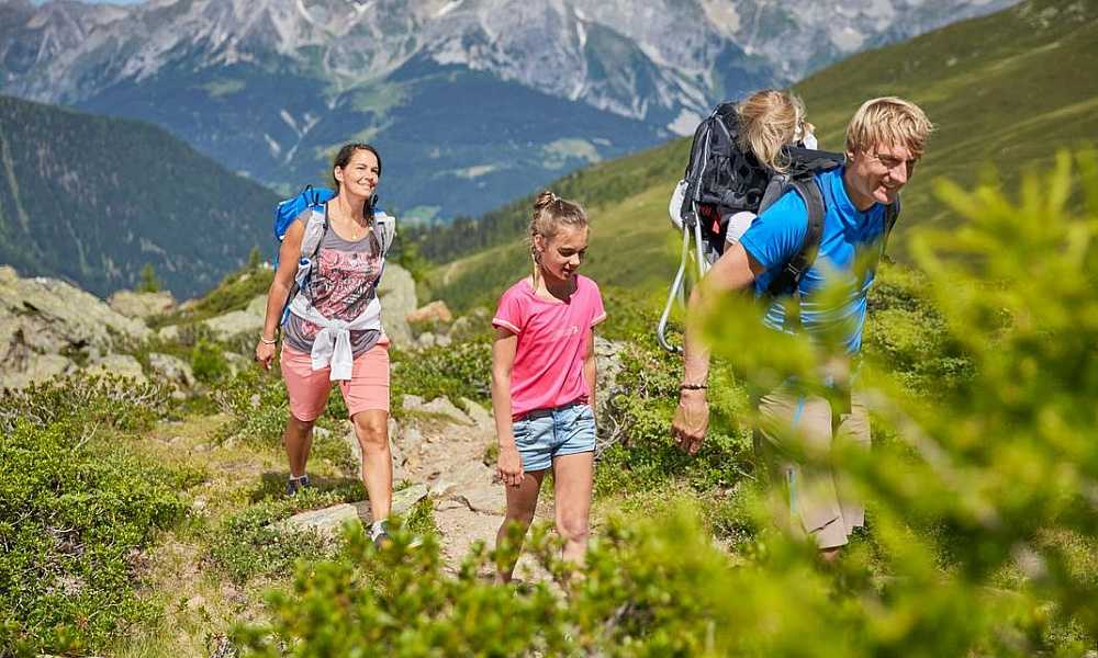
Use this map to locate all the spots mentioned here:
Hike Through the El Yunque Rain Forest , Rio Grande, Puerto Rico
- Puerto Rico
- Rio Grande
Rio Grande, Puerto Rico
Rated 4.6/5
based on 5 reviews
based on 5 reviews
Save
View all 15 photos
All 15 photos
Save
Review
Directions
Add Photo
Details
Distance
5 miles
Elevation Gain
1500 ft
Route Type
Out-and-Back
Description
Added by Emily Kent
The beautifully lush El Yunque National Rain Forest is located in Northeastern Puerto Rico.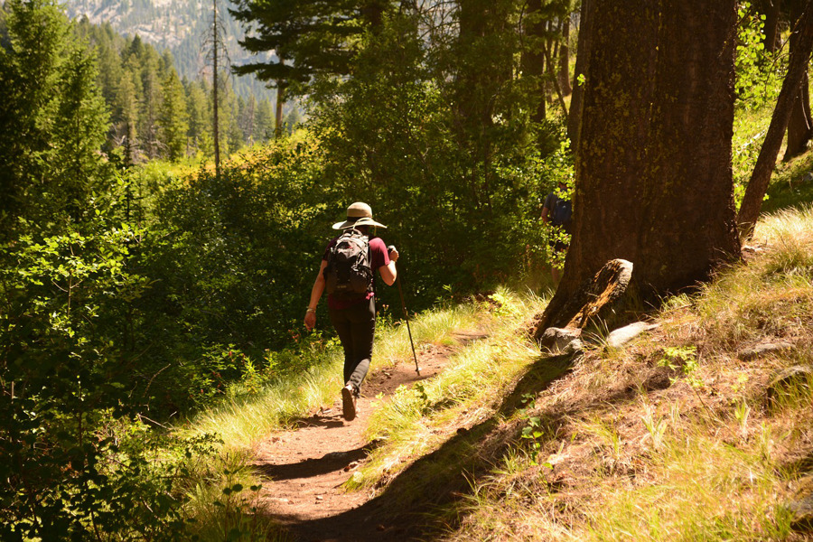 The hike along the El Yunque Trail will take you to the peak of the rain forest for a breathtaking vantage point.
Hiking the El Yunque Trail is a 5 mile round trip, about 3 to 4 hours in duration, with a moderate to difficult skill level. In parts, the paved path is well-maintained, and in others, you’ll need to navigate very wet, muddy terrain. The trail takes you up up through the Palo Colorado Forest, to the Palma Sierra, and finally the Dwarf Forest. Be sure to take note of your path as certain areas of the trail are not well marked. Look for waterfalls and natural pools along the way, as well as the native Coqui Tree Frog – listen for them!On the way back, you can retrace your steps or take an alternate route along the Mt. Britton Spur Trail, which will take you to the Mt. Britton lookout tower for an amazing, sweeping view of the forest. It’s hard to go wrong with any path chosen here!
Directions:
Take Route 3 to Rio Grande. Once you reach Rio Grande, take Route 955 to Road 191.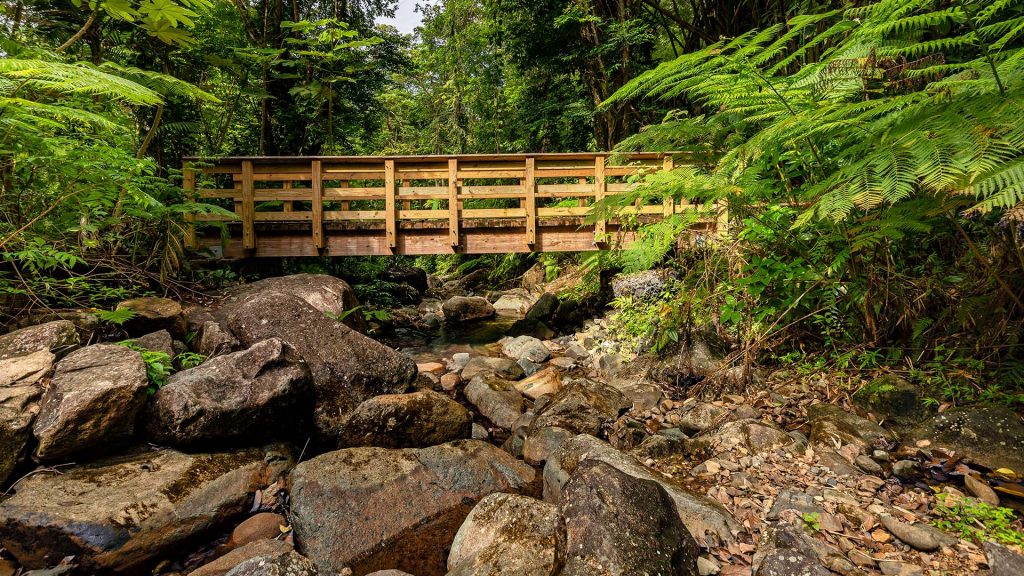 Continue on Road 191 until you see the El Yunque Trail head, located at Kilometer 12.2. It’s directly across from the Palo Alto Information Center. Park in one of the parking lots for the center or along the roadside if it’s full.
GPS Coordinates:
El Yunque Peak: (18.310433, -65.791436)
El Yunque Trail: (18.301547, -65.784858)
Note: Road 191 is currently closed (1/2016) above the Palo Colorado Visitors Center. In order to get to Mt Britton Tower (or trail) if you’re planning to visit this tower, you need to take the El Yunque Trail up and then turn left when you get to the “chimney” T (as opposed to going right at this point which will get you toward EL Yunque Peak).
Read More
Download the Outbound mobile app
Find adventures and camping on the go, share photos, use GPX tracks, and download maps for offline use.
Get the app
Features
Photography
Backpacking
Hiking
Forest
Romantic
Scenic
Waterfall
Wildflowers
Wildlife
Reviews
Kyle C
Hike Through the El Yunque Rain Forest
12/15/20
The rainforest is a pretty wild place and this is a great place to go and explore to mix up your trip.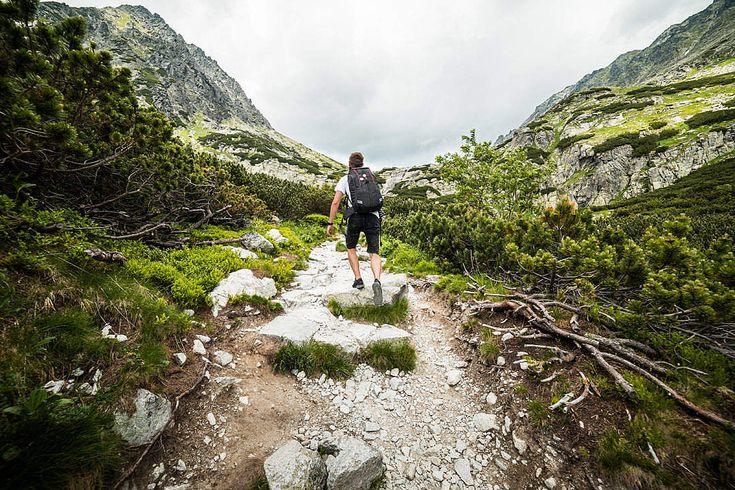 From what I remember it was crowded, but only at concentrated places like the waterfalls.
5.0
El Yunque is one of the only rainforests on U.S. soil. It is a beautiful hike that can get crowded, especially at the waterfalls and swimming holes.
5.0
Elena P
Hike Through the El Yunque Rain Forest
07/21/20
This rain forest is a very beautiful hike. However, it has changed since the hurricane a couple years ago.
4.0
El Yunque is a very popular destination. If you go to La Minha Falls to get your fill of beautiful waterfalls, expect a lot of tourists. The hiking paths are hilly. The views are amazing. Also, some trails are dangerous as well as difficult. Parts of the trails are thin, overlook a steep hill, and are slippery. It can be a rough combination. However, there are plenty of paths for beginners or for those seeking a casual experience. Just as around to find out which are best for you. Wildlife can be hard to see on the popular trails. The traffic can also be terrible, so I’d suggest not driving yourself unless you’re familiar with the area. The roads turn tightly and there can be a lot of traffic (both tourists and other cars). Also, make sure to check out the observation tower for some spectacular sights.
4.0
Wonderful hike. Just make sure to hit the restroom before you start, bring water to keep hydrated and take a camera.
 org/Rating”>
5.0
Leave No Trace
Always practice Leave No Trace ethics on your
adventures and follow local regulations. Please explore responsibly!
Nearby
Explore Juan Diego Falls
Juan Diego Falls are a pair of waterfalls that can be accessed by an incredibly short and ignored trail when passing through El Yunque.When driving up the mountain (heading southwest on 191) the trail entrance can be found behind a road barrier on the right hand side of the road at approximately KM 9.8. This is at a corner between Yokahú Tower and Big Tree Trail’s parking areas. There are ma…
Explore Playa la Pared
Wake up early for the sunrise on the beach and you won’t regret it! Unless of course you hate beautiful sunrises… Parking is easy with a public parking lot right next to the beach entrance, you can’t miss it!After you finish enjoying the view, start walking to the right and you will encounter what feels like a whole other world. There are no buildings along this side and it is full of palm …
Surf Aviones
This is a reef break in San Juan Puerto Rico. This is probably the most consistent wave on the entire island of Puerto Rico! It’s a very popular summer time spot for surf, as waves become unmanageable when the large NW swells come through. This wave offers both lefts and rights. I would recommend this spot for the more experienced surfer, since the wave isn’t the most forgiving and there is a…
Catch A Sunset at Escambron Beach
I took my first cruise earlier this year and Puerto Rico was one of the stops. This beautiful beach is only a 33 minute walk from the cruise terminal and you’ll get to see a decent amount of Puerto Rico on the walk. Check out the murals across the street too!
At the beach
You are able to snorkel and the reef makes it easily swimmable. The views are great too; to the west you can see the Capi…
Stroll through Old San Juan
*Puerto Rico’s history is very interesting. Exploring Old San Juan is fun, informative, and full of culture.
*There are unlimited options for food in Old San Juan, I recommend trying Mofongo, which is made from a plantain. Find a rooftop bar to take it all in (and maybe have a mojito or two!).
*Take pictures of the buildings and streets. It’s hard to find colors like this anywhere else in A…
Explore Castillo San Felipe del Morro
This is an awesome place to check out if spending some time near San Juan. This castle is located on the far side of Old San Juan, offering awesome views of the ocean and surrounding areas.
It costs $7 USD (for adults) to enter, and can be paid at the main entrance when you arrive. This also acts as a pass to other local castles operated by the National Parks Service (keep your receipt for pro…
Discover
- Local Adventures
- Tours and trips
- Camping Nearby
- Stories
Community
- Shop
- Outbound PRO Membership
- Add your property
Follow Us
- YouTube
© 2022 The Outbound Collective – Terms of Use – Privacy Policy
Tours Guantanamo Cuba 2022, ✈ hotel reservations and prices for holidays
High season
May – September
Temperature
Air: +30…+31 °C
Water2:Currency
Cuban peso
Time
-7 hours to Moscow
Guantanamo
- Guantanamo -Sunny Kubinsky city with a wealthy history and friendly residents.
- On the beaches of the resort, tourists relax on the coast of the turquoise Guantanamo Bay.
- Alexander Humboldt National Park fascinates with the grandeur of mountains, forests and rivers. Rare birds live in the reserve – the Cuban Amazon, the hook-billed kite and the white-billed woodpecker.
- Zoologico de Piedra is a family holiday destination where visitors take photos with stone statues of elephant, boar, lion and gorilla.
- At the costumed Festival del Caribe, party to the sound of vibrant Cuban music. nine0008
 nine0008
- Description of hotels
- About the resort
- Tours to this resort
About the resort
Reasons to go
- Attractions. Church of Santa Catalina is an ancient building, decorated with elements of 19th century architecture. In the picturesque Alexander Humboldt Reserve, tourists enjoy the beauty of mountains, mangroves, rivers and watch parrots, hummingbirds, lizards and snails.
- Beaches. Located 30 km from the city are stretches of Tortugilla Beach, Doña Yuya and Yateritas Beach where you can soak up the sun, swim in the blue Guantanamo Bay and enjoy refreshing cocktails at the waterside cafes. nine0008
- A boat trip on the Yumuri River is refreshing in hot weather and allows you to enjoy beautiful views of the rocks and lush greenery. Hiking to Boma Bay, the El Yunque and Paso de los Alemanes mountains, on the tops of which tourists take panoramic photos of natural landscapes, are popular among trekking enthusiasts.
nine0008Did you know…
- In the vicinity of the city there is an unusual landmark – the American military base, which houses the Guantanamo Bay prison. The camp contains criminals accused by the US government of terrorism.
- The resort was founded by the Spaniards in the 16th century.
- In the famous song of the Cuban musician Jose Fernandez “Guantanamera” is sung about love for a girl from the city of Guantanamo, who left the main character. nine0008
- The main sources of income are tourism, cultivation of sugar cane, coconuts and cocoa beans.
Travel life hacks
- Guantanamo is one of the most comfortable hotels for tourists – Islazul Guantanamo.
- Keep money and original documents in the hotel safe, and take a copy of your passport with you.
- Tourists move around the city on three-wheeled rickshaws. The average price of a trip is $1. nine0008
- Car rental costs from $60 per day, bicycle – $1 per hour.
- When traveling by car, please note that it is dangerous to give passengers a lift due to frequent robberies.
What to drink/eat?
Meat:
Picadillo. Braised beef with rice and spices.
La Caldosa. Chicken stew, ham, sweet potato, corn and spices.
Fish:
Ensalada de aguacates. Salad of avocado, salmon and mango. nine0005
Vegetarian:
Bognato con mojo.
Boiled sweet potatoes with garlic-citrus sauce.Moros and Christianos. Stewed rice with black beans.
Snacks:
Platanos. Fried banana slices.
Drinks:
Aguardiente. Traditional vodka made from sugar cane.
What to buy?
- Guayabera. Men’s linen or cotton shirt with pockets is a symbol of the local culture.
- Bacardi. Popular brand of Cuban rum has a pleasant aroma of coconut, mango and citrus, and a slight sourness in the taste. Cost – from $ 10 for 0.7 liters.
Tax Free
Not valid.
Where to photograph/what to photograph?
- Church of Saint Catalina. nine0063 The 19th century Catholic Church is an old building on the resort map. The building is decorated with a bell tower, statues of the Virgin Mary and Jesus, columns, candelabra and stained glass windows.
- Alexander Humboldt National Park. The reserve is named after a German scientist. It occupies 71 thousand hectares and is included in the UNESCO World Heritage List. During the tour, tourists take photos of rivers, mangrove and pine forests, majestic mountains and endangered birds: the Cuban Amazon, hook-billed kite and white-billed woodpecker. nine0008
- Church of Saint Catalina. nine0063 The 19th century Catholic Church is an old building on the resort map. The building is decorated with a bell tower, statues of the Virgin Mary and Jesus, columns, candelabra and stained glass windows.
Where, why?
- Fun – Festival del Caribe. Every year from early to mid-July, the streets of Guantanamo and Santiago de Cuba are filled with people in colorful costumes who sing and dance to fiery Cuban rhythms.
- Family holidays – Zoologico de Piedra. The unusual zoo features 425 stone sculptures of animals up to 3 m high. Kids and adults take photos near the figures of an elephant, a wild boar, a lion, a buffalo, a gorilla, a turtle and a peacock. nine0008
Geography and landscape
Guantanamo is a city in the southeast of Cuba, the capital of Guantanamo province.
Mountain landscape. The highest point is Mount El Yunque (575 m).
Tropical climate.
Emergency numbers
Police: 116, 820-116.
Ambulance: 242-811.
Fire Department: 811-115.
Embassies and Consulates of the Russian Federation
No. The nearest embassy of the Russian Federation is located in Havana.
- Barakoa
- Varadeero
- Clala
- Vignacles
- Gavana
- Granma
- Guantanamo
- ° D. Cayo Guillermo
- Fr. Cayo Coco
- about. Cayo Largo
- about. Cayo Santa Maria
- Camagüey
- Matanzas
- Holguín
- Pinar del Río
- Santa Lucia
- Santiago de Cuba
- Ciego de Avila
- Cienfuegos
- Trinidad
- Jibacoa
Can I help you?
We will select the best tour for you in a few minutes
By clicking on the button, you consent to the processing of personal data and agree to the privacy policy
Thank you! We will contact you as soon as possible
Papons graze in mammoths: Sturm El Yunque
But it all started well.
The rain that wets our
group in Humboldt Park, stopped by the evening. And in the morning I was expected
wonderful sun outside the window. It was very helpful, because the second sortie I
planned to make to the table mountain El Yunque, the same one that is visible beyond
Baracoa Bay, and which, according to legend, Columbus saw. I dressed in dry
picked up a backpack, and ran to the office of “Kubatur”. The group on El Yunque was
quite small, so after a short wait they put us in an elderly jeep and took us to the distant suburbs of the town of Baracoa. From yesterday’s acquaintances in the group
There was a Dutchman named Syurd. I managed to remember the name only due to the fact that some travel notes in the old netbook were preserved. nine0005First photo stop at the bend of the Duaba river,
flowing into the Atlantic Ocean. In the interfluve of the Duaba and familiar to us from the past
Toa report and there is a flat-topped mountain known as El Yunque that
translated from Spanish as “anvil”. It is believed that it is from this mountain
opens the most picturesque panorama of Baracoa.El Yunque is also a specially protected natural
territory, being part of the Cuchillas del Toa Biosphere Reserve. In addition, from 1979 years it has the status of a national monument
Cuba, and several eco-trails are organized here. Well, me in this case
interested in only one, the one that leads to the top of the mountain.The length of this trail is only five kilometers, which, however, is not
should be embarrassing, because for these five kilometers there is a rise of about 527 meters, that is
the height of an almost 180-story building. And it was not necessary to climb the stairs, but
forest path. It is not for nothing that this sign at the visitor center honestly states that
The difficulty of the trail is high, and it takes as much as five hours to complete it. How in
As a result, it turned out that five hours is still an optimistic estimate. nine0005But so far so good. The sun was shining and we were doing
the first hundreds of meters along the palm groves off the coast of the slow transparent Duaba.
True, a certain suspicion has already begun to appear, since nowhere in the foreseeable
perspective, no bridge was visible, and the mountain was obviously on
on the other side…Well, the suspicions turned out to be groundless. Our young
the mulatto escort cheerfully led us to the water
and in poor English he explained that it was necessary to cross to the other side. Wade. nine0005-Eh… How deep is it?
The guide, after a little hesitation, guided himself along the waist. Hm, here
That’s right, I put on swimming trunks. He took off his sneakers and shorts, putting them together in a backpack.
with a camera. Seurd, lazily pulling down his trousers, said, “Looks like it’s going to rain.
Something is somehow soaring strongly … “.– Spit! – I was indignant: Only we did not have enough rain!
And I bravely entered the water.
Well, maybe she was somewhere
belt, but where, it was only known from the group
our bastard guide, and he was the last one. I found a path that allowed
dive too deep, though not to the waist, but the poor fellow Seurd found a deep place, so
that on the other side he had to wring out his shirt. nine0005Puffing, climbing ashore. There is no place to squeeze the swimming trunks,
I’ll have to put shorts on them – maybe they’ll dry right on me, but straightened up,
and looking up the mountain, I found that while we were looking for a passage in the river, the sky
cloudy and it started to rain. Indeed, while we were looking
cocoa plantation at the foot of the mountain, it was still nothing, and I even hoped that
now the rain will end and the clouds will carry away, but as soon as we started the path uphill,
someone upstairs seemed to have flipped a switch, turning the rain out of
“Drip-drip-drip” into the “Autumn drizzle” mode. nine0005As any field worker knows, although walking along a forest path is not so
difficult, it is still much more difficult than on an asphalt path. But this
little things compared to hiking on a forest path in the rain. Reddish clayey
the trail becomes wet and slippery as soap. In some places it narrows or
loops too tight, so you have to grab onto the plants that are being sprayed
you with water also from above. And then there is dientes de perro , “dog teeth”… Oh, you,
probably don’t know what 9 is0311 dientes de perro .
With this joy you can meet in the places of occurrence of limestones, that is, in
There are many places in the tropics, and El Yunque is no exception. Limestone is a sedimentary rock
formed as a result of sedimentation in the water column of particles of organic
origin, for example, shells of mollusks or protozoa. And the looseness of this
rocks are very variable, so that in some places the limestone can be loose, like chalk,
and in some places, hard as marble. If a limestone slab suddenly fell on
land surface, after millennia of rain and wind soft fraction in limestone
is washed out, and porous hard rocks remain, which, breaking off, form
sharp fragments, called “dog teeth” in Cuba. I’ve already removed these teeth
near Varadaero, in the Varaiikos reserve. But those on El Yunque are no worse. nine0005And yes, remember that the path is uphill. Something with the rain
I was even lucky, because the one and a half liter bottle of water that I took with me
enough just to the top. You wander on slippery clay, stopping more and more often
catch your breath, the sweat on you has long been mixed with rainwater, and you curse your
overweight. The bright spot of the walk was the stop at this booth
about half way. The booth is run by a local fruit growing cooperative, and for one
cook here you can refuel with fresh sour fruits that are grown in
lower reaches of the mountain. nine0005Bananas (where would the tropics be without them?), oranges, grapefruits
and pomelo, I believe, are familiar to everyone. A lesser known relative of the taiga oxalis
carambola, which has the English name star fruit , since its fruit in the context has the shape of a five-pointed
asterisks. But an oblong, very sour fruit, similar to a small cucumber,
was no longer familiar to me. Bare-chested fruit grower peeling fruit
explained that the fruit is called pepinillo ,
which is translated from Spanish as “cucumber”. “Pepinillo” indeed
phenomenally sour, so that it is eaten with honey (a dark glass bottle on
table and contains honey), and in Baracoan cuisine it is used for marinating
pork (usually lime is used for this in Latin America). Primary
a search on the Internet, however, did not give anything: by the word pepinillo showed
regular pickled gherkins. But later I found out that this is another
a relative of oxalis and carambola, called bilimbi ( Averrhoa bilimbi ).In theory, a beautiful view should open from here, but you can see
only wet trees and the folds of neighboring mountains in a haze. The camera is stowed away
cover, and cover – in a backpack. He, although waterproof, but once again his
nothing to be exposed to water. And there are still no beautiful views. Personnel
for the photo essay, as you can see, it was not possible to scrape together,Alas, the halt is fleeting. Again we wander on, everything is strong
less, and the slope is steeper. Slipping again and cursing your thickness
trying not to think about how you will wade through the slippery clay through the “dog
teeth”, going back. Stops for breath are becoming more frequent, and water in
the bottle is getting smaller. And the top is still far away. The guide sympathetically offered to carry
my backpack – I just waved: There is nothing heavy. It’s hard here, I
patted his belly…As strange as it sounds, I did it. The last climb up
steep path and we are on a small platform at the top. More precisely, the very top
fifty meters higher, but the end of the eco-trail from the observation deck is already here.
We are happy to have the opportunity to visit again. On the one hand, the patch is a bust of Jose
Marty, on the other hand, is a sign of some endemic species of local palm, and around
– gray cloud. And it continues to drizzle from above.Well, the descent, which is traditionally much worse than the ascent. Speed
even lower, because you have to walk literally with the gait of a penguin. How many times
I slipped and fell on the descent, I no longer counted. On one of the falls
the button of the shorts escaped with the meat, so further I had to hold on
shorts. We were not only wet, but smeared with red clay, so
the reverse forcing of Duaba, no one
began to undress, just plopping into the water. At least the dirt can be washed away. hike
lasted about eight hours instead of five. nine0005I hobbled home (just hobbled) almost at dusk.
The hostess of the cash desk, seeing my wet, dirty look, only gasped. As it turned out,
shorts not only had a button torn out, but they also burst on the side, so they
immediately went to the trash can. Glory to the CPSU, the shorts were no longer new and that’s it
would have gone there soon. Swimming trunks that were under the shorts, like socks,
had to be washed off the clay. However, as it should, I washed them almost already
not at home. Of the losses there was also a wonderful PVC comb, probably
flying out of his pocket during one of the falls. PVC combs
more convenient than plastic, because PVC is flexible, and it does not begin to
teeth break out after a couple of months, and apparently, therefore, they are no longer at all
sell, so I have not restored this loss so far. I’m still happy
that I figured not to take a passport with a passport on El Yunque – for some reason, Syurd
took it and wet it mercilessly. But the most unpleasant thing was not even that, but the fact that I
finally tore off the callus on the left leg into the blood. trample corns in the first
vacation days are common, especially considering that on vacation I wear
other shoes, but as a rule, this is solved with a simple patch in a few days, and here
the patch no longer covered the abrasion, and it began to fester, and the iodine pencil,
which I took in the first aid kit, helped little.
 nine0008
 nine0008
 nine0008
 Boiled sweet potatoes with garlic-citrus sauce.
 The rain that wets our
 It is believed that it is from this mountain
 nine0005
 Well, maybe she was somewhere
 But this
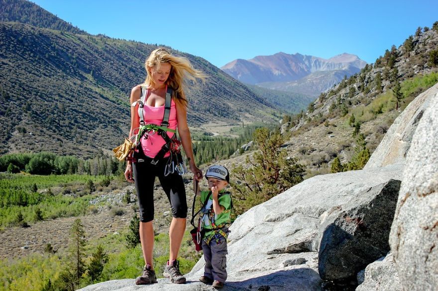 I’ve already removed these teeth
 But an oblong, very sour fruit, similar to a small cucumber,
 And there are still no beautiful views. Personnel
 And it continues to drizzle from above.
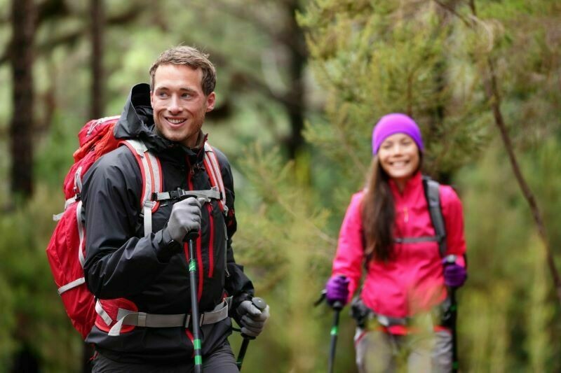 However, as it should, I washed them almost already