Usa city state postal code: Printable ZIP Code Maps – Free Download
U.S.A. City Name List | United States ZIP Code 5 Plus 4 ✉️
You are here
Home
This is the list of Cities in U.S.A.. The zip code, county and city are displayed in the list. You can click the City Name to get 5-digit zip code and 5-digit plus 4 zip code.
The primary city name as designated by the United States Postal Service. The USPS designates cities in all uppercase (ie. NEW YORK). The Post Office “city” name associated with a particular ZIP Code in the mailing address for a residence may differ from the legal municipality or district in which the housing unit is actually located.
County City ZIP Code Adjuntas Municipio ADJUNTAS 00601 Guam AGANA HEIGHTS 96910 Guam AGAT 96928 Aguada Municipio AGUADA 00602 Aguadilla Municipio AGUADILLA 00603 Aguas Buenas Municipio AGUAS BUENAS 00703 Guayama Municipio AGUIRRE 00704 Aibonito Municipio AIBONITO 00705 Anasco Municipio ANASCO 00610 Utuado Municipio ANGELES 00611 All other territories and foreign countries APO 09002 Arecibo Municipio ARECIBO 00612 Arroyo Municipio ARROYO 00714 Guam ASAN 96910 Arecibo Municipio BAJADERO 00616 Barceloneta Municipio BARCELONETA 00617 Barranquitas Municipio BARRANQUITAS 00794 Guam BARRIGADA 96913 Bayamon Municipio BAYAMON 00956 Cabo Rojo Municipio BOQUERON 00622 Cabo Rojo Municipio CABO ROJO 00623 Caguas Municipio CAGUAS 00725 Camuy Municipio CAMUY 00627 Canovanas Municipio CANOVANAS 00729 Carolina Municipio CAROLINA 00979 Lares Municipio CASTANER 00631 Catano Municipio CATANO 00962 Cayey Municipio CAYEY 00736 Ceiba Municipio CEIBA 00735 Guam CHALAN PAGO 96910 St.  Croix Island
CHRISTIANSTED 00820 Federated States of Micro CHUUK 96942 Ciales Municipio CIALES 00638 Cidra Municipio CIDRA 00739 Coamo Municipio COAMO 00769 Comerio Municipio COMERIO 00782 Corozal Municipio COROZAL 00783 Ponce Municipio COTO LAUREL 00780 Culebra Municipio CULEBRA 00775 Guam DEDEDO 96912 Dorado Municipio DORADO 00646 All other territories and foreign countries DPO 09001 Marshall Islands EBEYE 96970 Guanica Municipio ENSENADA 00647 Fajardo Municipio FAJARDO 00738 Florida Municipio FLORIDA 00650 Bayamon Municipio FORT BUCHANAN 00934 All other territories and foreign countries FPO 09204 St. Croix IslandFREDERIKSTED 00840 Arecibo Municipio GARROCHALES 00652 Guanica Municipio GUANICA 00653 Guayama Municipio GUAYAMA 00784 Guayanilla Municipio GUAYANILLA 00656 Catano Municipio GUAYNABO 00965 Gurabo Municipio GURABO 00778 Guam HAGATNA 96910 Hatillo Municipio HATILLO 00659 Hormigueros Municipio HORMIGUEROS 00660 Humacao Municipio HUMACAO 00791 Guam INARAJAN 96915 Isabela Municipio ISABELA 00662 Jayuya Municipio JAYUYA 00664 Juana Diaz Municipio JUANA DIAZ 00795 Juncos Municipio JUNCOS 00777 St. Croix IslandKINGSHILL 00850 Federated States of Micro KOSRAE 96944 Aibonito Municipio LA PLATA 00786 Lajas Municipio LAJAS 00667 Lares Municipio LARES 00669 Anasco Municipio LAS MARIAS 00670 Las Piedras Municipio LAS PIEDRAS 00771 Loiza Municipio LOIZA 00772 Luquillo Municipio LUQUILLO 00773 Guam MAITE 96910 Marshall Islands MAJURO 96960 Manati Municipio MANATI 00674 Guam MANGILAO 96913 Maricao Municipio MARICAO 00606 Maunabo Municipio MAUNABO 00707 Mayaguez Municipio MAYAGUEZ 00680 Pages
- 1
- 2
- next ›
- last »
 Croix Island
 Croix Island
 Croix Island
Random Address
U.
 S. Zip Code Database | Complete List of Zip Codes for the United States
On this page, we have a complete list of 27,537 zip codes for the United States, broken down by state, with information about the land area, county name and demographics for the zip code.
The table below shows the states and territories that we have zip codes for, and includes the number of counties and zip codes for each state, as well as the land area in square miles, and the state rank based on the size of its land area.
Click the state links in the first column to drill down and find more state-level zip code information.
| State | Counties | Zip Codes | Land Area (sq. mi.) | Rank |
|---|---|---|---|---|
| Alabama | 72 | 560 | 52,420 | 30 |
| Alaska | 29 | 238 | 665,384 | 1 |
| Arizona | 17 | 390 | 113,990 | 6 |
| Arkansas | 81 | 479 | 53,179 | 29 |
| California | 63 | 1,647 | 163,695 | 3 |
| Colorado | 66 | 448 | 104,094 | 8 |
| Connecticut | 8 | 186 | 5,543 | 48 |
| Delaware | 4 | 61 | 2,489 | 50 |
| District of Columbia | 1 | 53 | 68 | 52 |
| Florida | 67 | 911 | 65,758 | 22 |
| Georgia | 160 | 663 | 59,425 | 24 |
| Hawaii | 4 | 86 | 10,932 | 43 |
| Idaho | 49 | 222 | 83,569 | 14 |
| Illinois | 103 | 1,289 | 57,914 | 25 |
| Indiana | 92 | 682 | 36,420 | 38 |
| Iowa | 105 | 918 | 56,273 | 26 |
| Kansas | 108 | 667 | 82,278 | 15 |
| Kentucky | 122 | 469 | 40,408 | 37 |
| Louisiana | 65 | 447 | 52,378 | 31 |
| Maine | 16 | 143 | 35,380 | 39 |
| Maryland | 25 | 391 | 12,406 | 42 |
| Massachusetts | 15 | 355 | 10,554 | 44 |
| Michigan | 83 | 749 | 96,714 | 11 |
| Minnesota | 96 | 834 | 86,936 | 12 |
| Mississippi | 84 | 341 | 48,432 | 32 |
| Missouri | 118 | 879 | 69,707 | 21 |
| Montana | 60 | 293 | 147,040 | 4 |
| Nebraska | 102 | 570 | 77,348 | 16 |
| Nevada | 23 | 164 | 110,572 | 7 |
| New Hampshire | 10 | 110 | 9,349 | 46 |
| New Jersey | 21 | 475 | 8,723 | 47 |
| New Mexico | 40 | 310 | 121,590 | 5 |
| New York | 62 | 1,290 | 54,555 | 27 |
| North Carolina | 100 | 691 | 53,819 | 28 |
| North Dakota | 61 | 368 | 70,698 | 19 |
| Ohio | 88 | 1,086 | 44,826 | 34 |
| Oklahoma | 79 | 612 | 69,899 | 20 |
| Oregon | 41 | 341 | 98,379 | 9 |
| Pennsylvania | 67 | 1,369 | 46,054 | 33 |
| Puerto Rico | 78 | 125 | 5,325 | 49 |
| Rhode Island | 5 | 51 | 1,545 | 51 |
| South Carolina | 46 | 375 | 32,020 | 40 |
| South Dakota | 85 | 347 | 77,116 | 17 |
| Tennessee | 99 | 502 | 42,144 | 36 |
| Texas | 261 | 1,657 | 268,596 | 2 |
| Utah | 36 | 270 | 84,897 | 13 |
| Vermont | 14 | 119 | 9,616 | 45 |
| Virginia | 135 | 596 | 42,775 | 35 |
| Washington | 41 | 522 | 71,298 | 18 |
| West Virginia | 57 | 415 | 24,230 | 41 |
| Wisconsin | 72 | 717 | 65,496 | 23 |
| Wyoming | 32 | 146 | 97,813 | 10 |
We spent a lot of time downloading, cleaning, merging, and formatting the data that is shown on the site.
If you found the data or information on this page useful in your research, please use the tool below to properly cite or reference Name Census as the source. We appreciate your support!
<a href=”https://namecensus.com/zip-codes/”>Complete List of U.S. Zip Codes by State</a>
“Complete List of U.S. Zip Codes by State”. NameCensus.com. Accessed on November 21, 2022. https://namecensus.com/zip-codes/.
“Complete List of U.S. Zip Codes by State”. NameCensus.com, https://namecensus.com/zip-codes/. Accessed 21 November, 2022
Complete List of U.S. Zip Codes by State. NameCensus.com. Retrieved from https://namecensus.com/zip-codes/.
state zip – Translation into Russian – examples English
Premium
History
Favorites
Advertising
Download for Windows It’s free
Download our free app
Advertising
Advertising
No ads with Premium
English
Arabic
German
English
Spanish
French
Hebrew
Italian
Japanese
Dutch
Polish
Portuguese
Romanian
Russian
Swedish
Turkish
Ukrainian
Chinese
Russian
Synonyms
Arabic
German
English
Spanish
French
Hebrew
Italian
Japanese
Dutch
Polish
Portuguese
Romanian
Russian
Swedish
Turkish
Ukrainian
Chinese
Ukrainian
These examples may contain rude words based on your search.
These examples may contain colloquial words based on your search.
state postal code m
But it’s by no means the only Empire State ZIP code where the median home price is in the several millions: New York City is home to three of the top five – and eight of the top 30 – most.
But it’s by no means the only zip code Empire State where the median home price is in the several millions: New York is home to three of the top five zip codes – and eight of the 30 most expensive zip codes in the U.S. Sagaponack just happens to be the most expensive.
Other results
The FSM is also part of the United States ZIP code system, with the same postal rates charged.
The Federated States of Micronesia is also part of the U. S. Zip Code system and charges the same postage rates.
In the United States , ZIP codes are used.
So, for example, USA uses ZIP code system .
POSTNET is the standard bar code used in the United States for ZIP codes in bulk mailing.
POSTNET is the standard barcode used in United States for postcode in bulk mail.
Simply enter your city, state and zip code to get a list of stuffed animals businesses in your town.
Just enter your city, state and zip code to get a list of pet food businesses in your community.
In this scenario, additional fields would be defined for city, state , and zip code.
In this case, additional fields can be defined for the city, state and zip code .
The name and complete address (including city, state , and zip code) of each incorporator of the corporation.
The name and full address (including city, state , and zip code ) of each corporation organizer.
You can refine your search by city, state , and zip code to get a narrower selection of hits.
You can refine your search by city, state and zip code to get a narrower selection of hits.
Cookies which record the user’s approximate address (city, state , zip code) obtained by IP address, to be able to automatically select the right Country or server and inform users of any commercial offers in the same area.
Location cookiesCookies that capture the user’s approximate address (city, area , zip code ), received IP address, in order to be able to automatically select the correct country or server and inform users about any commercial offers in that area.
City, state or zip On the front page, you’ll see a list of the top blog posts, and it even shows how much money those posts have generated (sometimes in the thousand-dollar range).
On the first page you will see a list of the top blog posts and it even shows how much money they have created (sometimes thousands of dollars).
If in doubt about which locations are safe and legal or hunting, visit the U.S. Fish and Wildlife Service’s online hunting site locator, which allows you to search by state , zip code, and type of game.
If you have questions about which locations are safe, legal, or hunting, visit the U. S. Fish and Wildlife Service’s hunting site search website, which allows you to search by state , zip code , and game type.
Records released What Do You Know, Deutschland? in the United States States without “ Zip “.
Records decided to release What Do You Know, Deutschland? at US .
Not all addresses in the United States have had a ZIP +4 code assigned to them.
Not all addresses in United States had Zip Code 4 codes assigned to them.
Because so many businesses are housed in the building the Empire State has its own zip code, 10118.
Because there are so many businesses in the building, Empire State has its own zip code 10118.
Partial address default values - Because some of your points might have only partial addresses, you can use the data import wizard to define default values for missing fields, such as state or zip Code.
Partial address with default values. Because some of your locations may only have partial addresses, you can use the Data Import Wizard to define default values for missing fields, such as state or zip code .
You can also change your registration information such as: name, address, city, state , zip code, country, phone number, profile, likes and dislikes, desired date profile, Descriptions and saves search criteria.
You can also change your registration details such as: name, address, city, state , zip code , country, phone number, profile, likes and dislikes, desired profile date, essay and save search criteria.
If in doubt about which locations are safe and legal or hunting, visit the U.S. Fish and Wildlife Service’s online hunting site locator, which allows you to search by state , zip code, and type of game.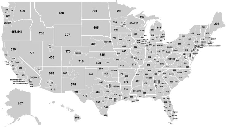
If you are in doubt as to which state coyote hunting is safe and legal, visit the US Fish and Wildlife Service’s online game locator site, which allows you to search by state , zip code, or type of game.
of ‘ALL’ searches on Google include a geographical modifier like a city, state , or zip code
43% of “ALL” searches on Google include a geographic modifier such as city or zip code
Use Google to “Geotarget” your exact customers by city, state , or zip code
You can use Google to “Geotarget” your exact client by city, state or zip code
When submitting such a request, please include in the text of your appeal the wording “Your rights to maintain confidentiality in the state of California”, as well as your name, address, city, state , and zip code .
When making such a request, please include the wording “Your privacy rights at State California” and include your name, address, city, State , and Zip Code .
Possibly inappropriate content
Examples are used only to help you translate the word or expression searched in various contexts. They are not selected or validated by us and can contain inappropriate terms or ideas. Please report examples to be edited or not to be displayed. Rude or colloquial translations are usually marked in red or orange.
Register to see more examples
It’s simple and it’s free
Register
Connect
No results found for this meaning.
More features with our free app
Voice and photo translation, offline features, synonyms , conjugation , learning games
Documents
corporate solutions
Conjugation
Synonyms
Grammar Check
Help&about
Word index: 1-300, 301-600, 601-900
Expression index: 1-400, 401-800, 801-1200
Phrase index: 1-400, 401-800, 801-1200
9000 Preparation of your data—ArcGIS for Power BI
Geocoding is the process of converting a description of a location (such as a pair of coordinates, an address, or a place name) into a location on the surface of the Earth.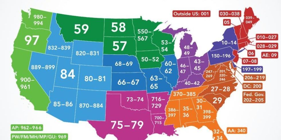
Esri provides resources to search for addresses, cities, places of interest, businesses, and other locations in more than 100 countries around the world. ArcGIS for Power BI uses the ArcGIS World Geocoding Service to find point features (such as addresses, U.S. cities, and cities around the world) and the ArcGIS GeoEnrichment service to find boundary features (such as zip codes, states, counties, and countries). If you’re signed in to your ArcGIS Online or ArcGIS Enterprise account, ArcGIS for Power BI uses the default locators configured to find locations in your organization.
When adding a map from Power BI, select the location type that best represents your information. Location information from your data is used to create a relationship between the business data and the specified location type. While ArcGIS for Power BI does its best to provide a map location based on location input, there are several ways to prepare your data before adding it to a map to ensure that the results are consistently accurate.
Location types
Follow these guidelines to accurately map your data.
Use appropriate location information in the Location field
The following types of information are allowed in the Location field:
- Address Information – Depending on your organization’s geographic region, address data can include any of the following: address, state, district, city , state, province, zip code, ZIP Code (for USA), country, etc. The more address elements your data contains, the more accurate the results will be.
When geocoding addresses, you can add a maximum of 3,500 points to an ArcGIS for Power BI visualization as a regular user, or 10,000 points if you’re signed in to your ArcGIS Online or ArcGIS Enterprise account.
The Location field cell accepts only one value. Therefore, if your address information is contained in separate columns, it is very important to concatenate the information into a separate comma delimited location column.
You can then place data from this column into a cell in the Location field to add the data to the map. - Standard administrative boundaries – When you use standard administrative boundaries in the Location field, ArcGIS for Power BI first looks for specific settings in the column’s Data Category metadata; if the data is categorized as State or Province, Zip Code, County, or Country/Region, ArcGIS for Power BI uses a standard geographic query to locate items on the map.
In some cases, postal codes can be associated with non-residential mailboxes; these codes do not have a border associated with them, and the GeoEnrichment service does not support demographic data for this type of zip code. If you are creating postcodes for non-residential properties, use the Points location type. If you select the location type Borders, an error will be thrown during geocoding.
If no metadata is found, ArcGIS for Power BI searches for supported keywords in data field names that match standard administrative boundaries.
The following table lists standard administrative boundaries and related keywords. Keywords are not case sensitive.Location type Keywords supported Geometry Administrative boundaries are added to the map as polygons that represent both shape and location.
If ArcGIS for Power BI cannot find metadata or keywords that it can recognize, the textual data is sent to the ArcGIS World Geocoding Service in an attempt to locate point features. In many cases, this leads to inaccurate results because there is not enough information to determine exact locations. Use the Location Type panel to specify options for locations.
- EsriJSON – If your data has location information in EsriJSON format, it should appear in the Shape column. Drag the value and Shape fields into the Location field to show EsriJSON locations on the map.
EsriJSON supports points, lines, and polygons.Default locators
When you add locations to a map, ArcGIS for Power BI uses various locators to find locations and display them on the map.
The following table describes how ArcGIS for Power BI determines which locator to use:
Default locator that supports batch processing configured for your organization
online.
Choosing a boundary location search method
When you map boundaries, such as state lines or standard administrative lines, ArcGIS for Power BI uses the closest match method to locate areas. This behavior is the default and allows for typos and other data errors. Use Closest Match if you know your dataset has spelling errors (for example, Claifornia instead of California), if there are multiple possible English translations for location names, or if you’re unsure of the exact spelling used in Esri Data Services.
This option is not recommended for codes as it may return invalid geometries. Examples of data that are well suited for the Closest Match method:- Country names
- States of Brazil
- States of the United States
- Any data that may contain spelling errors or special characters
it exactly matches the spelling in Esri Data Services, use the Exact Match search method. For example, use Exact Match for the following data:
- Postcodes
- U.S. state abbreviations
- Three-letter country codes (ISO 3166-1 Alpha-3)
- Place names with a single English spelling that are correctly entered into your dataset (for example, California)
Zip code lookup
When If you use zip codes in the Location field, ArcGIS for Power BI looks for specific settings in the Data Categories metadata column to determine the type of location and accurately display it on the map.
When you map locations using postcodes or codes, it is important to correctly identify the data based on the format of your postcodes.When postal codes are presented as codes or identifiers, such as 92374 or CF, select the Postcode category for your data. This will allow ArcGIS for Power BI to recognize the data as codes and accurately display the features on the map.
If postcodes are represented as a full name, such as Cardiff, then selecting the postcode metadata category may produce inaccurate results. In these cases, it’s a good idea to set the metadata to No category and provide a column name that ArcGIS for Power BI can correctly identify using well-known keywords such as Postal Code or Postal Code. Instead, you can use the Location Type panel in ArcGIS for Power BI to set the location type to the zip code category of the country whose data you are using.
Using precise latitude and longitude values
The latitude and longitude values represent the x,y coordinates of a location on the map.
The x,y coordinate data can be specified using the World Geodetic System 1984 (WGS84) coordinate system. In this system, latitude (Y) has values from -90 to 90, and longitude (X) has values ranging from -180 to 180. You can also use the DMS (Degrees, Minutes, Seconds) option to map your data, see Supported Symbol Formats.Create a separate Location column in your data
Because the Location field can only contain a single value, it’s best to create a new column in your dataset that combines all address information (such as address, city, state, and zip code) into a single, delimited comma column, which you can then use to add location-based information to the map.
Convert address and zip code values to text format (Format: Text) before merging columns.
To add a new location column to your dataset, do the following:
- Using the Desktop Report Editor in Power BI, select the dataset you want to change.
- You can do the following:
- On the Simulation tab, under Calculations, click New Column.
- In the Fields panel, click More Options next to the dataset you are about to edit and select New Column.
- On the Simulation tab, under Calculations, click New Column.
- In a new column, create a custom DAX formula that combines fields from different address columns into a single column. For example, to combine the columns Address, City, County, and Postal Code, your formula would look something like this:
Column = [Address] & ", " & [City] & ", " & [Province] & ", " & [Postal Code]
You can omit commas, using only spaces between field values. For example, Column = [Address] & ” ” & [City] & ” ” & [Province] & ” ” & [Postal Code].
- Name the new column so that it is easily recognizable as the merged location data column.
- Save the data set. You can now use the new location column to map your data.
Checking for geocoding errors
When you add a location field to a cell in the Location field in an ArcGIS for Power BI visualization, ArcGIS for Power BI sends information to one of the geocoding or geoenrichment servers to determine the correct locations on the map.
Sometimes, due to spelling errors or incomplete location information, geocoding fails and the location cannot be located on the map. If some locations don’t appear on the map, check the accuracy of your original data, fix any errors you find, and re-import your dataset to create the map.Data types, formats, and categories
The subsections above provide more information about ArcGIS for Power BI and data.
Define location field categories
To make sure ArcGIS for Power BI accurately geocodes your data, specify a data category for each of your fields. Using the Desktop Report Editor in Power BI, select the table you want to edit. On the ribbon, click the Modeling tab. Select a column in the table and select the appropriate category from the Data Category drop-down menu. For example, the US State column should be categorized as State or County. For the World column, select Country / Region. For postal codes, select the Postcode category. If you created a merged location column, select the Address category.
For columns containing location data, set the default Summarization option to Do Not Summarize.
Using text values
Dataset columns that will be used for location (such as zip codes) must be formatted as text, not as numeric fields. If the data contains a zero-based number, as is often the case in postal codes, some software packages interpret these fields as numeric values and discard the leading zero, which changes the original value. Formatting columns like text ensures that the data stays the same.
Using time formats
ArcGIS for Power BI supports several different date and time formats, as shown in the table below. If you use a format that is not listed in the table, ArcGIS for Power BI will try to find an equivalent for the format: for example, 30-Dec-1997 will be displayed as 30-Dec-1997. If no equivalent format is found, ArcGIS for Power BI uses the default format DD/MM/YYYY HH:MM (12/30/1997 6:00 PM).
For best results, use the Power BI modeling tools to set up date and time formats for your data before the data is added to the map.
- EsriJSON – If your data has location information in EsriJSON format, it should appear in the Shape column. Drag the value and Shape fields into the Location field to show EsriJSON locations on the map.
 You can then place data from this column into a cell in the Location field to add the data to the map.
 The following table lists standard administrative boundaries and related keywords. Keywords are not case sensitive.
 EsriJSON supports points, lines, and polygons.
 This option is not recommended for codes as it may return invalid geometries. Examples of data that are well suited for the Closest Match method:
 When you map locations using postcodes or codes, it is important to correctly identify the data based on the format of your postcodes.
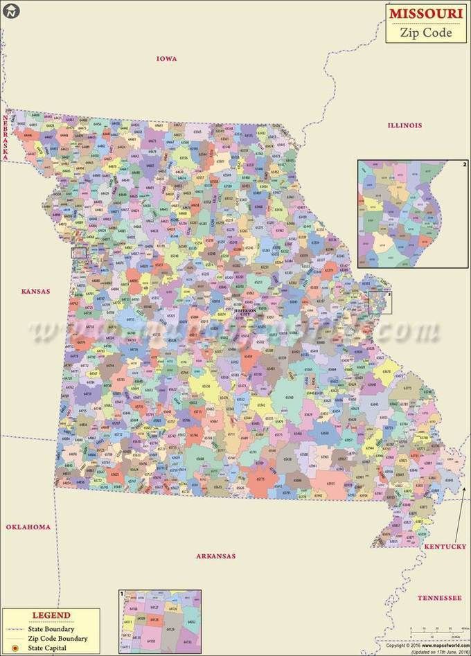 The x,y coordinate data can be specified using the World Geodetic System 1984 (WGS84) coordinate system. In this system, latitude (Y) has values from -90 to 90, and longitude (X) has values ranging from -180 to 180. You can also use the DMS (Degrees, Minutes, Seconds) option to map your data, see Supported Symbol Formats.
 Sometimes, due to spelling errors or incomplete location information, geocoding fails and the location cannot be located on the map. If some locations don’t appear on the map, check the accuracy of your original data, fix any errors you find, and re-import your dataset to create the map.
