Viejo san juan facts: 10 Facts About Old San Juan and then some
10 Facts About Old San Juan and then some
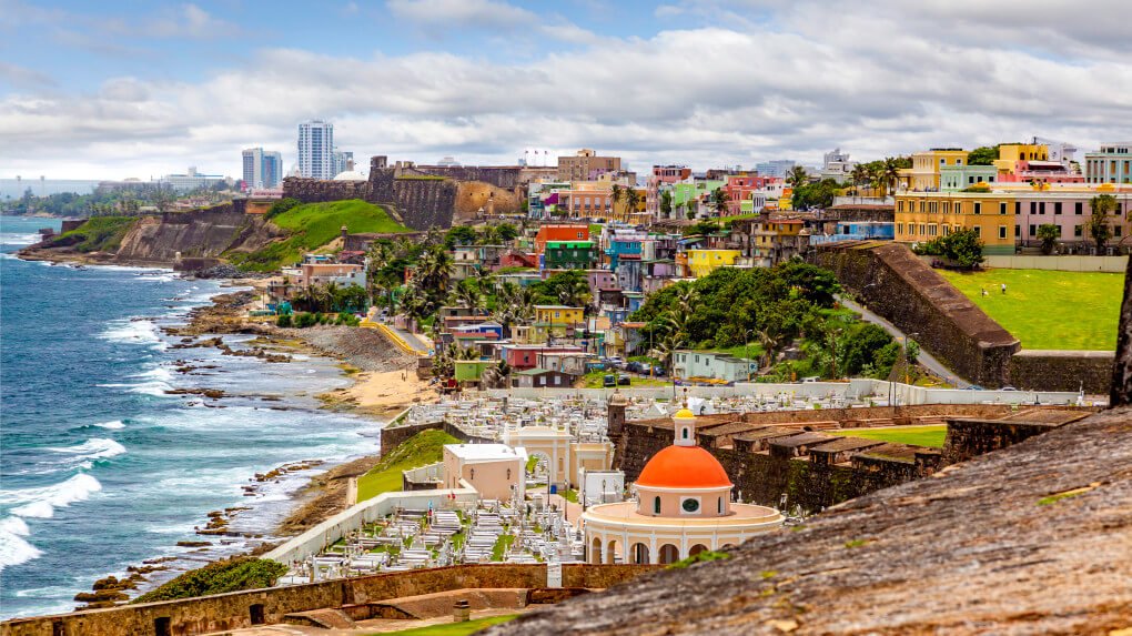
San Juan Bay. Click on image to see it larger.
Old San Juan is one of those wonderful places that people pay a small fortune to visit and I have it for free. Why? Because it’s 12 ½ miles away from my home. And it’s beautiful. That’s God’s honest truth.
When my children were kids (they’re all now in their 30’s) I took them so many times to Old San Juan that they could draw a map of the city. Now I’m doing it once again with my grandchildren. Every time they want to go for a ride they ask me to take them to “los castillos”, meaning the Spanish forts that defended the old city during the Island’s first colonial period.
Old San Juan is a magical place, where your imagination takes you to another era. It’s like stepping back in time without a time machine. But if you’re thinking about visiting now you’d probably be better off staying home. Covid-19 has seen to that. It’s not that the city is closed to visitors. It’s just that traveling these days is a risky proposition altogether. Besides, many attractions are closed, as well as bars and restaurants.
So I thought I would help you do the next best thing: “learn all you can about Old San Juan so you’ll be well prepared to visit us when things return to normal”.
Old San Juan Is Old
Old San Juan is the second oldest city in the Western Hemisphere. It was founded back in 1521 by Juan Ponce de León. Yeah, that was the same dude that was killed in Florida while searching for the fountain of youth. He was also Puerto Rico’s first governor.
San Juan Coat Of Arms, click on image to see it larger.
Santo Domingo de Guzmán, the capitol of the neighboring Dominican Republic is the oldest city in the Western Hemisphere. It was founded back in 1496 by Nicolás de Ovando, just 4 years after their island was discovered by Christopher Columbus in 1492.
The geographic center of Old San Juan sits approximately at GPS coordinates 18.466517, -66.117051, at the corner of Calle Sol and Calle San Jose. In case you’re wondering, the word “calle” means “street” and in normal Spanish syntax it precedes the actual name of the street. This is totally contrary to English syntax. Now back to the story…
Old San Juan Is Small
According to Wikipedia (that beacon of human knowledge), the city of Old San Juan has about 250 acres of military installations and 62 acres for private and public use. So basically it was a war machine during the Spanish colonial era.
And here’s a piece of historical trivia for you. Originally Old San Juan was christened Puerto Rico in remembrance of a similar port in the Canary Islands. Later on, in 1521, the city was renamed “San Juan Bautista de Puerto Rico” and the island as a whole was named Puerto Rico.
The Island was a stopover point for ships traveling between Spain and the New World, hence it was one of the most heavily fortified cities under Spanish rule. Lucky for us, all those post medieval structures have become tourist attractions that make visiting Puerto Rico a unique experience.
There are approximately 50 streets in the Old City, which starts where the Government Reception Center sits today and extends to Fort San Felipe del Morro to the west. North to south the original city extends from Calle Norzagarray to Recinto Sur. Everything to the south of Recinto Sur is landfill.
Is Old San Juan A Walled City?
San Juan City Wall, click on image to see it larger.
Well, almost. Construction of the Old San Juan city wall started in 1634 and it was finished by 1783. This alone tells you the importance that the city of San Juan had for the Spanish empire. However, by the end of the 19th century the city folks were being cramped in by their own walls and the Spanish government authorized the demolition of the south east quadrant of the walls in 1897.
The original wall encircled the City and had only five access point or “puertas”. These were: “Puerta de San Juan” which granted access to the southwestern part of the city and the cathedral, “Puerta de San José” and “Puerta de Santa Rosa” which led to the cemetery, “Puerta de San Justo” or “Puerta de España” which connected the southern part of the city to commercial maritime traffic and “Puerta de San Justo”, also called “La Puerta de Tierra” because it connected the city to the land on the west side.
Only 3 of these “puertas” exist today. “Puerta de San Justo” and “Puerta de Santiago” were demolished in 1897 along with a segment of the city wall and and the southern quadrant of Fort San Cristóbal.
And here’s a piece of trivia for you. Prior to 1897 Fort San Cristóbal was the largest military structure built by the Spaniards in the New World. And even with the piece that it’s missing, Fort San Cristóbal is still the largest. There’s a an architectural model at the fort that will give you a clearer understanding of how immense this structure really was. But more on this later.
Even with the missing portion, the Old San Juan city wall is probably the most complete in the New World. Can you imagine what it would be like if they hadn’t demolished the missing structures? Old San Juan would be the only walled city in the New World. What kind of tourist attraction would that be?
Is It Safe To Walk Around In Old San Juan?
Yes it is. About as safe as any other tourist attraction. There is municipal police and state police that looks after the safety of locals and visitors. But that doesn’t mean that you are exempt from trouble altogether.
Like any other populous city you have to protect your belongings and be mindful of your surroundings. That means not leaving valuables in your car, not walking alone in dark areas and keeping your prized possessions in your hotel safe.
The one place you don’t want to walk is on the city walls. In most places the walls can be as high as 42 feet. A fall from such a height will surely ruin your vacation and could even cost you your life.
Surprisingly, people are constantly told not to do this and they still do. I guess I’ll never fully understand human nature.
Is Old San Juan and San Juan the same thing?
No it’s not. Old San Juan comprises the area that was originally encircled by the City Wall. That represents the western tip of “la Isleta de San Juan” (San Juan Islet). The eastern portion of San Juan Islet is known as “Puerta De Tierra”, which —as you will recall— was the nickname given to the “Puerta de Santiago”, demolished in 1897.
The municipality of San Juan covers an area of 199.4 km², which is roughly 77 square miles. It’s also the capitol city of Puerto Rico and the most densely populated area on the Island.
Is Real Estate Expensive In Old San Juan?
Yes it is. It’s a matter of supply and demand. The city isn’t getting any larger so living in the second oldest city in the New World comes at a cost.
And that cost goes well beyond the monetary aspect. Most buildings in Old San Juan don’t have elevators. So what, you might think. It’s only a three story building! Right? Yeah, but each floor can be 18 feet high. So three floors can feel more like six. So believe me, carrying your groceries up 60 feet of stairs grows old really quick.
Another aspect that annoys many residents of Old San Juan is the hustle and bustle. During the weekends the city comes alive. Puerto Rican youth adores Old San Juan. It’s the place to go bar hopping, visit great restaurants or simply hang out with your significant other and do some people watching.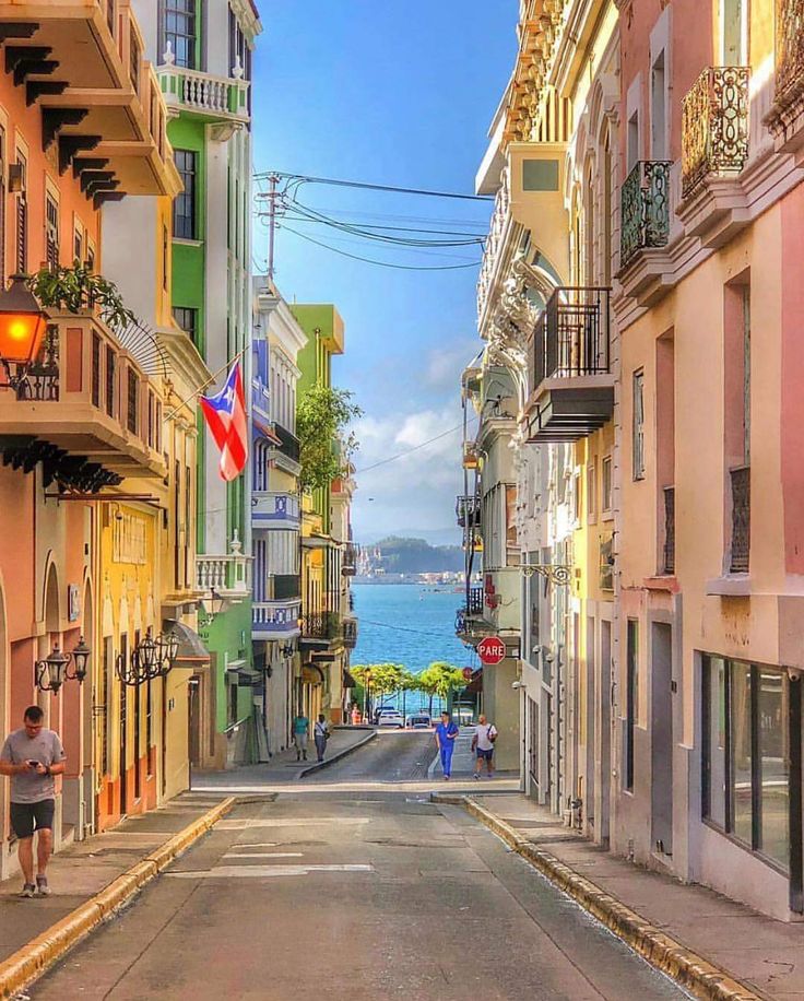 So if you’re imagining it like a tranquile place to have peace and quiet, you’re dead wrong. There’s a price to pay for living in the second oldest city in the New World.
And finally, there’s the traffic. Somehow locals have surmised that there’s something smart about sitting in a traffic jam for an hour or so while you crawl through Old San Juan. I don’t get it!!!
The city should have been a pedestrian city decades ago. But every time the subject comes up you get contrarian opinions and no common ground. Meanwhile, the city is slowly crumbling under vehicular traffic, toxic fumes and grime. The beautiful architecture and ambiance of this historical marvel is sadly obscured by thousands of motor vehicles covering every inch of available curbs.
What Is The Best Way To See Old San Juan?
On foot. I personally wrote a book for the Amazon Kindle titled “The Old San Juan Walking Tour” that covers every mayor attraction in the Old City. It starts at Plaza Dársena next to where the old “Puerta De San Justo” used to stand and takes you on a beautiful walk ending at the Government Reception Center next to Fort San Cristóbal and Plaza Colón.
The average temperature in Old San Juan is between 72°F and 89°F (22°-31°C), but it can reach peaks of 92°F or above during the months of July and August. The real offender is humidity. The annual average is 79% and it can go even higher between August and December. Besides, climate change has made conditions more unpredictable, so your best bet is to err on the side of caution.
So, what does all this mean? It means light clothing materials, light colors, comfortable walking shoes, plenty of water, sunglasses, sunblock and a wide brim hat. And stay out of the mid day sun.
With all this said, if you really want to discover Old San Juan the best way to do it is on foot. There are historic landmarks at every turn. Historical buildings are generally identified with bronze plates, albeit most are in Spanish. There are also dozens of museums, churches, restaurants and bars that you’ll surely miss from a motor vehicle.
Besides, if the heat becomes unbearable, you can always stop for a “piragua” (snow cone) or a “piña colada”, which —by the way— was actually invented in Puerto Rico.
Your first stop… The Forts
Fort San Felip del Morro, click on image to see it larger.
Here’s a sad statistic for you: most tourists spend less that 8 hours in Puerto Rico. Sad, but true. And who are those? They are the tourists who come on cruise ships. They disembark at San Juan peer in the morning and are usually gone by sunset.
That leaves them enough time to visit both the forts and maybe, just maybe, go for a short walk in the Old City. That’s sad. Old San Juan has so much to offer and most visitors never experience it.
You can visit the forts in any order. In my book, “The Old San Juan Walking Tour” we visit Fort San Felipe del Morro” first and “Fort San Cristóbal” last.
Fort San Felipe Del Morro is the smallest of the two. It is also the oldest. It’s a six level fort that was in charge of protecting the entrance to San Juan Bay. When you arrive on a ship it seems to be the largest because of its multilevel design, but it’s actually the smallest of the two.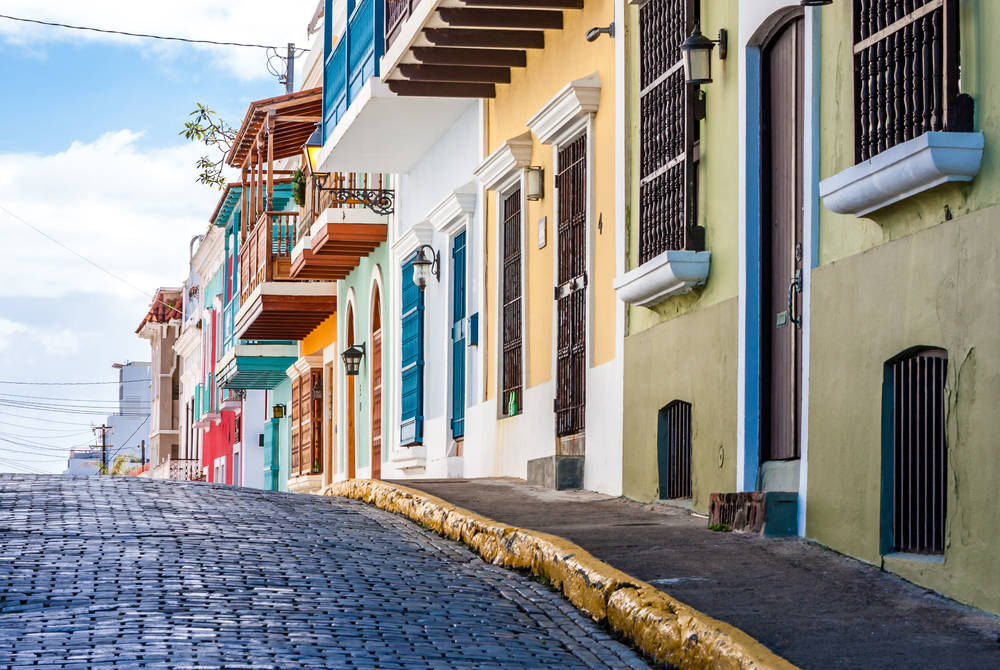
Fort San Felipe del Morro worked in tandem with a smaller fort across the bay called “San Juan de la Cruz”, also known by the locals as “El Cañuelo” that protected the bay from the other side. Any ship attempting to enter the bay would be caught in a merciless crossfire.
Reenactment at Fort San Felip del Morro, click on image to see it larger.
And why is “El Cañuelo” so small, you might ask? Well, the starboard side of the bay going in is ridden with reefs that took care of any ship getting too close to the shore, so the only side that actually needed protecting was the port side.
On the western end of the city is Fort San Cristóbal, an enormous multilevel castle that covered the entire western quadrant from the ocean to the bay. Both forts were equipped with all the weaponry of the day, but what really made them special was the fact that they were weapons in themselves. Their extremely large glacis, dry moats, collapsible tunnels and multilevel designs made them practically unbreachable.
Things at Fort San Cristóbal went even further. The fort was the last stage in a multi-defense system that started at the far west coast of San Juan Islet. So any attempt to attack Fort San Cristobal would’ve met all the exterior defenses first.
Fort San Cristóbal, clcik on image to see it larger.
Many people call Fort San Cristobal and Fort San Felipe del Morro castles, but they are actually not. Castles were buildings made for aristocrats and nobles to live in. The forts in Old San Juan were military machines designed from the ground up to repel any possible attacks to the city.
So, if Fort San Felipe del Morro guarded the western part of the Old City and Fort San Cristóbal guarded the east, why are there no forts on the northern and southern coasts of Old San Juan? The answer is simple, although it isn’t obvious. The northern coast of Old San Juan is ridden with reefs. Any attempt to disembark there would have led to imminent disaster. Landing on the southern coast would have been even more difficult because it would’ve required breaching the security of one of the two forts. And that was no easy task.
Are There Any Historical Churches In Old San Juan?
San Juan Basilica interior, click on image to see it larger
Yes there are, but don’t expect the splendor, art and riches of European churches. Churches in the Old City are rich in architecture and historical importance. Any gold that might have been found in Puerto Rico ended up in Spain.
However, the San Juan Basilica, dedicated to San Juan The Baptist, is a beautiful church. Construction started in 1529 but the original structure was destroyed by a hurricane. The structure that you see today, with its beautiful gothic facade, was started in 1540.
The San Juan Basilica is also the second oldest church in the western hemisphere and seat of the archdiocese of San Juan. Juan Ponce de León, Puerto Rico’s first colonial governor is buried there.
There are other beautiful churches around the city including San José Church, one of the earliest surviving examples of 16th-century Spanish Gothic architecture in the Western hemisphere. The altar on this church was donated by Juan Ponce De León and the family’s coat of arms is still there. José Campeche, one of the Islands most renown painters, is buried in this church.
Other examples include San Francisco Parrish (Parroquia de San Francisco), on San Francisco Street and Santa Ana Church (Iglesia Santa Ana), on Tetuán Street.
Is Food Any Good In Old San Juan?
Mofongo, click on image to see it larger.
You bet!!! Puerto Rico has one of the most varied and delicious cuisines in the World. When the Spanish discovered the Island back in 1493 they had just expelled the moors from southern Spain after 8 centuries of domination. So they brought a mixture of Spanish, Jewish and Moorish cuisines that mixed with African, Taíno, Cuban, Dominican, American and even Chinese influences to produce one of the best and unique cuisines anywhere on the globe.
And while Old San Juan isn’t home to every great restaurant on the Island, it certainly has a wide selection of every type of food Puerto Rico has to offer. Many of them are lined along Comercio Street but there are dozens hidden along the secondary streets as well.
If you’ve done any kind of research so far you’ll probably know about “mofongo”. But in case you don’t, it’s a mixture of fried and mashed plantain, garlic and crushed pork rind filled with your choice of shrimp, lobster, conch, octopus, chicken, pork, steak and much more. You can have it with a cold beer or a glass of wine. But if you really want to take in the entire Puerto Rican experience try a “piña colada”, a mixture of Puerto Rican rum, coconut cream, pineapple juice and a beautiful red cherry on the top. It’s refreshing and tasty.
And there’s more… much more
There are many more things to do in Puerto Rico outside Old San Juan. The Island has some of the most beautiful beaches in the world. The only tropical rain forest in the United States is also in Puerto Rico, about 30 miles east of the San Juan Metroplex.
If you are the adventurous type you can try “The Monster” at Toro Verde, a 2. 5Km zipline that’s the largest in the Americas. Personally, I wouldn’t be caught dead on it because I’m terrified by heights. But if reaching speeds of up to 52.8km/h, really high up in the air, is your thing, then Puerto Rico has it.
The Island also has three (yes, that’s right, 3) bioluminescent bays in the towns of Guánica and Fajardo, and on the smaller island of Vieques.
Finally, Puerto Rico has a large collection of paradores (small family-owned hotels) peppered throughout the Island. If you’re looking for fun under the sun, agro-tourism or simply that peace and quite that you won’t find in the San Juan Metroplex the one of the paradores could be right for you.
The important thing is to plan ahead. Why ahead? Because many people simply are afraid to travel until they get vaccinated. And who can blame them? I wouldn’t travel either. After all, I’m 66 and catching Covid-19 would probably send me straight to heaven (did you notice how I didn’t even consider the other direction?).
So now’s the time to plan. Take some time to explore Puerto Rico By GPS. Watch our videos on the right hand column. Watch other people’s videos too (of course, after you watch ours) and become an expert in all things Puerto Rico. That way you’ll hit the ground running when you get here.
I hope to see you soon,
©2021,Orlando Mergal, MA
____________________
Bilingual Content Creator, Blogger, Podcaster,
Author, Photographer and New Media Expert
Tel. 787-750-0000, Mobile 787-306-1590
Learn More About Puerto Rico
OLD SAN JUAN
Enjoy an adventure through centuries of history.
EL YUNQUE NATIONAL FOREST
Explore the only tropical rain forest in the U.S.
LET’S HIT THE BEACH
Have fun at one Puerto Rico’s world renown beaches.
Disclosure of Material Connection: Some of the links in this post are “affiliate links. ” This means that if you click on a link and purchase an item, I will receive an affiliate commission. Regardless, I only recommend products or services that I use personally and believe will add value to my readers. I am disclosing this in accordance with the Federal Trade Commission’s 16 CFR, Part 255: “Guides Concerning the Use of Endorsements and Testimonials in Advertising.”
A Day in Old San Juan
Old San Juan is a 465-year-old neighborhood originally conceived as a military stronghold, it is contained within 7-square-block
and includes more than 400 carefully restored 16th- and 17th-century Spanish colonial buildings.
Old San Juan is not a big area and the best way to fully submerge yourself into its culture is walking through its streets. You
want to see all the details – the architecture, people, food and street life. Most attractions are within walking distance of each other.
Your first stop should be the Castillo de San Cristóbal, this is El Morro’s partner in the city’s defense.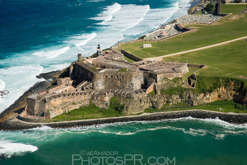 Built in the
18th century, was considered the Gibraltar of the West Indies. San Cristobal was supported by a massive system of outworks which
provided defense in depth and is is one of the largest defenses ever built in the Americas. Guided tours show visitors through
the maze Tue, Thu-Fri at 10am, 11am, 2pm and 3pm. Open daily 9am – 5pm. (787) 729-6653
After your visit to San Cristobal continue on Norzagaray Street toward Fort El Morro.
You can’t miss the massive Castillo de San Felipe del Morro (“El Morro”) across the old city. This six-level fortress rises
140 feet above the sea with its massive 18-foot-thick wall proved a formidable defense.
El Morro is a National Historic Site administered by the National Park Service. The fort is open to the public everyday from
9am to 6pm (except on Thanksgiving, Christmas and New Years). Admissions US$3 adults, children under free, (787) 729-6960.
After you complete your tour of the fort, walk across the street and continue into the Plaza de Ballaja, this building housed
Spanish soldiers and their families in the late 1800s, and later was the quarters for American soldiers following the
Spanish-American War.
Open Mon-Fri 10am – 4pm, Sat-Sun 11am – 5pm, guided tours available weekdays 10:30am, 11:30am, 12:30pm and 2pm.
Admission is free. (787) 724-5052
Now walk to the Plaza de Beneficiencia along San Sebastián Street until you get to
Cristo Street. Check out La Catedral de San Juan, El Convento, La Capilla del Cristo and the
Parque de las Palomas. Continue on Cristo Street and you will find the
San José Plaza, nearby the Casals Museum and the San José Church.
Soon enough you will reach Plaza the Armas where you can seat across the city hall and enjoy the view, this
is Old San Juan’s main square, on San José Street.
Walk to Plaza Colón then into San Francisco Street, where you can stop for
lunch or grab a quick snack. Along the way take your time and browse all the stores and sights.
Do not forget to stroll Paseo de la Princesa, a 19th-century esplanade situated just outside the city walls.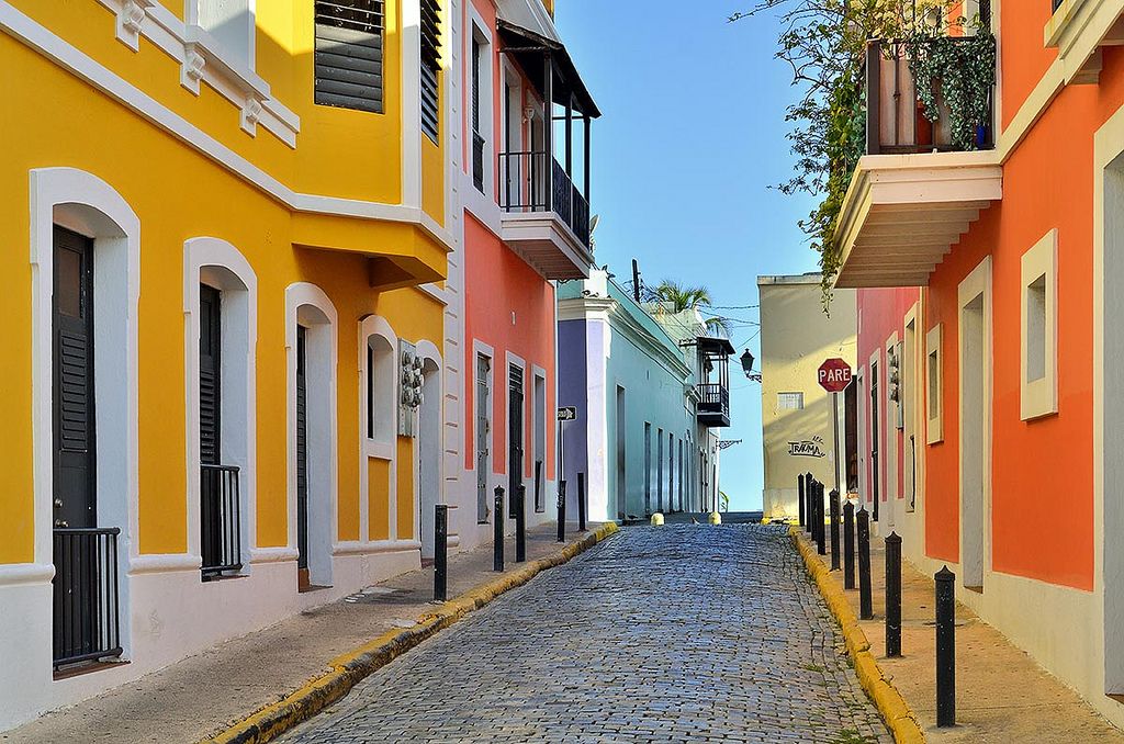
Make sure to do this walk during sunset, I guarantee many breathtaking photos.
Best Souvenir Bacardi or Don Q rum
Best Cocktail Piña Colada
Best Street Food Coconut water or a piragua
Resources:
- Frommer’s Puerto Rico, 5th Edition (October 27, 1998)
How gold was found again in the Dominican Republic))
In the Dominican Republic, near the city of San Juan – in the hills, closer to the mountains – large new gold deposits
were discovered
. According to some estimates, the gold deposits here promise to be even more massive than in the famous Dominican gold mine Pueblo Viejo. Based on the conducted geological surveys, it was established that, in addition to gold, there is also a high content of copper, zinc
and lower –
silver
.
Geological exploration of the San Juan area is being conducted by the Canadian mining company Goldquest. Its subsidiary in the Dominican Republic is referred to as Goldquest/Inex. Preliminarily, we are talking about the initial use of the natural reserve, not less than 10 million ounces of gold . Geological exploration was started here back in 1998… REFERENCE for counting enthusiasts: 1 ounce = 0.028 kg)) 9(SolCity Rio San Juan), on the beautiful coast of the warm Atlantic Ocean. The second San Juan is the 10th largest city in the Dominican Republic:
San Juan de la Maguana
(San Juan de la Maguana). The development of gold and the organization of a large mine are now threatening the city of San Juan de la Maguana …
INFORMATION: The city of San Juan de la Maguana is located in the south of the Dominican Republic. This large city is the capital of the province of San Juan. Distance from Santo Domingo: 200 km. Its population for 2012: 169032 people.
Gold mine in San Juan de la Maguana is planned to be built on El Romero Hill. The amazing rich geology of El Romero was confirmed in May 2012. Also interesting are the geological data of the town of Las Tres Palmas (Las Tres Palmas) from 2011, and La Guama (La Guama) – geological surveys of 2013. Over the past year, exploring the vicinity of San Juan de la Maguana, Canadian geologists have drilled a total of exploratory wells for 25 thousand meters … The Geological Research Center is located in Hondo Valle. All Geological survey data by the Canadian mining company Goldquest has been released.
Foreign investment in the Dominican Republic and how to use gold
Gold mining
in the Dominican Republic is gaining momentum.
Natural gold reserves
in the Dominican Republic are already estimated in billions of dollars. The discovery of new deposits of the precious metal in the Dominican country means
large foreign investments
in the mining industry, providing thousands of jobs for the population and tangible
profits
from the gold mined.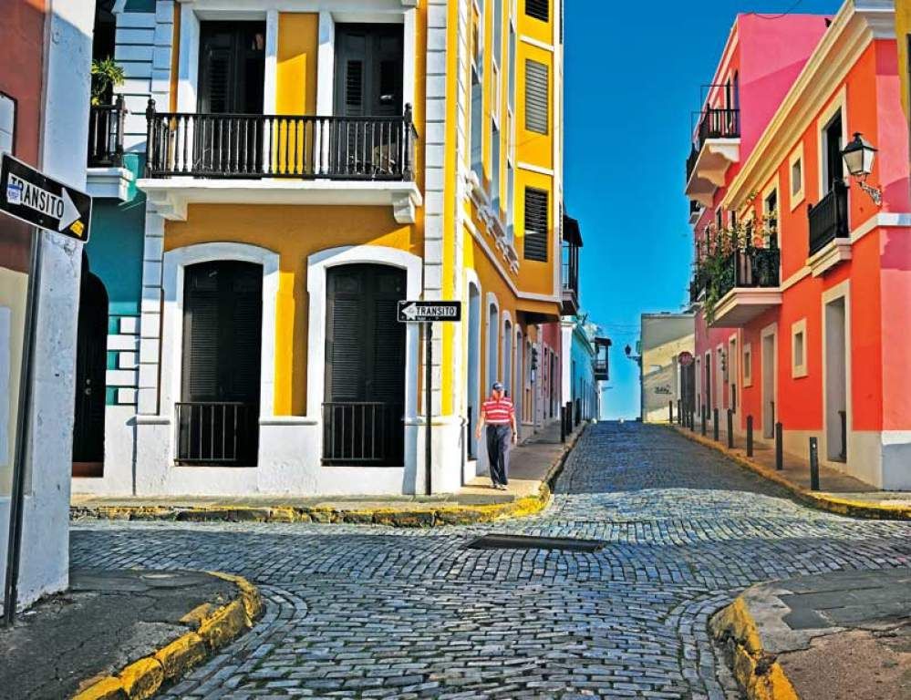 Last year, in 2012,
21 million dollars
foreign investments were received to continue geological exploration in San Juan de la Maguana. Foreign companies that start mining gold in the Dominican Republic undertake to work on modern advanced technologies that protect the country’s ecology.
(Always warm, Atlantic coast of the Dominican Republic))
-drilling-at-guam
TIP: Dear friends, the land in the Dominican Republic can please you even more than you expected)) Having taken possession of the site, inspect all its corners – and especially the banks of small streams. Open pit gold mining on your own plot of land in the Dominican Republic is a good form of leisure))
attractions with photos and descriptions of interesting places
Nicaragua is a small Spanish-speaking country in Central America. The manager of the TOUR EXPRESS travel company will organize exciting excursions for you to the sights of this state, accompanied by a professional guide.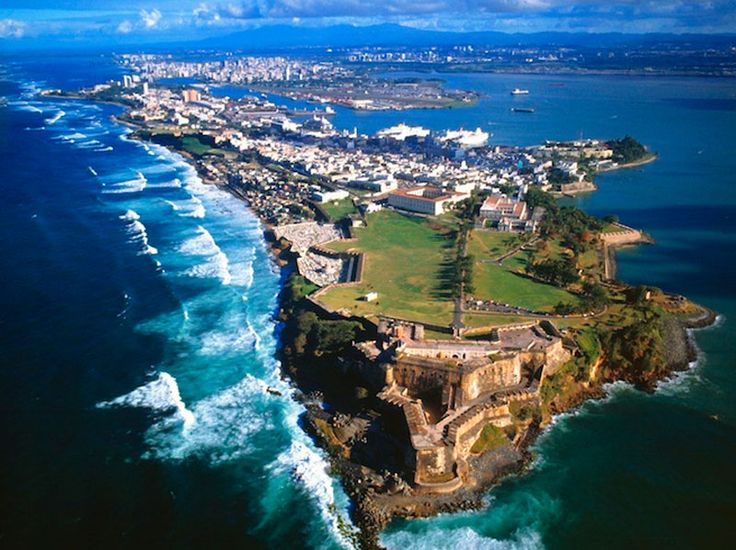 You will see colonial towns and ancient military forts, active volcanoes and picturesque national parks, as well as relax on the beaches of the Pacific Ocean and the Caribbean Sea.
Masaya National Park
The largest Nicaraguan Masaya nature reserve is located near the capital of the country – Managua, and is named after its main attraction – the active Masaya volcano. The entrance to the park is located right at the crater – travelers are greeted by smoke billowing from the mouth of the volcano, through which on windy days you can see the lava bubbling below. The volcano is in an active state – evidence of periodic eruptions are scorched patches of earth around and clots of magma.
Masaya Volcano
Masaya is a massive shield volcano located in Nicaragua.
Interesting facts:
the age of the volcano is about two and a half thousand years;
the conquistadors mistook Masaya for the gates to Hell and placed a massive cross at its crater;
cars at Masaya are parked with their noses towards the exit of the park – in order to quickly leave in the event of an eruption.

Mombacho volcano
Mombacho is an active volcano near Granada, the conical top of which is always covered with a smoke cap. This smoking mountain, due to its peculiarity, has become a symbol of the cigar brand of the same name. Although the volcano looks intimidating – as if it is ready to throw lava flows into the air at any moment, the last documented eruption occurred here at the end of the sixteenth century. Mombacho is located on the shores of Lake Nicaragua, tropical trees grow on the slopes – the view from the top in good weather is breathtaking.
Cerro Negro Volcano
Cerro Negro is one of the smallest and youngest volcanoes in Nicaragua, the name of which is translated into Russian as “black hill”. Despite the fact that the volcano is active and an eruption can begin at any moment, such an extreme form of entertainment as volcanoboarding is popular here – descending a black rocky slope on a wooden board at a speed of about sixty kilometers per hour. The daredevils are dressed up in colorful costumes so that they do not disappear from sight along the road, covered with volcanic dust.
City of Catarina
A small neat town, in the vicinity of which are Lake Apoyo and Mombacho volcano. Tourists love it for shops with authentic souvenirs and small restaurants serving national cuisine.
City of San Juan Del Sur
San Juan Del Sur is a resort in Nicaragua on the Pacific coast. As a rule, tourists spend a couple of days here, enjoying the sunsets and listening to the measured lapping of the waves. Of the attractions – a small Catholic church, a suspension bridge and a statue of Jesus, from the observation deck which offers a beautiful view of the lagoon.
City of Estelí
In the town of Estelí, travelers usually visit the Cathedral of Our Lady of Rosario, the central park, the Museum of Former May 18 Fighters, the Museum of History and Archeology, and a tobacco factory.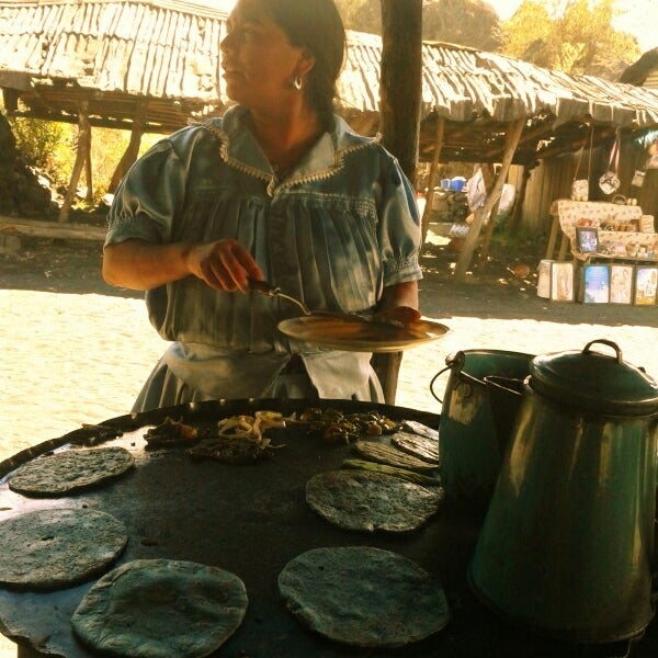 Nearby are the Cantagallo Ecological Park, the reserves of La Pataste and Miraflor, and other interesting places.
Apoyo Lagoon
Apoyo is a crater lake formed in the mouth of an extinct volcano. Unlike most of these natural reservoirs, the lagoon is inhabited by life – it is inhabited by fish and swimming is allowed. However, economic activity is prohibited – Apoyo is a conservation area. There are resorts and hostels for those who like a secluded vacation.
Lake Nicaragua
Lago de Nicaragua is one of the largest lakes in Latin America.
Interesting facts:
is the largest freshwater lake on the continent;
Locals call Nicaragua “fresh sea” because of severe storms;
There are sharks in the lake, which makes it unique.
Ometepe Island
Ometepe is an island in the middle of Lake Nicaragua, consisting of the two volcanoes Maderas and Concepción.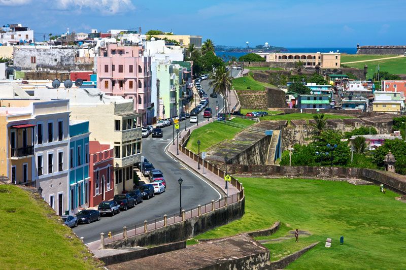 The two parts of Ometepe are connected by a narrow isthmus, so from a bird’s eye view, the island is shaped like an hourglass. It is inhabited – about thirty thousand people live here. Recognized by UNESCO as a biosphere reserve.
Somoto Canyon
Somoto is a national natural monument of Nicaragua, a picturesque canyon in the north of the country. According to scientists, Somoto was formed about thirteen million years ago – the river running along its bottom has sharpened stones and deepened the channel for thousands of years.
The sheer banks of the canyon reach one hundred and fifty meters, but it is relatively small in width: at its narrowest point, the distance between the edges is only five meters. There are boat tours around Somoto, during which those who wish go down into the water to swim.
Bosawas Reserve
Bosawas Biosphere Reserve of Nicaragua, the green lungs of the country. It occupies almost one-fifth of the entire territory of the state.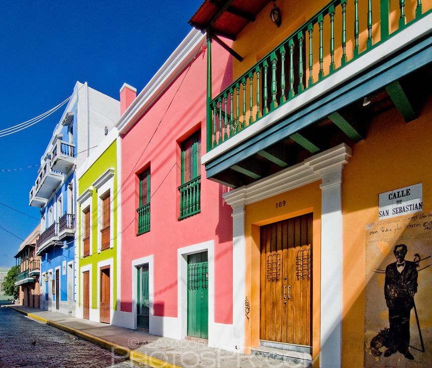 Oaks, pines, red and rubber trees grow here; deer, monkeys, ocelots, cougars, alligators and brown momots live – small bright birds with two elegant thin feathers on their tails. Here they are called guardabarranco – “guardians of the ravines”, and are considered a national symbol.
Cultural sites of Nicaragua
Leon Cathedral
An architectural monument and a UNESCO World Heritage Site located in the city of Leon. The construction of the cathedral continued from the end of the eighteenth to the beginning of the nineteenth century, the temple was consecrated by Pope Pius IX. It became the largest Catholic cathedral in Central America. Many famous personalities who were citizens of the country are buried here.
Revolution Square in Managua
Revolution Square is the historic center of Managua, the capital of Nicaragua.
Interesting facts:
Another name for this attraction is Republic Square;
squares and neighborhoods around were seriously damaged by an earthquake in the seventies of the last century – many buildings have not been restored to this day;
here are the Cathedral of St.
James, the National Palace of Culture, the theater named after the Latin American poet Ruben Dario and other attractions.
 James, the National Palace of Culture, the theater named after the Latin American poet Ruben Dario and other attractions.
León Viejo (Old León)
León Viejo is the ruins of a colonial city built in the early sixteenth century. They are located near the small settlement of Puerto Momotombo. During its short existence, in the past, this settlement has been subjected to natural disasters countless times – earthquakes and eruptions of the Momotombo volcano. In the end, the inhabitants could not stand it and moved the city thirty-two kilometers to the west – here is now the modern city of Leon.
Fortress of the Immaculate Conception
Fortress of the Immaculate Conception – a seventeenth-century bastion that protected Nicaragua from attacks by the British, who fought for access to the Pacific Ocean. Nineteen-year-old Rafaela Herrera gained fame here, who opposed the surrender of the fort after the death of her father commander.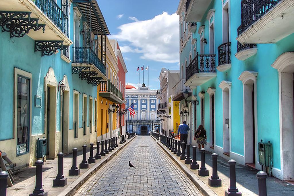 Thanks to her, the fortress survived, and Herrera herself became the national heroine of Nicaragua.
National Theater Ruben Dario
This attraction is located in the historic center of the capital of Nicaragua – Managua. The theater is named after the Nicaraguan poet Ruben Dario, whose popularity peaked at the end of the nineteenth century. He became the first world-famous Latin American poet, was a prominent representative of modernism in Spanish-language literature.
Cathedral of the Immaculate Conception
Unusual Catholic Cathedral in Managua, built in the nineties of the last century. Outwardly, it looks more like an Islamic mosque due to the combination of Romanesque and Arabic elements of the facade. The roof is crowned with a construction of sixty-three domes – so many parishes were in the diocese at the time of its construction.
Port of Salvador Allende
Port of Salvador Allende is located in Managua, on the shores of the freshwater lake of the same name.