Yunque rainforest: Best Hiking Trails in El Yunque National Forest
Coquí in the Rainforest | Discover Puerto Rico
In Puerto Rico’s tropical rainforest, El Yunque, it is easy to have an encounter with our beloved little tree frog, the coquí, as it is a perfect habitat for this species.
The coquí, an endemic amphibian on the Island, enchants the forest at night with its peculiar song that sounds the same as its name (“co-kee.”) In this episode, we invite you on an adventure to explore the forest alongside the forest’s Heritage Program Manager and archeologist, Raymond Feliciano — and learn more about this tiny singing creature. You’ll also learn some Taíno phrases and words that we still use today. The Taínos were Puerto Rico’s first inhabitants, and they venerated El Yunque, as they believed the mountains of the rainforest were sacred and served as a home for gods and spirits.
Visit El Yunque National Forest
Fun facts
The amphibian’s common name derives from the co-kee sound produced by males to attract females.
Although the female coquí doesn’t sing, it emits a sound when it feels threatened.
Studies show that the first “co” part of a call deters other males, while the “quí” part attracts the females.
There are 17 endemic species of coquí in Puerto Rico— 13 of which can be found in El Yunque.
The coquí is considered the loudest known amphibian; its call has been recorded at peaks of a hundred decibels from three feet away.
Exploring El Yunque Hiking Trails
More about El Yunque
Its name derives from the Taíno word Yuque or Yuké, which means White Earth (Tierra Blanca in Spanish). The Taínos gave it this name because of the white clouds that covered the mountains.
According to various historians, the Taínos believed that their benevolent god Yocahu (also found as Yúcahu, Yocajú, Yukiyú) lived at the top of the mountains of El Yunque and protected them from the god of disorder responsible for hurricanes, Juracán (also known as Huricán.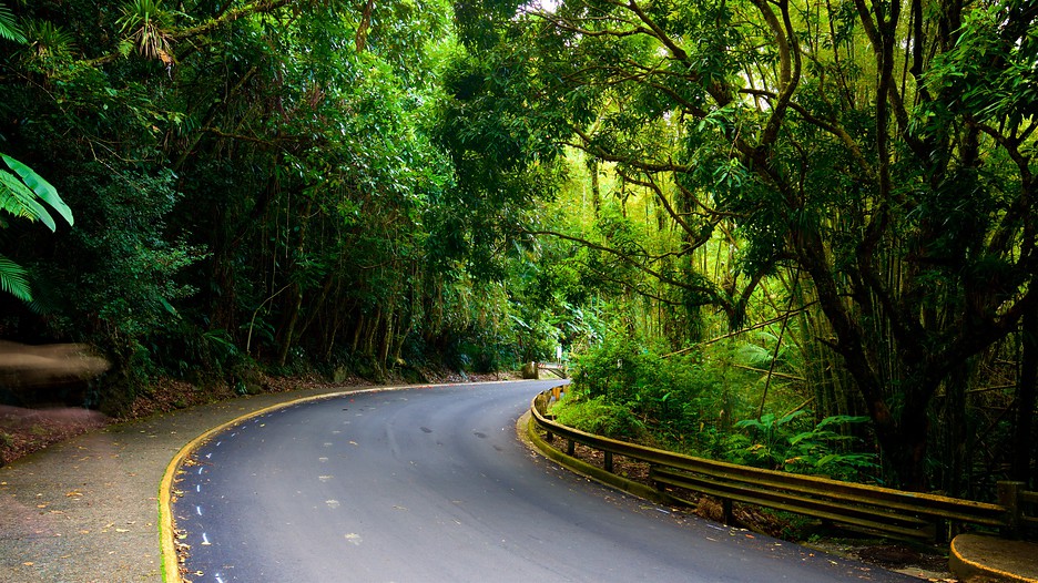 )
)
The English word hurricane comes from the Taíno word hurakán
The observation tower at El Yunque is named after the god Yokahu.
From there, you can observe two landslides that occurred during hurricanes Irma and María. Park rangers refer to them as Yocahu’s battle scars, as El Yunque protected the Island once again from Huricán.
Although it expands for 28,000 acres, El Yunque is one of the smallest forests in the world.
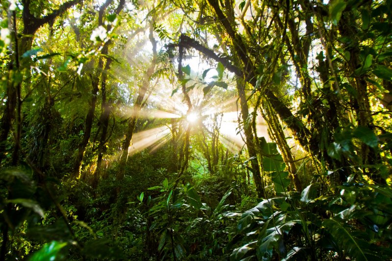
El Yunque has the largest concentration of biodiversity in Puerto Rico. Besides the abundance of coquí, the forest is home to nearly 70 kinds of birds, over 200 types of trees, over 10 species of bats, and multiple lizards.
Before being acquired by the United States Forest Service System, El Yunque was declared a protected territory by the King of Spain in 1876.
During World War II, the US Army placed a radar on the second highest peak to detect German aircraft and submarines.
El Yunque National Forest Weather Forecast, PR
El Yunque National Forest Weather Forecast, PR – WillyWeather
Feels Like 80.
 6 °F
6 °F
Roosevelt Roads, Roosevelt Roads Naval Station, Ofstie Field (9.6 miles)
Get an account to remove adsView More
Real-Time Extremes
View More
Trending Locations
- Glacier Bay National Preserve, AK
- Sun City Grand, AZ 85374
- Tucson, AZ 85716
- Prescott, AZ 86303
- Mission Bay – Sea World San Diego, CA
- Chumash Painted Cave, CA
- Goleta Beach, CA
- Candlestick, CA 95127
- Quaker Hill, CT 06375
- Daytona Beach, FL 32114
Get an account to remove ads
Today 28 Feb Northeast
Sunny.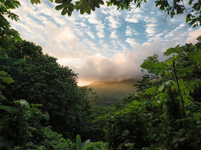 Highs around 84. East Winds 10 to 15 Mph.
Tonight 28 Feb Northeast
Clear. Lows around 74. East Winds 5 to 10 Mph.
Wed 1 Mar Northeast
Partly cloudy in the Morning, then becoming sunny. Isolated Showers. Highs around 85. East Winds 5 to 10 Mph. Chance of rain less than 20 percent.
Wed 1 Mar Northeast
Mostly clear. Isolated Showers in the evening. Lows around 74. Northeast Winds 5 to 10 Mph. Chance of rain less than 20 percent.
Thu 2 Mar Northeast
Partly cloudy with isolated Showers in the Morning, then variably cloudy with scattered Showers in the afternoon. Highs around 85. East Winds 10 to 15 Mph. Chance of rain 40 percent.
Thu 2 Mar Northeast
Partly cloudy with isolated Showers in the Evening, then variably cloudy with scattered Showers after midnight. Lows around 75. Chance of rain 30 percent.
Fri 3 Mar Northeast
Variably cloudy with scattered Showers in the Morning, then sunny in the afternoon. Highs around 85. Chance of rain 30 percent.
Fri 3 Mar Northeast
Partly cloudy with isolated Showers. Lows around 76. Chance of rain 20 percent.
Sat 4 Mar Northeast
Variably cloudy with scattered Showers in the Morning, then partly cloudy with isolated Showers in the afternoon. Highs around 85. Chance of rain 30 percent.
Sat 4 Mar Northeast
Partly cloudy with isolated Showers. Lows around 76. Chance of rain less than 20 percent.
Sun 5 Mar Northeast
Partly cloudy with isolated Showers in the Morning, then variably cloudy with scattered Showers in the afternoon. Highs around 85. Chance of rain 30 percent.
Sun 5 Mar Northeast
Variably cloudy with scattered Showers. Lows around 75. Chance of rain 40 percent.
Mon 6 Mar Northeast
Variably cloudy with scattered Showers. Highs around 85. Chance of rain 40 percent.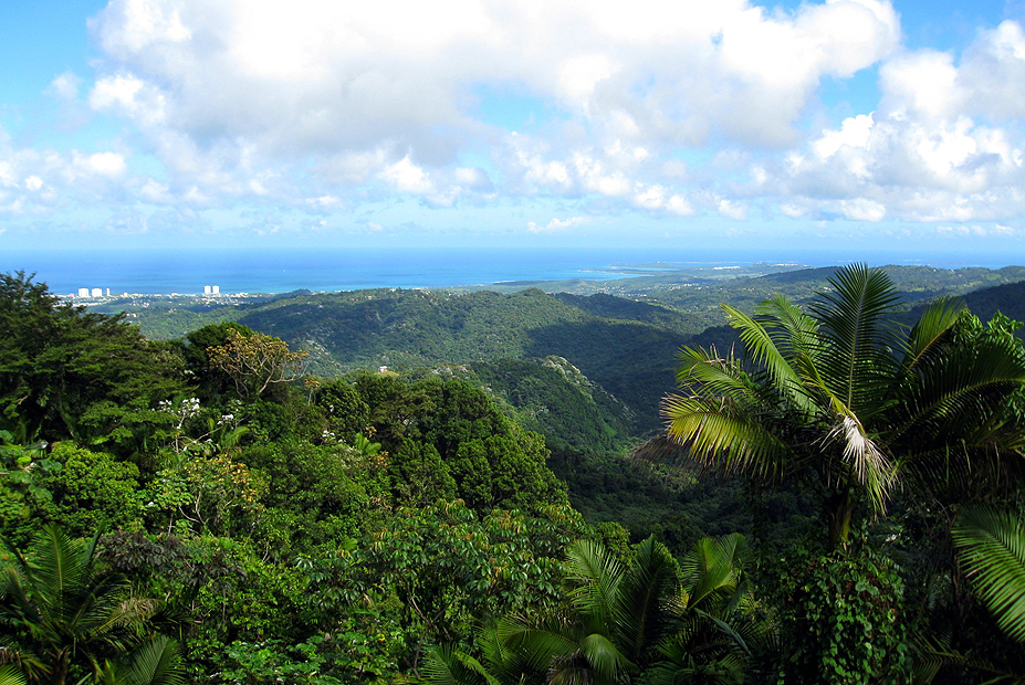
El Yunque National Forest weather forecast issued today at Next forecast at approx.
El Yunque National Forest Temperature Statistics
February Temperature
Roosevelt Roads, Roosevelt Roads Naval Station, Ofstie Field (9.3 miles)
Climate (2010–Present)
Roosevelt Roads, Roosevelt Roads Naval Station, Ofstie Field (9.3 miles)
Take a look at our website widgetsAvailable free! Find Out More
Get an account to remove ads
New 7 natural wonders of the world announced (PHOTO + VIDEO)
For 4 years, candidates were selected for the title of 7 new natural wonders of the world. And now the global Internet voting is completed, the results are summed up. Who became the winner?
The New Seven Wonders of Nature is a competition run by the Swiss non-profit organization New Open World Corporation.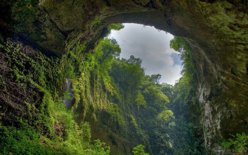 The project started in December 2007. Until July 7, 2009, the nomination and preliminary selection of candidates took place. As a result, a short list of 77 candidates was formed.
On July 21, 2009, the expert council of the competition selected 28 finalists from among them, who were admitted to the general vote.
Finalists:
- Amazon river and forests (South America)
- Great Barrier Reef (Australia, Papua New Guinea)
- Angel Falls (Venezuela)
- Iguazu Falls (Argentina, Brazil)
- Vesuvius Volcano (Italy)
- Galapagos Islands (Ecuador)
- Mount Kilimanjaro (Tanzania)
- Mount Matterhorn (Italy, Switzerland)
- Mount Yushan (Taiwan)
- Grand Canyon (USA)
- Jeita Cave (Lebanon)
- Mud volcanoes (Azerbaijan)
- Bay of Fundy (Canada)
- Ha Long Bay (Vietnam)
- Masurian Lake District (Poland)
- Maldives (Maldives)
- Sundarban Mangrove Forest (Bangladesh, India)
- Dead Sea (Israel, Jordan)
- Milford Sound Fjord (New Zealand)
- Komodo National Park (Indonesia)
- Jeju Island (Republic of Korea)
- Bu Tina Islands (UAE)
- Puerto Princesa Park (Philippines)
- Uluru Rock (Australia)
- Cliffs of Moher (Ireland)
- Table Mountain (South Africa)
- El Yunque Rainforest (Puerto Rico)
- Black Forest Black Forest (Germany)
November 11, 2011 ended the worldwide voting on the site new7wonders. com, selecting the seven greatest natural wonders of the world.
Amazonian rainforest,
extending over seven million square kilometers and located in the territories of Bolivia, Brazil, Colombia, Ecuador, French Guiana, Guiana, Peru, Suriname and Venezuela. Amazonia represents half of the remaining rainforests on the planet. The Amazon River is the largest river in the world, exceeding the volume of the world’s ten largest rivers combined. The Amazon has the largest river basin in the world.
Ha Long Bay (Vietnam).
Halong is located in Quang Ninh province, it has 1969 limestone islands of various sizes and shapes. Some of the islands are hollow with huge caves inside, while others have fishing villages. In the waters of the bay there are 200 species of fish and 450 species of shellfish.
Iguazu Falls (Brazil).
The waterfall stretches for 2700 meters and consists of 275 different waterfalls. Located on the border of the Brazilian state of Parana and the Argentinean province of Misiones, they are surrounded by national parks from subtropical forests, where hundreds of rare and endangered species of flora and fauna live.
Jeju Island (Korea).
Located 130 kilometers off the south coast of Korea, the island is the largest Korean island and the smallest province with an area of 1846 square kilometers. The island has the highest mountain in South Korea – the extinct volcano Hallasan, which is surrounded by 360 small volcanoes, the height of Hallasan is 1950 meters above sea level.
Komodo Island (Indonesia).
Komodo National Park is located on three islands – Komodo, Rinka and Padar, it was created in 1980 to protect the rarest Komodo dragons.
Puerto Princesa Underground River (Philippines).
The longest underground river in the world, ships sail along it, picturesque arches of rocks, stalactites and stalagmites are above the river. The lower part of the river is subject to high and low tides. At the mouth of the cave, right at the water’s edge, trees grow.
Table Mountain (South Africa).
A mountain with a flat, tabletop top has become the name for similar mountains all over the world.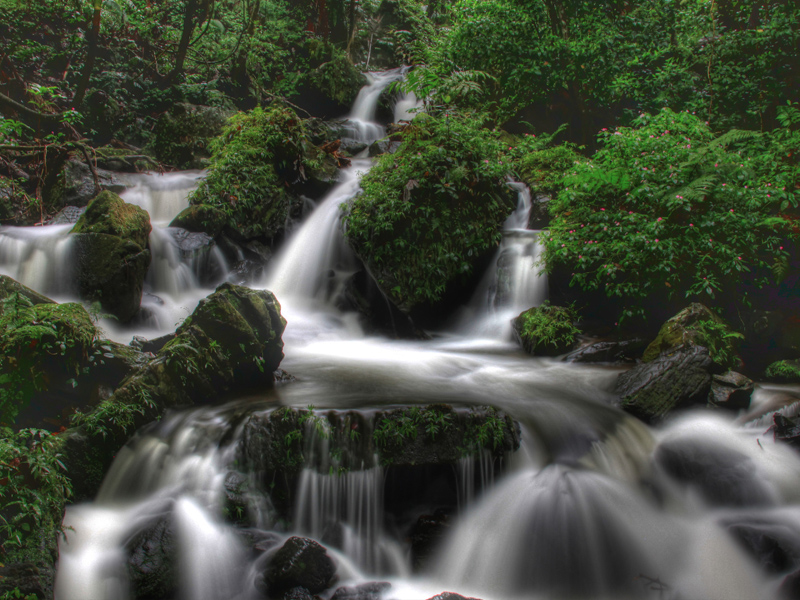 This is the most recognizable object in Cape Town, its silhouette is located on the flag of the city. Near Table Mountain are the famous peaks of the Twelve Apostles.
Editor’s note: if you liked this news, tell your friends about it using the “Share” buttons located just below this inscription – this is VERY important for us.
www.otpuskrk.ru
Source: www.otpuskrk.ru
3.8376
Please rate:
Return to the country
Traveling the world with Terry Hennet. Part 2
Today is the second and final part of the journey with the famous Swiss photographer Terry Hennet, a man who can dream with his eyes open.
40 photos
Another photo of the Trummelbach Falls from Switzerland. Here, 10 glacial waterfalls pour over 20 thousand liters of water per second inside the mountain .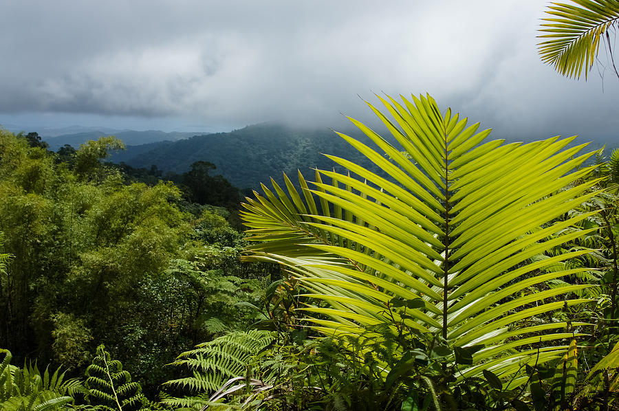 ..
..
Mysterious Forest:
Lake Lucerne (translated from German literally “lake of the four forest cantons”) in Switzerland. It has a complex shape and stretches from the city of the same name right into the mountains:
Sunset over the Santa Cruz Islands in the Western Pacific:
Rainbow Bridge in Glen Canyon National Park in the US state of Arizona. It is one of the most impressive natural bridges in the world with a distance of 71 meters between 2 pillars. According to geologists, this bridge was formed from sandstones at the end of the Jurassic:
Wheat field:
Sunset in the Alps:
On the ocean. “Spider”:
Under red sails near Enkhuizen, Holland:
Zabriskie Point is an area in the eastern part of Death Valley (California, USA). It is known for its incredible erosional landscapes that formed 5 million years ago:
3 km Moming Glacier located in the Swiss Alps:
Arno River, Italy:
Stone bridge Ponte dei Salti, Lavertezzo, Switzerland:
Natural textures:
19th century Neuschwanstein castle in southwestern Bavaria:
Amsterdam:
Ice Blue:
On the edge of the abyss:
Autumn landscape:
Venice and the Grand Canal are the concentration of the most beautiful buildings in the city. Its length is 3,800 meters, width – from 30 to 70 meters, depth – about 5 meters:
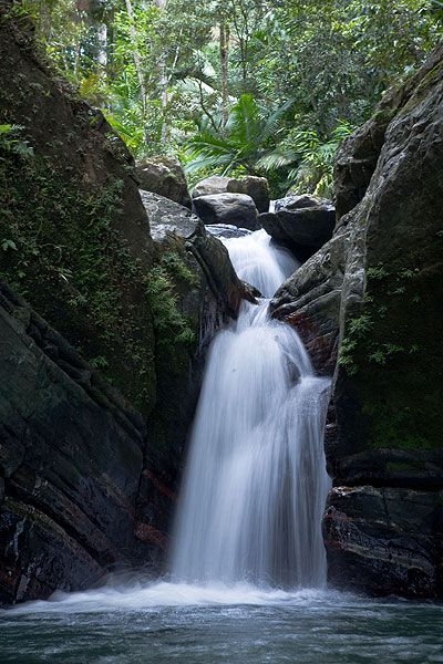
The El Yunque Rainforest is located on the island of Puerto Rico. It is also known as the Caribbean National Forest:
Lake Frostastadavatn with green-blue water in Iceland. (Clickable, 1800 x 680 px):
Mount Grosser Mythen:
Solidified lava:
Double sun:
Regensberg, Switzerland:
Curiosity:
One of the three most important cathedrals in Zurich, the Grossmünster, made in the Romanesque style:
Desert:
The majestic Gullfoss waterfall (translated as “golden waterfall”) in southwest Iceland:
The White Desert is part of the Sahara Desert and is located in western Egypt, 500 km from Cairo. Many millions of years ago, there was an ocean floor here, and white limestone is the remains of marine microorganisms.