Puerto rico corozal: Corozal | Central Mountains | Discover Puerto Rico
Corozal
Corozal, Puerto Rico
Corozal, founded in 1795, is located in the west central region of the island, close to the north coast. It is bordered on the north by Vega Alta and Toa Alta, on the south by Orocovis, Barranquitas and Naranjito, on the east, also, by Naranjito, and on the west by Morovis and Orocovis. Its area is 110.4 square kilometers (42.6 square miles).
Corozal is divided into 13 sectors: Abras, Cibuco, Corozal Pueblo, Cuchillas, Dos Bocas, Magueyes, Maná, Negros, Padilla, Palmarejo, Palmarito, Palos Blancos and Pueblo (Barrio). The population is 36,867corozaleños (2000 Census).
The corozaleños are also known as «The plantain farmers,» because of the huge numbers of plantains planted in the mountains of the municipality. The municipality is also called the «cradle of volleyball» and the «Capital of the Center of the Island.»
Corozal’s patron saint festival honors the Holy Family and is held in the month of January. The town also has a Plantain Festival.
Geography
The highest elevations in the municipality are in the south, in the Palmarito and Maná sectors, where the elevations reach 2,296 feet (700 meters ) above sea level. In the southwest, in the Magueyes sector, the peak of the same name measures 2,067 feet (630 meters). In the south, between the Palmarito sector of Corozal and the Mata de Cafías sector of Orocovis is the Matacañas peak, which reaches 2,408 feet (734 meters) on the Orocovis side of the border. In the center of Corozal, in the Negros and Palos Blancos sectors, are the Corozal Mountains, with elevations between 1,640 feet (500 meters) and 2,296 feet (700 meters). In the north, in the Cibuco, Abras and Palmarejo sectors, the land is flat.
The rivers where gold was extracted during the first centuries of colonization of the island were the Cibuco, the Corozal, Espíritu Santo, Fajardo, tHerrera, Mameyes, Manatí, Mavilla, the Morovis and La Plata. Four of those lie in the municipality of Corozal: the Cibuco and its three tributaries Corozal, Mavilla and Morovis. Other rivers that are tributaries of the Cibuco are the Negros, Dos Bocas, Indio, Unibón and Las Carreras. Of all of these, the one that produced the most gold was the Mavilla River.
The Cibuco River originates in the Cuchillas sector of Corozal and empties into the Atlantic Ocean to the north in Vega Baja. It is some 35 kilometers (21.7 miles) in length. The Corozal River originates in the Negros sector of Corozal and is 8 kilometers (5 miles) long.
The Mavilla River originates in the Cedro Arriba sector of Naranjito and is approximately 25 kilometers (15.5 miles) long. The Morovis River forms in the Morovis sector of the municipality of the same name. It is approximately 11 kilometers (7 miles) in length. The Grande de Manatí River crosses Corozal from the southeast to the southwest. Its tributary, the Riachuelo creek, forms in Corozal.
In the Abras sector are La Chiquita and Quintero caves and in the Padilla sector is the Rodríguez cave. All are wet and dark. The Quintero cave is especially deep.
The name of Corozal is derived from the word «corozo,» the Spanish name for the prickly palm (Acrocomia media), which is known for being strong, spiny, and producing edible yellow fruit that grows in bunches. This fruit was part of the diet of the Tainos. The first colonialists used it to make oil.
In the late 18th century, the site called Corozal was part of the jurisdiction of Toa Alta, but was not officially one of its sectors. The distance between the sites and the constant floods on the Cibuco River made communication impossible with the center of Toa Alta. This led some of the residents to organize and request the governor to grant authorization to form an independent town. Their request was granted in 1795. When, some researchers claim the town was founded.
However, the founding of a new town was conditioned on meeting certain requirements, including the construction of a church and government buildings, marking the borders of the territory, and holding elections.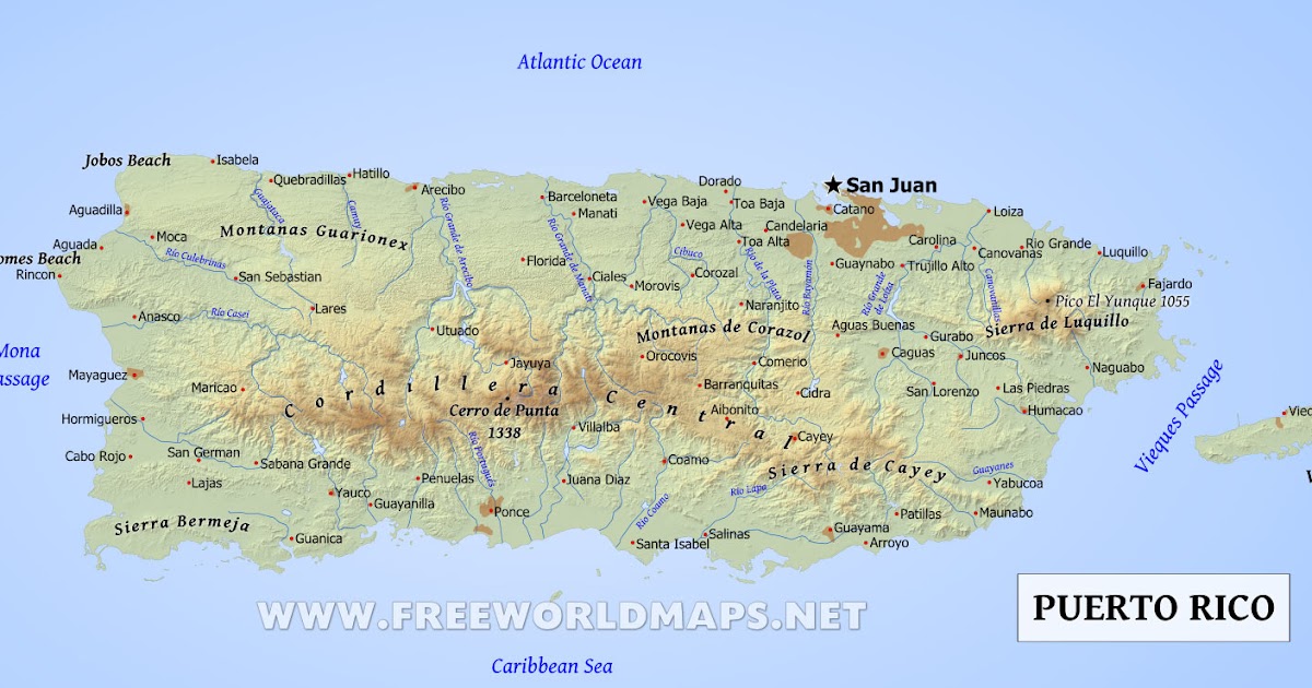 The official year of the founding of Corozal is believed to be 1803 or 1804, the date when a rudimentary church existed, a fence had been built around the cemetery, and a military commander had been elected to serve as the leader of the territory. Later, this official took on the title of mayor.
In 1828, the territory had 1,985 residents. During that era, the Corozal economy was based on the production of coffee, tobacco, sugar cane and other crops, as well as the raising of livestock. In 1853, there were 28 sugar cane presses, numerous coffee estates and fruit orchards. For a brief period of time, gold mining also took place.
In 1855, Corozal had two public schools, one in the center of town and the other in the rural zone. The municipality was divided into the sectors of Corozal Pueblo, Cuchilla, Dos Bocas, Habras, Maná, Negros, Padilla, Palmarejo, Palmarito, Palos Blancos and Sibuco. Despite various natural disasters, including a deadly cholera epidemic (1855) and the ravages of the San Roque (1893) and San Ciriaco (1899) hurricanes, the population grew to 11,508 residents by 1899.
With the passage of the Law for the Consolidation of Certain Municipal Terms in 1902, Corozal once again became part of Toa Alta. It was reconstituted as a municipality in 1905 when the law was reversed. Later, in 1948, the existing Magueyes sector and the urban center of town were reconstituted, creating the new sector called Pueblo.
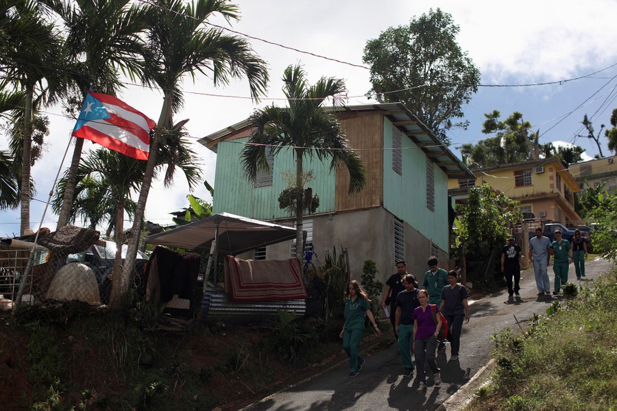
Today, agriculture still has a role in Corozal but on a smaller scale. The municipality also has factories producing clothing, food products and machinery. The current population is approximately 70,000 inhabitants.
Symbols
Flag
The Corozal flag is inspired by its coat of arms. It consists of three horizontal bands of equal width: yellow above, green in the center, and blue below. The central band carries the town’s coat of arms.
Coat of Arms
On a field of gold are three corozo palms with fruit in front of mountains and behind waves of water in blue and silver. Above is the crowned wall in gold with three towers, outlined in green.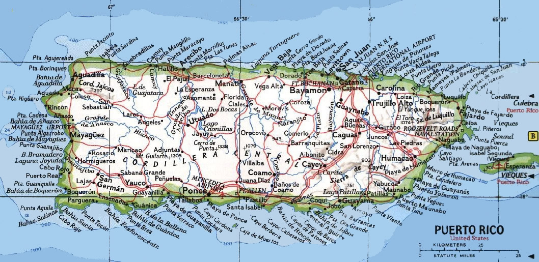 Under the coat of arms, on a flowing white ribbon, is the phrase: «In God and Corozal, We are United.» The motto expresses the spirit of brotherhood among corozaleños under the fatherhood of God. The palms represent the name of the town and its river, whose banks are luxuriously planted with these palm trees. The mountains represent the tall and striking Corozal hills and symbolize the «strength of character and forward looking nature» of the sons of Corozal. The waves represent the Corozal River and the gold stones represent the precious metal that was collected from the river’s sands until recently. The gold color of the background of the coat of arms is a symbol of industriousness and also alludes to the gold found in Corozal. The crowned wall is a symbol on the coats of arms of the cities and towns.
Places of Interest
• Town barber shop
• City Hall
• Cibuco Historical Tourism Center
• El Rancho Recreational Center
• Municipal church
• Public Plaza
Illustrious Citizens
Ramón Luis Acevedo – Writer and professor.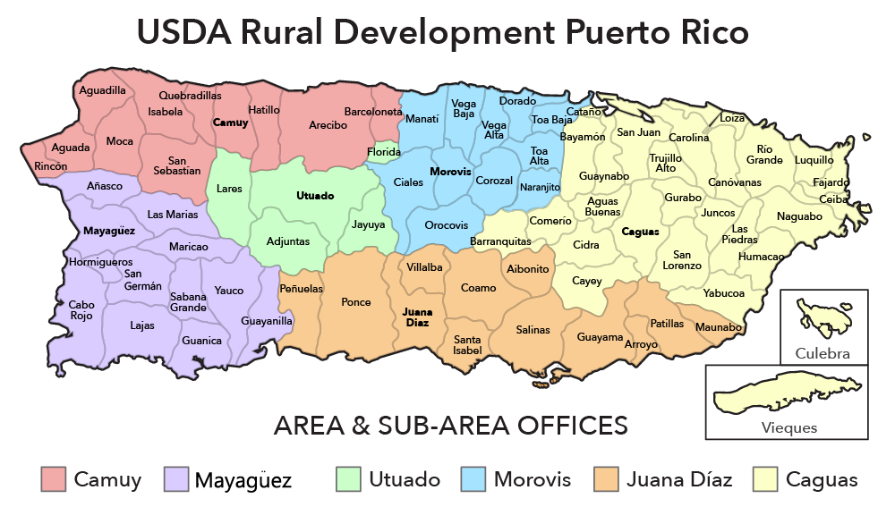 Currently he is the director of the Puerto Rican Literature Institute. He also a directo of Estudios Hispánicos journal.
Emilio R. Delgado – Poet and journalist. He was editor of three important, leading magazines: Faro, Vórticeand Puerto Rico Ilustrado. He also directed the newspaper La Correspondencia and was Secretary and Librarian of the Puerto Rican Athenaeum. (1901-
Sixto Febus – painter. Studied in classes taught by Picasso at the Sorbonne University in Paris. He has painted portraits of famous personalities. He worked as conservatore in prestigious museum as the Louvre, in Paris, the Prado, in Madrid and Buckingham Palace in England. His works have been exhibited in prestigious museums in the United States, Spain, Vienna and Australia.
Events
• Corozal Carnival – June
• San Juan Bautista Carnival – June
• Corozo Festival – October
• Plantain Festival – October
• Patron Saint Festival (The Holy Family) – January
Text taken from enciclopediapr. org
org
Video
Ayúdenos a describir todo lo que su municipio ofrece a las Industrías del Turismo y Negocios.
Favor enviar sus textos, fotografías y videos a:
U.S. Census Bureau QuickFacts: Corozal Municipio, Puerto Rico
— Select a fact –Population Estimates, July 1 2022, (V2022)Population Estimates, July 1 2021, (V2021)Population estimates base, April 1, 2020, (V2022)Population estimates base, April 1, 2020, (V2021)Population, percent change – April 1, 2020 (estimates base) to July 1, 2022, (V2022)Population, percent change – April 1, 2020 (estimates base) to July 1, 2021, (V2021)Population, Census, April 1, 2020Population, Census, April 1, 2010Persons under 5 years, percentPersons under 18 years, percentPersons 65 years and over, percentFemale persons, percentWhite alone, percentBlack or African American alone, percent (a)American Indian and Alaska Native alone, percent (a)Asian alone, percent (a)Native Hawaiian and Other Pacific Islander alone, percent (a)Two or More Races, percentHispanic or Latino, percent (b)White alone, not Hispanic or Latino, percentVeterans, 2017-2021Foreign born persons, percent, 2017-2021Housing units, July 1, 2021, (V2021)Owner-occupied housing unit rate, 2017-2021Median value of owner-occupied housing units, 2017-2021Median selected monthly owner costs -with a mortgage, 2017-2021Median selected monthly owner costs -without a mortgage, 2017-2021Median gross rent, 2017-2021Building permits, 2021Households, 2017-2021Persons per household, 2017-2021Living in same house 1 year ago, percent of persons age 1 year+, 2017-2021Language other than English spoken at home, percent of persons age 5 years+, 2017-2021Households with a computer, percent, 2017-2021Households with a broadband Internet subscription, percent, 2017-2021High school graduate or higher, percent of persons age 25 years+, 2017-2021Bachelor’s degree or higher, percent of persons age 25 years+, 2017-2021With a disability, under age 65 years, percent, 2017-2021Persons without health insurance, under age 65 years, percentIn civilian labor force, total, percent of population age 16 years+, 2017-2021In civilian labor force, female, percent of population age 16 years+, 2017-2021Total accommodation and food services sales, 2017 ($1,000) (c)Total health care and social assistance receipts/revenue, 2017 ($1,000) (c)Total transportation and warehousing receipts/revenue, 2017 ($1,000) (c)Total retail sales, 2017 ($1,000) (c)Total retail sales per capita, 2017 (c)Mean travel time to work (minutes), workers age 16 years+, 2017-2021Median household income (in 2021 dollars), 2017-2021Per capita income in past 12 months (in 2021 dollars), 2017-2021Persons in poverty, percentTotal employer establishments, 2020Total employment, 2020Total annual payroll, 2020 ($1,000)Total employment, percent change, 2019-2020Total nonemployer establishments, 2019All employer firms, Reference year 2017Men-owned employer firms, Reference year 2017Women-owned employer firms, Reference year 2017Minority-owned employer firms, Reference year 2017Nonminority-owned employer firms, Reference year 2017Veteran-owned employer firms, Reference year 2017Nonveteran-owned employer firms, Reference year 2017Population per square mile, 2020Population per square mile, 2010Land area in square miles, 2020Land area in square miles, 2010
1Table
Dashboard
Corozal on the map, Puerto Rico.
 Exact time, nearest cities
Corozal on the map, Puerto Rico. Current time, nearest cities
Show country capitals
Distance
City
Corozal on the map, Puerto Rico
18.30976
latitude
-66.32002
longitude
11.3K
population
Exact time — 14:54
Other locations
San Sebastian Utuado Santa Isabel Naranjito Morovis Sabana Grande Aguirre Yabucoa Hayuya Rincon Dorado Carolina
Contents
- Location
- Coordinates
- Population
- Local time
- Sunrise and sunset
- Surrounding cities
- Distance to the capital
Where is Corozal
The exact location is Corozal, Puerto Rico, marked with a red marker on the map.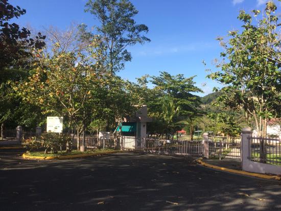
Coordinates
Corozal, Puerto Rico coordinates in decimal format: latitude – 18.3097638, longitude -66.3200234. When converted to degrees, minutes, seconds, Corozal has the following coordinates: 18°18′35.15 north latitude and -66°19′12.08 east longitude.
Population
Corozal, Puerto Rico, according to our records the population is – 11,297 inhabitants, which is approximately 0.4% of the total population of the country (Puerto Rico).
Current time
The time zone for this location Corozal is UTC -4 America/Puerto_Rico. The exact time is Saturday, February 2, 2023, 03:46.
Sunrise and sunset
Corozal, sunrise and sunset data for the date – Saturday 02/04/2023.
| Voskhod | Sunset | Day (duration) |
|---|---|---|
| 06:59 -1 minute | 18:18 +1 minute | 11:18. +2 minutes |
You can control the scale of the map using the auxiliary tools to find out exactly where Corozal is located. When you change the scale of the map, the width of the ruler (in kilometers and miles) also changes.
Nearest cities
Largest cities nearby:
- Bayamon (United States) – 15 km
- Bayamon – 17 km
- Carolina – 39 km
- Ponce – 45 km
- Punta Cana (Dominican Republic) – 221 km
- La Romana (Dominican Republic) – 278 km
- San Pedro de Macoris (Dominican Republic) – 313 km
- Santo Domingo (Dominican Republic) – 381 km
- San Cristobal (Dominican Republic) – 397 km
- San Francisco de Macoris (Dominican Republic) – 424 km
- La Vega (Dominican Republic) – 451 km
- Santiago (Dominican Republic) – 474 km
- Puerto Plata (Dominican Republic) – 483 km
- Port-au-Prince (Haiti) – 631 km
- Cap-Haitien (Haiti) – 633 km
- Carrefour (Haiti) – 639 km
- Leogane (Haiti) – 661 km
- Punto Fijo (Venezuela) – 841 km
- Coro (Venezuela) – 847 km
Distance to neighboring capitals:
- St.