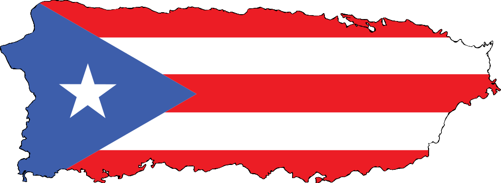
Puerto rico pueblos: Pueblos of Puerto Rico – Puerto Rican Genealogy
Pueblos of Puerto Rico – Puerto Rican Genealogy
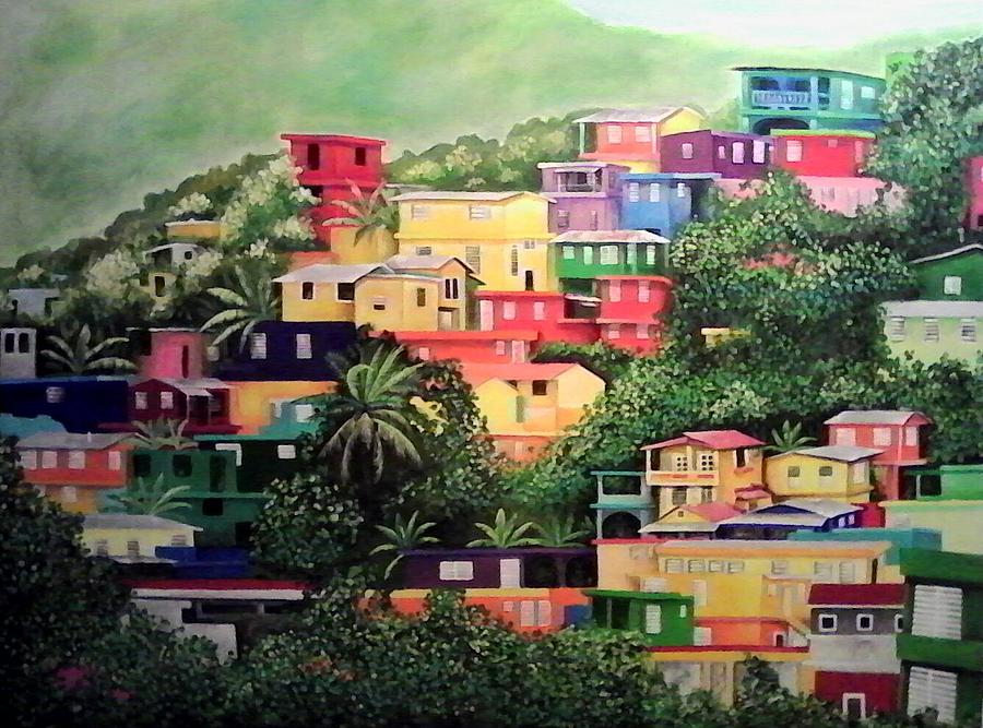
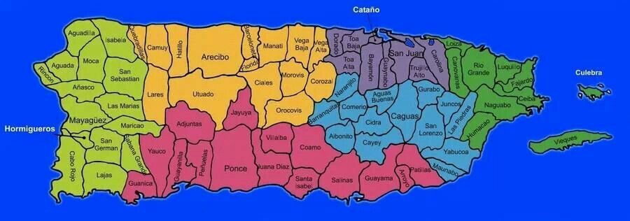
Los Pueblos
Click map to enlarge |
Breakdown of Puerto Rico Geography
Puerto Rico is divided into 78 ‘municipios‘ (municipalities) which many states would refer to as counties. Those 78 municipalities are broken down into ‘barrios‘. These barrios are official, legal, geographical boundaries unlike in the states where a barrio may refer to a neighborhood such as Fairhill in Philadelphia or East Harlem in Manhattan. The ‘barrios‘ in Puerto Rico are then divided further into a ‘sector‘ otherwise known as a neighborhood in the states but because of the vastness of the space in the countryside it seems more like a village. The pueblo is where you will find the plaza and the Catholic church this is the center of town and that barrio will be known as the ‘. .. Pueblo’.
Of course, there are larger cities such as San Juan, Ponce, Mayagüez, and Caguas where it can sometimes become a little trickier because they are cities with another subset of divisions and urbanizations. When reading census records (1910-1940), there are no street names in rural areas but at the top left hand corner the form will indicate the municipalidad and the barrio.
I included the “foundation” date of each of the pueblos only to help give context of when Europeans officially created a town meaning, there were enough settlers. This is usually near the date that the Catholic church would have been built. Obviously, all of these areas were likely inhabited by the native Taínos long before any Europeans and Africans arrived. Sadly, there is scant information to be found about specific places from this point in history. It is safe to say, that very likely, if you do not have ancestors that you can find coming directly from Europe, the matrilineal line of your ancestors were indigenous.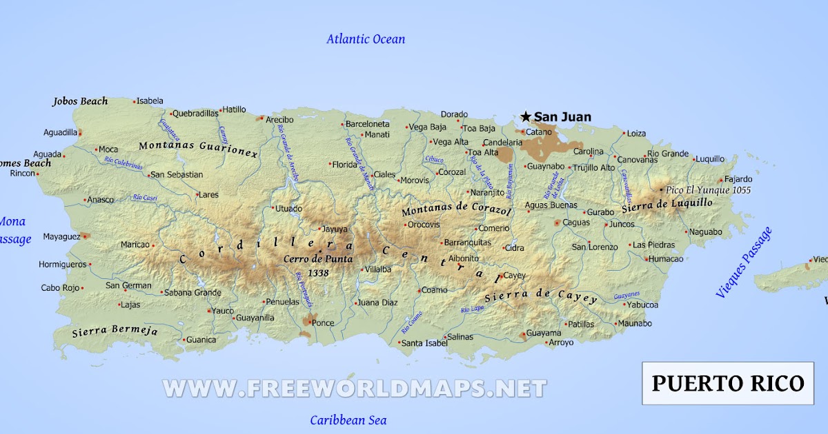
When searching on Ancestry.com, the municipality is listed as ‘county’ and the barrio as ‘township’.
*Be sure not to have your browser on translate mode on this page or the place names won’t be accurate.*
Over the centuries, some places changed names, became absorbed into other municipalities or separated from larger ones. For each area of the island I listed places that had a name change after 1825, which may affect your research. For example, if you are looking for a census record for Cataño before 1930, you must search in Bayamón as Cataño didn’t become its own municipality until 1927. In the table below, I will put an asterisk next to those municipalities that either changed its name or was a part of another. Also keep in mind that in the early 20th century, particularly in rural areas (el campo), people didn’t leave very often. Therefore, they may have referred to their barrio as their place of residence, passing that name down over the generations without using the name of the larger municipality the barrio belonged to.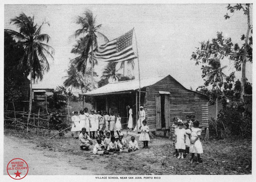 For example, my great-grandparents lived in Barrio Rincón in Cidra. If I only had the name Rincón passed down, I may have misidentified this as the municipality Rincón and spend time looking on the wrong side of the island. Conversely, it is good to know the barrio as each municipality is quite large so knowing Cidra only isn’t as helpful as knowing the barrio. Because rural areas didn’t (and some still don’t) have street names and formal address numbers, knowing the barrio will help in finding ancestors each decade.
This can become frustrating when looking for specific people and coming up empty. Be sure to check the list below to find place names that are the same but in different areas. This will help expand your search. Another example: Puerto Rico has several places with the name Ceiba. The municipality Ceiba in the eastern part of the island but there are also barrios named Ceiba in Florida, Vega Baja, Cidra, Las Piedras, Juncos and Aguadilla! So if you think you’ve hit a dead end, remember that there may be other places to look.
*Municipalities are listed from west to east and north to south*
Northern Puerto Rico |
|
Municipalidad | Barrios |
Camuy | Abra Honda, Camuy Arriba, Cibao, Ciénagas, Membrillo, Piedra Gorda, Pueblo, Puente, Puertos, Quebrada, Santiago, Yeguada, Zanja |
Hatillo | Aibonito, Bayaney, Buena Vista, Campo Alegre, Capáez, Carrizales, Corcovado, Hatillo Pueblo, Naranjito, Pajuil |
Arecibo | Arecibo Pueblo, Arenalejos, Arrozal, Cambalache, Carreras, Domingo Ruiz, Dominguito, Esperanza, Factor, Garrochales, Hato Abajo, Hato Arriba, Hato Viejo, Islote, Miraflores, Río Arriba, Sabana Hoyos, Santana, Tanamá |
Barceloneta | Barceloneta Pueblo, Garrochales, Florida Afuera, Palmas Altas |
Florida | Florida Pueblo y Florida Adentro – sectores: Aguacate, La Ceiba, Comisión, Fogones, Los Guanos, Pajonal, Parcelas Arroyo, Parcelas Selgas, El Perol, Pueblo Viejo, San Agustín, La Vázquez, La Villamil, La Dorta, Tosas |
Manatí | Barrio Altagracia, Bajura Afuera, Bajura Adentro, Coto Norte, Coto Sur, Manatí Pueblo, Río Arriba Poniente, Río Arriba Saliente, Tierras, Nuevas Poniente, Tierras Nuevas Saliente |
Vega Baja | Algarrobo, Almirante Norte, Almirante Sur, Cabo Caribe, Ceiba, Cibuco, Puerto Nuevo, Pugnado Adentro, Pugnado Afuera, Quebrada Arenas, Río Abajo, Río Arriba, Vega Baja Pueblo, Yeguada |
Vega Alta | Bajura, Candelaria, Cienegueta, Espinosa, Maricao, Mavilla, Sabana, Barrio Pueblo |
Dorado | Dorado Pueblo, Higuillar, Maguayo, Río Lajas, Mameyal, Espinosa, Santa Rosa, Los Puertos |
Toa Baja | Candelaria, Media Luna, Palo Seco, Sábana Seca, Toa Baja Pueblo, Ingenio, Campanilla |
Toa Alta | Pueblo, Contorno, Galateo, Mucarabones, Ortiz, Piñas, Quebrada Arenas, Quebrada Cruz, Río Lajas |
Central Puerto Rico |
|
Municipalidad | Barrios |
Lares | Bartolo, Buenos Aires, Callejones, Castañer, Espino, Lares, Lares Pueblo, La Torre, Mirasol, Pezuela, Piletas, Pueblo, Río Prieto |
Utuado | Ángeles, Arenas, Caguana, Caníaco, Caonillas Abajo, Caonillas Arriba, Consejo, Don Alonso, Guaonico, Las Palmas, Limón, Mameyes Abajo, Paso Palma, Río Abajo, Santa Rosa, Roncador, Sabana Grande, Salto Abajo, Salto Arriba, Santa Isabel, Tetuán 1, Tetuán 2, Utuado Pueblo, Viví Abajo, Viví Arriba |
Adjuntas | Adjuntas Pueblo, Capáez, Garzas, Guayabo Dulce, Guayo, Guilarte, Juan González, Limaní, Pellejas, Portillo, Portugués, Saltillo, Tanamá, Vegas Abajo, Vegas Arriba, Yahuecas, Yayales |
Jayuya | Jayuya Pueblo, Jayuya Abajo, Coabey, Collores, Jauca, Mameyes Arriba, Pica, Río Grande, Saliente, Veguitas, Zamas |
Ciales | Jaguas, Pesas, Cordillera, Pozas, Hato Viejo, Ciales Pubelo, Cialitos, Toro Negro, Frontón |
Morovis | Barahona, Cuchillas, Franquez, Montellano, Morovis Pueblo, Morovis Norte, Morovis Sur, Pasto, Perchas, Río Grande, San Lorenzo, Torrecillas, Unibón, Vaga |
Orocovis | Ala de la Piedra, Barros, Bauta Abajo, Bauta Arriba, Bermejas, Botijas, Cacaos, Collores, Damián Abajo, Damián Arriba, Gato, Mata de Cañas, Pellejas, Sabana, Saltos, Orocovis |
Villalba | Caonillas Abajo, Caonillas Arriba, Hato Puerco Abajo, Hato Puerco Arriba, Vacas, Villalba Abajo, Villalba Arriba, Villalba Pueblo |
Corozal | Abras, Barrio Pueblo, Cibuco, Cuchillas, Dos Bocas, Magueyes, Maná, Negros, Padilla, Palmarejo, Palmarito, Palos Blancos |
Naranjito | Achiote, Anones, Cedro Abajo, Cedro Arriba, Guadiana, Lomas, La Colina, Nuevo, Naranjito Pueblo |
Barranquitas | Barrancas, Barranquitas Pueblo, Cañabón, Helechal, Honduras, Palo Hincado, Quebrada Grande, Quebradillas |
Comerío | Comerío, Pueblo, Cedrito “La Prieta”, Naranjo, Palomas, Doña Elena, Río Hondo, Piñas, Vega Redonda, Cejas |
Aibonito | Aibonito Pueblo, Algarrobo, Asomante, Caonillas, Cuyón, Llanos, Pasto, La Plata, Robles |
Aguas Buenas | Aguas Buenas, Bairoa, Bayamoncito, Cagüitas, Jagüeyes, Juan Asencio, Mula, Mulitas, Sonadora, Sumidero |
Cidra | Arenas, Bayamón, Beatriz, Ceiba, Certenejas, Cidra Pueblo, Honduras, Montellano, Rabanal, Rincón, Río Abajo, Salto, Sud, Toíta |
Cayey | Pueblo, Beatriz, Cedro, Cercadillo, Culebras Alto, Culebras Bajo, Farallón, Guavate, Jájome Alto, Jájome Bajo, Lapa, Matón Abajo, Matón Arriba, Montellano, Pasto Viejo, Pedro Ávila, Piedras, Quebrada Arriba, Rincón, Sumido, Toíta, Vegas |
Eastern Puerto Rico |
|
Municipalidad | Barrios |
Loíza | Loíza Pueblo, Medianía Alta, Medianía Baja, Torrecilla Baja |
Canóvanas | Canóvanas, Canóvanas Pueblo, Cubuy, Hato Puerco (Campo Rico), Lomas, Torrecilla Alta (La Central) |
Rio Grande | Carola, Ciénaga Alta, Ciénaga Baja, El Verde, Guzmán Abajo, Guzmán Arriba, Herreras, Jiménez, La Ponderosa, Las Dolores, Las Tres T, Malpica, Mameyes, Palmer, Río Grande Pueblo, Zarzal |
Luquillo | Juan Martín, Luquillo Pueblo, Mameyes I, Mata de Plátano, Pitahaya, Sabana |
Fajardo | Barriada Obrera, Las Cabezas (Las Croabas), Demajagua, Fajardo Pueblo, Fajardo Gardens, Florencio, Monte Brisas, Monte Mar, Monte Vista, Naranjo, Paraiso, Quebrada Fajardo, Quebrada Vueltas, Río Arriba, Santa Isidra, Sardinera, Jerusalén, Valle Puerto Real, Veve Calzada, Villa Clarita |
Ceiba | Ceiba Pueblo, Chupacallos, Daguao, Guayacán, Machos, Quebrada Seca, Río Abajo, Saco |
Naguabo | Daguao, El Duque, Húcares, Santiago y Lima, Maizales, Mariana, Peña Pobre, Florida, Río Blanco, Pueblo, Rio (Brazo Seco) |
Humacao | Pueblo, Mambiche, Antón Ruiz, Punta Santiago, Collores, Mabú, Tejas, Río Abajo, Cataño, Mariana, Buena Vista, Candelero Arriba, Candelero Abajo |
Las Piedras | Boquerón, Ceiba, Collores, El Río, Pueblo, Montones, Quebradas Arenas, Tejas |
Juncos | Caimito, Ceiba Norte, Ceiba Sur, Gurabo Abajo, Gurabo Arriba, Lirios, Mamey, Valenciano Abajo, Valenciano Arriba |
Gurabo | Celada, Hato Nuevo, Jagual, Jaguas, Mamey, Masas, Navarro, Rincón, Santa Rita |
San Lorenzo | Cerro Gordo, Espino, Florida, Hato, Jagual, Quebrada, Quebrada Arenas, Quebrada Honda, Quemados, Cayaguas |
Yabucoa | Jácanas, Juan Martín, Calabazas, Limones, Camino Nuevo, Guayabota, Playa Guayanés, Aguacate, Tejas, Yabucoa Pueblo |
Maunabo | Calzada, Emajagua, Lizas, Matuyas Alto, Matuyas Bajo, Palo Seco, Tumbao, Quebrada Arenas, Talante |
Culebra | Pueblo, Flamenco, Fraile, Playa Sardinas I, Playa Sardines II, San Isidro |
Vieques | Isabel Segunda, Florida, Puerto Diablo, Puerto Ferro, Puerto Real, (Llave, Mosquito, Punto Arenas – occupied by US military from 1941-2003) |
 Humacao
Western Puerto Rico |
|
Municipalidad | Barrios |
Aguadilla | Aguadilla Pueblo, Aguacate, Arenales, Boriquén, Caimital Alto, Caimital Bajo, Camaceyes, Ceiba Alta, Ceiba Baja, Corrales, Guerrero, Maleza Alta, Maleza Baja, Montaña, Palmar, Victoria |
Isabela | Arenales Altos, Arenales Bajos, Bajura, Bejucos, Coto, Galateo Alto, Galateo Bajo, Guayabos, Guerrero, Jobos, Llanadas, Mora, Planas, Isabela Pueblo |
Quebradillas | Cacao, Charcas, Cocos, Guajataca, Quebradillas, Pueblo, San Antonio, San José, Terranova |
Rincón | Atalaya, Barrero, Calvach, Cruces, Ensenada, Jagüey, Pueblo, Puntas, Rincón Pueblo, Río Grande |
Aguada | Aguada Pueblo, Asomante, Atalaya, Carrizal, Cerro Gordo, Cruces, Espinar, Guanábano, Guaniquilla, Guayabo, Jagüey, Laguna, Mal Paso, Mamey, Marías, Naranjo, Piedras Blancas, Río Grande |
Moca | Aceitunas, Capá, Centro, Cerro Gordo, Cruz, Cuchillas, Marías, Naranjo, Plata, Pueblo (zona rural y urbana), Rocha, Voladoras |
San Sebastian | Aibonito, Alto Sano, Bahomamey, Calabazas, Cibao, Cidral, Culebrinas, Eneas, Guacio, Guajataca, Guatemala, Hato Arriba, Hoya Mala, Juncal, Magos, Mirabales, Perchas Uno, Perchas Dos, Piedras Blancas, Pozas, Robles, Saltos, San Sebastián Pueblo, Sonador |
Añasco | Añasco Pueblo, Añasco Abajo, Añasco Arriba, Caguabo, Caracol, Carreras, Casey Abajo, Casey Arriba, Cerro Gordo, Cidra, Corcovada, Dagüey, Espino, Hatillo, Humatas, Marías, Miraflores, Ovejas, Piñales, Playa, Quebrada Larga, Río Arriba, Río Cañas |
Las Marías | Alto Sano, Anones, Bucarabones, Buena Vista, Cerrote, Chamorro, Espino, Furnias, Las Marías Pueblo, Maravilla Este, Maravilla Norte, Maravilla Sur, Naranjales, Palma Escrita, Purísima Concepción, Río Cañas |
Mayagüez | Algarrobo, Bateyes, Guanajibo, Isla de Mona e Islote Monito, Juan Alonso, Leguízamo, Limón, Malezas, Mayagüez Arriba, Mayagüez Pueblo, Miradero, Montoso, Naranjales, Quebrada Grande, Quemado, Río Cañas Abajo, Río Cañas Arriba, Río Hondo, Rosario, Sábalos, Sabanetas |
Maricao | Bucarabones, Indiera Alta, Indiera Baja, Indiera Fría, Maricao Afuera, Maricao Pueblo, Montoso |
Hormigueros | Hormigueros Pueblo, La Prerra, Jaguitas, Valle Hermoso, Guanajibo, Lavadero, Verdum, Planbonito, Carretera Nueva, San Romualdo, Hoya Grande, El Hoyo, Las Plumas |
San Germán | Ancones, Caín Alto, Caín Bajo, Cotuí, Duey Alto, Duey Bajo, Guamá, Hoconuco Alto, Hoconuco Bajo, Maresúa, Minillas, Retiro, Rosario Alto, Rosario Bajo, Rosario Peñón, Sabana Eneas, Sabana Grande Abajo, San Germán Pueblo, Tuna |
Sabana Grande | Maginas, Machuchal, Rayo, Rincón, Santana, Susúa, Tabonuco, Torre, Pueblo |
Cabo Rojo | Bajura, Boquerón, Guanajibo, Llanos Costa, Llanos Tuna, Miradero, Monte Grande, Pedernales |
Lajas | Candelaria, La Costa, Lajas Arriba, Lajas Pueblo, Llanos, Palmarejo, Parguera, Paris, La Plata, Sábana Yeguas, Santa Rosa |
Guánica | Arenas, Bélgica, Caño, Carenero, Ciénaga, Ensenada, Fuig, Guánica Pueblo, Guaypao, Magueyes, Montalva, Playa Santa, Susúa Baja, La Joya |
Southern Puerto Rico |
|
Municipalidad | Barrios |
Yauco | Aguas Blancas, Algarrobo, Almácigo Alto, Almácigo Bajo, Barinas, Caimito, Collores, Diego Hernandez, Duey, Frailes, Jácana, Naranjo, Palomas, Quebradas, Ranchera, Río Prieto, Rubias, Sierra Alta, Susúa Alta, Susúa Baja, Vegas, Yauco Pueblo |
Guayanilla | Barrero, Boca, Cedro, Consejo, Guayanilla Pueblo, Indios, Jagua Pasto, Jaguas, Llano, Macaná, Magas, Pasto, Playa, Quebrada Honda, Quebradas, Rufina, Sierra Baja |
Peñuelas | Barrea, Coto, Cuevas, Encarnación, Jaguas, Macaná, Penuelas Pueblo, Quebrada Ceiba, Rucio, Santo Domingo, Tallaboa Alta, Tallaboa Poniente, Tallaboa Saliente, Caracoles 1, Caracoles 2, Caracoles 3, Belleza, Alturas 1, Alturas 2, Las Quebradas |
Ponce | Canas, Magueyes, Portugues, Machuelo Arriba, Sabanetas, Coto Laurel, Cerrillos, Anón, Canas, Capitanejo, Coto Laurel, Guaraguao, Marueño, Quebrada Limón, Real, San Patricio, Bucana, Canas Urbano, Machuelo Abajo, Magueyes Urbano, Playa, Portugués Urbano, San Antón, Primero, Segundo, Tercero, Cuarto, Quinto, Sexto, Magueyes, Tibes, Montes Llanos, Maragüez, Portugués, Machuelo Arriba, Cerrillos, Sabanetas |
Juana Díaz | Amuelas, Cayabo, Capitanejo, Cintrona, Collores, Emajagual, Guayabal, Jacaguas, Juana Díaz Pueblo, Lomas, Río Cañas Abajo, Río Cañas Arriba, Sabana Llana, Tijeras |
Coamo | Coamo Arriba, Cuyón, Hayales, Los Llanos, Palmarejo, Pasto, Pedro García, Coamo Pueblo, Pulgillas, San Idelfonso, Santa Catalina |
Santa Isabel | Santa Isabel, Peñuelas, Playa, Boca Velázquez, Descalabrado, Jauca I, Jauca II, Felicia I, Felicia II |
Salinas | Aguirre, Lapa, El Coco, Sabana Llana, La Plena, Las 80s, La Playa, La Playita, Las Mareas, Palmas, Quebrada Yeguas, Río Jueyes, Pueblo, Vertero, El Coqui |
Guayama | Algarrobo, Caimito, Carite, Carmen, Guamaní, Jobos, Machete, Palmas y Pozo Hondo, Pueblo |
Arroyo | Arroyo Pueblo, Ancones, Guásimas, Palmas, Pitahaya, Yaurel |
Patillas | Apeadero, Bajo, Cacao Alto, Cacao Bajo, Egozcue, Guardarraya, Jacaboa, Jagual, Mamey, Marín, Mulas, Muñoz Rivera (El Real), Pollos, Pueblo, Quebrada Arriba, Ríos |
Metropolitan Area |
|
Municipalidad | Barrios |
Cataño | Bahía, Bay View, Cucharillas, Dos Ríos, Enramada, Jardines de Cataño, Juana Matos, Las Vegas, Mansión del Norte, Mansión del RíoMansión del Sur, Marina Bahía, Matienzo Cintrón, Puente Blanco, Sector Cucharillas, Urb. |
Bayamón | Buena Vista, Cerro Gordo, Dajaos, Guaraguao Abajo, Guaraguao Arriba, Hato Tejas, Juan Sánchez, Minillas, Nuevo, Pájaros, Santa Olaya |
Guaynabo | Guaynabo Pueblo, Camarones, Frailes, Guaraguao, Hato Nuevo, Mamey, Pueblo Viejo, Río, Santa Rosa, Sonadora |
San Juan | Caimito, Cupey, El Cinco, Gobernador Piñero, Hato Rey Central, Hato Rey Norte, Hato Rey Sur, Monacillo, Monacillo Urbana, Oriente, Pueblo, Quebrada Arenas, Sabana Llana Norte, Sabana Llana Sur, San Juan Antiguo (Viejo San Juan), Santurce, Tortugo, Universidad |
Trujillo Alto | Carraízo, Las Cuevas, Dos Bocas, La Gloria, antes llamada (Quebrada Infierno), Quebrada Grande, Quebrada Negrito, San Justo, Barrio Pueblo |
Caguas | Caguas Pueblo, Bairoa, Beatriz, Borinquen, Cañabón, Cañaboncito, Rio Cañas, San Antonio, San Salvador, Tomás de Castro, Turabo |
Carolina | Barrazas, Cacao, Cangrejo Arriba, Canovanillas, Carolina Pueblo, Carruzos, Hoyo Mulas, Cedro, Martín González, Sabana Abajo, San Antón, Santa Cruz, Trujillo Bajo (sector: Isla Verde, Camp Rico) |
 Las Palmas, Valparaíso, Vista del Morro, William Fuertes
San Juanextras | San Juan annexed areas that are still referred to by their original names which can be confusing. |
 Such as El Roble became Río Piedras which was eventually annexed by San Juan in 1951. San Mateo de Cangrejos became Santurce in 1880 and was also annexed by San Juan. Santurce has many sectores (neighborhoods) that are well-known in their own right such as Ocean Park, Miramar, and Condado.
Between 2010 -2013 José Martí Mut put together a stunning booklet about the plazas and churches of the towns of Puerto Rico.
| Use the Google map and the outlined map to cross reference boundaries when researching. |
 The text is in Spanish. Even if you don’t read Spanish, it is worth perusing.
Crest of the PueblosIn front of the capitol building in San Juan, there is a small plaza that sits on the coast of the Atlantic Ocean which has a statue of San Juan Bautista. On either side of the statue is a beautiful display of glass mosaics of the crest of each of the municipalities. I took pictures of many of them. |
“Perdonadle al desterrado
ese dulce frenesí:
vuelvo a mi mundo adorado,
y yo estoy enamorado
de la tierra en que nací.”
- José Gautier Benítez
References:
Pueblos de Nuestro Puerto Rico, 2nd ed. ©1999, Publicaciones Puertorriqueñas
| ISBN(s) |
|
|---|---|
| Subject |
|
 Massol-González received the prestigious Goldman Prize (popularly known as the Green Nobel) for the organization’s initiatives to protect the environment, affirm cultural and human values, and create sustainable economic alternatives. This collective translation was undertaken in the spirit of the organization and offers a chronological account of Casa Pueblo’s evolution from a small group of concerned citizens to an internationally recognized model for activism.
 First Anti-Mining Journey
 An Alternate Model: Local Action in a Globalized World
Inkaterra Machu Picchu Pueblo Hotel, Machu Picchu
- Option and Price Information
- Amenities and Services
- Accommodation Conditions
- Guest Reviews (127)
Get the celebrity treatment with world-class service at Inkaterra Machu Picchu Pueblo Hotel
Colonial-style Inkaterra Machu Picchu Pueblo is located in Aguas Calientes. It offers massages and an original Andean sauna. The spacious rooms feature tiled floors, a fireplace and a seating area. The rate includes a buffet breakfast and an a la carte dinner.
Hotel Inkaterra’s rooms are decorated with Andean tapestries and feature four-poster beds with cotton sheets and alpaca duvets. Some rooms feature Wi-Fi, marble sinks and private pools.
The restaurant overlooks the Vilcanota River and serves dishes from the Andean region.
Guests at the Inkaterra Machu Picchu Pueblo can book a guided tour of the area, read a book from the library in the fireplace lounge or visit the gift shop.
Cusco city can be reached by train in 4 hours.
Couples especially like the location – they rated accommodation in the area for a trip as a couple at 9.7 .
Inkaterra Machu Picchu Pueblo Hotel has been welcoming Booking.com guests since Jul 18, 2011.
More details
Most Popular Amenities & Services
Free WiFi
Spa and wellness center
Restaurant
Non-smoking rooms
24 hour front desk
Currency exchange.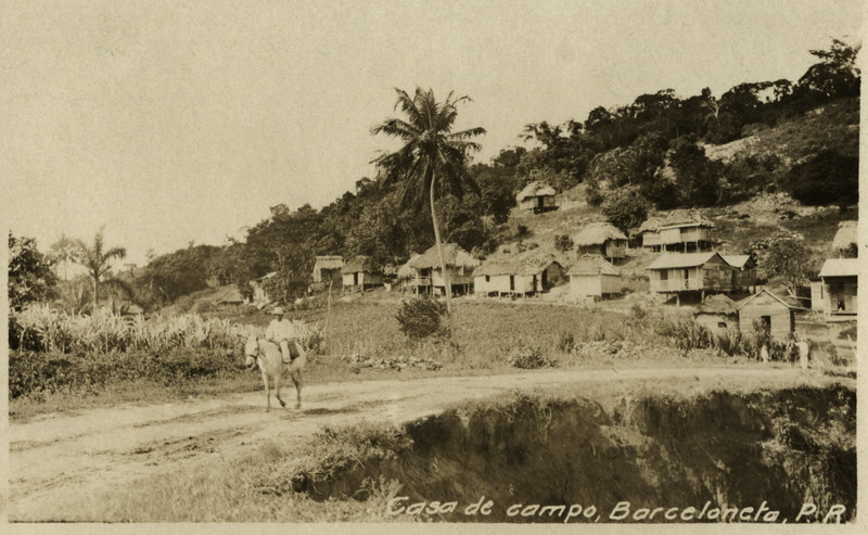 Need money in local currency? There is an exchange office here.
Benefits of this option
Great Location: Highly rated by recent guests (9.5)
Buffet
Select dates to see availability and rates.
Room type
Accommodates
Master suite
2 large double beds
or
1 Big double bed
Show prices
Lux
2 single beds
or
1 large double bed
Deluksa
900 beds
Show prices
Junior suite
2 single beds
or
1 double bed
Show prices
Improved number DEDUX
2 single beds
or
1 double bed
Show prices
Improved number
2 single beds
or
1 double
so. Please try again.
Something went wrong. Please try again.
Something went wrong. Please try again.
Something went wrong. Please try again.
Something went wrong. Please try again.
Something went wrong. Please try again.
FAQ about property
See what other guests are asking to learn more about this property.
Can we get Machu Picchu tickets at the hotel?
Dear traveler!
Tickets are sold on the government website, so the only way to buy them is either online or through their main offices in central Cusco. If available, we can definitely help with a full tour.This is a translation –
Reply September 23, 2022
What time is check out? And do you store luggage after check out?
departure time at 10:00 am
indeed we do have a storage room and you can use it after check out
Thank you!
Ecommerce teamThis is a translation –
Reply July 20, 2022
Do you have connecting rooms? We have 2 children and would like them to have their own bedroom and bathroom.

Dear Guest,
This property only has interconnecting rooms: suite and inkaterra suite. The rest of the rooms can be connected.This is a translation –
Reply August 29, 2022

Landmarks nearby *
Cafe Inkaterra
Open on:
Dinner,
Dinner
Most Popular Amenities & Services
Free WiFi
Spa and wellness center
Restaurant
Non-smoking rooms
24 hour front desk
Bathroom
Slippers
Private bathroom
Toilet
Free toiletries
Robe
Hair dryer
Shower
outdoors
Garden
Sports and recreation
Cooking class
Additional chargeWalking tours
Seating area
Dining area
Media and technology
Flat screen TV
Satellite channels
Telephone
TV
Food and drink
Bar
Restaurant
Internet
Wi-Fi is available in some hotel rooms and is free of charge.
Parking
No parking available.
Services
Daily cleaning
Concierge services
Luggage storage
Wake-up service
Tourist office
Currency exchange
Laundry
Additional charge24-hour front desk
Security
Key entry
24 hour security
Safe
Heating
Non-smoking rooms
Health services
Spa treatments
Massage
Additional chargeSpa and wellness center
Additional chargeSauna
Additional charge
The staff speaks these languages
Spanish
Accommodation conditions
Inkaterra Machu Picchu Pueblo Hotel takes special requests – add in the next step!
check in
From 13:00
Departure
Until 10:00
Cancel/
advance payment
Cancellation and prepayment policies vary depending on the type of option chosen.
Please enter your dates of stay and review the booking conditions for the requested room.
Beds for children
Child Policy
Children of all ages are welcome.
Children aged 12 and over are considered adults at this property.
To see exact prices and availability, please enter the number of children in your group and their age when searching.
Crib and Extra Bed Policy
No extra beds or cots available.
No age limit
There are no age restrictions for check-in.
Pets
Pets are not allowed.
Cards accepted by the hotel
Moscow Russia
-7 °
St. Petersburg Federal City of St. Petersburg
-8 °
Sakha (Yakutia)
-38 °
9000 9000 9000 9000 9000 9000 9000 9000 9000 9000 9000 9000 9000 9000 9000 9000 9000 9000 9000 9000 9000 9000 9000
-17°
°C
02:00 Saturday Artboard 0025 81% in hours
in the coming hours variable cloud cover
No notification now
Río Grande
- Weather for 1 – 7 days
- 8 – 14 days
- hours
- Map
- Models
9000 Weather satellites
- today
3 Dec. 70%
0.4 mm +28° / +22° 4 – 9
m/s - tomorrow
4 Dec. 80%
1.8 mm +27° / +19° 5 – 11
m/s - Monday
5 Dec. 70%
1.4 mm +28° / +21° 4 – 10
m/s - Tuesday
6 Dec. 90%
1.5 mm +28° / +23° 4 – 11
m/s - Wednesday
7 Dec. 80%
2.1 mm +26° / +23° 4 – 11
m/s - Thursday
8 Dec. 60%
0.2 mm +27° / +22° 4 – 9
m/s - Friday
9 Dec. +27° / +21° 3 – 8
m/s
 70%
70% 40
- First Ray of the Sun
- 06:16
- Half
- 12:13
- The last ray of the Sun
- 9053ULA0025 11h 5m The remaining daylight 11H 5M
Lunar calendar
- SB 3
- BC 4
- PN 5
- CP 7
- Sun 11
- Mon 12
- Tue 13
- Wed 14
- Thu 15
- Fri 16
9000 W 6
9000 9000 9000 9000 9000 9000 9000 9000 9000 9000 9000 Sat 10
- 0004
- Historical
- FPS levels:
- Additional information
Quality in El Pueblo Del Niño
Released 32 Released O₃ (80 µg/M³)
- Very low risk to health.