Aguas buenas puerto rico: Aguas Buenas, Puerto Rico
Aguas Buenas, Puerto Rico
Aguas Buenas is known as La Ciudad de las Aguas Claras
(city of clear waters), because of the purity of its fresh water springs,
the name literally translates to “good waters”.
Originally named Aguabuena, a sector of Caguas, later in 1798, became
Aguas Claras as residents started establishing houses near the area.
The town was founded in May 25, 1838 by Francisco de Salas Torres, who was declared the first city mayor.
Geography
Aguas Buenas territory is moderately mountainous, located
in the Central Mountain Range, north of
Cidra and
Caguas; south of
Bayamón,
Guaynabo and
San Juan; east of
Comerío; and west of Caguas.
Aguas Buenas’ highest peaks are La Peña (552 m), Santa Bárbara (510 m),
and Chícharo (490 m).
Several rivers flow through Aguas Buenas. Some of them are the Bayamón River, and several small rivers that are part of the
Río Grande de Loíza, like Bairoa, Caguitas, and Cañas.
Aguas Buenas is made up of 10 barrios (wards/districts):
- Bairoa
- Bayamóncito
- Cagüitas
- Jagüeyes
- Juan Ascencio
- Mulas
- Mulitas
- Pueblo
- Sonadora
- Sumidero
Climate
Aguas Buenas annual precipitation is 66.5 inches, and its average temperature is 75°F.
June is the warmest, February is the coldest, November is the wettest, and March is the driest month.
10 Day Forecast
Notable People
There are many well-known “aguasbonenses”, among them:
- Jacobo Córdova Chirino, journalist
- Gustavo Muñiz Díaz, doctor
- Rafael Nicolau, journalist
- Luis Rechani Agrait, dramatist
- Pio Rechani, journalist
Restaurants
- El Panoramico, Restaurante (Puerto Rican), (787) 732-6634
- Sirimar (Puerto Rican), (787) 732-6012
Festivals and Events
- Aguas Buenas Carnival – March
- Festival Folklorico de Campo y Pueblo – January
- Fiestas Patronales Nuestra Senora de la Monserrate – September
Every year, Aguas Buenas celebrates a patron saint festival. The festivities include dances, food, parades and religious processions.
(787) 732-8621
 The festivities include dances, food, parades and religious processions.
Symbols
Flag
The flag of Aguas Buenas features a blue triangle with the base at the hoist. The triangle has a solitary white star, like the national banner. A second triangle appears interposed with the first one, in yellow, with its point reaching the other end of the flag. The main field of the flag, under both triangles, is color green.
Coat of Arms
The coat of arms features a four-paneled shield. The upper left panel shows the Virgin of Monserrate,
while the upper right panel features a Taino, a symbol of the original inhabitants of this region. At
the bottom right panel, lies a cornucopia containing the native fruit of Aguas Buenas. This panel
represents how the agriculture was the primary source of income for the town. In the lower left panel,
there are four maracas and a güicharo, typical instruments of the
“jibaros” of Aguas Buenas and Puerto Rico. The crown, as with other municipalities of Puerto Rico, consists of three towers.
Anthem
The anthem was written by Ramon Cintron. The title is
Aguas Claras.
Education
There are 14 public schools in Aguas Buenas,
education is handled by the Puerto Rico Department of Education.
Demographics *
Population
24,223
Puerto Rico: 3,285,874
Land Area: 30.08 sq mi
Density: 840.9 per sq mi
Median Age: 42.6
Sex: 51% female
Economics **
Per capita income
$12,245
Puerto Rico: $21,058
Median household income: $20,190
Puerto Rico: $21,058
Persons below poverty line: 44.8%
Housing, families and educational attainment *
Number of households
8,629
Housing units density:
382 (2013)
Persons per household: 2.91
High school grad or higher: 72.7%
Marital status: 39% married
* U.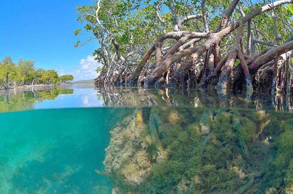 S. Census Bureau 2020 data, unless otherwise noted – Source: Quick Facts Puerto Rico.
** U.S. Census Bureau 2016-2020
Map References
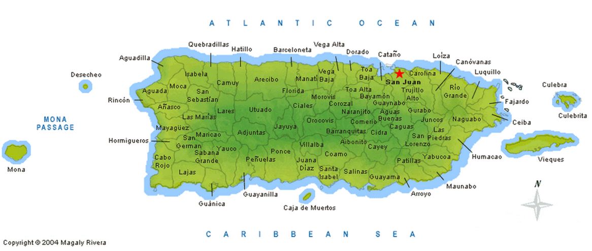
Coordinates: 18.2569° N, 66.1031° W
Zip Code: 703
Driving Distance from San Juan: 21.3 miles
Driving Time: 43 minutes
Aguas Buenas
Aguas Buenas, Puerto Rico
The municipality of Aguas Buenas, also known as the «City of Clear Waters» and the «Oasis of Puerto Rico,» is located in the extreme eastern end of the central mountain range. It has an area of 79.3 square kilometers (30.6 square miles) and its population is 29,032 residents (2000 census). The territory is divided into ten sectors: Aguas Buenas Pueblo, Bairoa, Bayamoncito, Cagüitas, Jagüeyes, Juan Asencio, Mula, Mulita, Sonadora, and Sumidero. The patron saint festival, in honor of Our Lady of Monserrate, is held in early September.
Today, agriculture has diminished markedly. The economy is mainly based on certain industrial businesses and the service sector.
Geography
This municipality is located in the center of the island and is part of the region known as the eastern humid mountains. It is about 259 meters above sea level. It is bordered on the north by Bayamón, Guaynabo and Río Piedras; on the south by Cidra; to the east by Caguas and to the west by Comerío. The humid tropical climate provides precipitation of between 64 and 78 inches each year. However, it rains less than in the towns of the western humid mountains. The land is fertile, very appropriate for growing coffee and fruit.
The topography of this upland municipality is, in general, mountainous, with very few plains. However, the mountains are low elevation. The most notable are the slopes of the central mountain range and are found in the Mulitas sector, in the west, and in the Cagüitas sector, in the south. The highest peaks are La Peña with 1,811feets (552 meters), located in the Juan Asencio sector, Santa Bárbara with 1,673 feets (510 meters), in Bayamoncito, and Chícharo with 1,607 feets (490 meters) in Sonadora.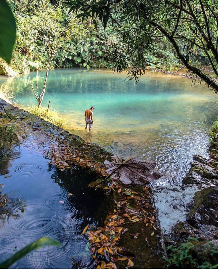
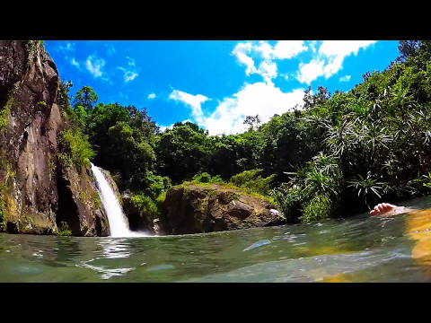
They hydrographic system of Aguas Buenas consists of various rivers and streams. The rivers are the Bayamón, which runs from south to north, as well as the three branches of the Grande de Loíza River, the Bairoa, Cañas, and Cagüitas rivers. The latter passes underground through Sumidero, where the Aguas Buenas caves are found. Among the streams that complete the hydrographic system are tributaries of the Bayamón River such as: La Zapera, Pueblo Viejo, Jácana, Vicente, Grande, Las Piedras, Las Chorreras and Sonadora and other tributaries of the Grande de Loíza River, such as: Horno, Sanjuelo and Los Muertos.
The territory that makes up the municipality of Aguas Buenas has many natural springs, which is one reason that a growing number of people settled in the area from the late 18th century on. In the beginning, the settlements were a sector of Caguas known as Aguabuena, but in 1798 the residents chose to change the name to Aguas Claras.
By 1832, the population had grown considerably. That same year, the residents held an assembly and elected Francisco de Salas Torres and Ramón Díaz to be in charge of performing the necessary steps to convert Aguas Claras into a municipality. Another resident, Julián López, granted ten cuerdas of his property for the construction of a church, a parish house, a government house or city hall, and a plaza. In 1834, the decree was issued that authorized the creation of the municipality, but it was not until May 25, 1838, under the government of Miguel López de Baños, that Aguas Claras became the municipality of Aguas Buenas, with Francisco de Salas Torres as the first captain of the settlement, or mayor.
In 1842, the first public school was established under the direction of teacher José Marcelino Alvarez. The church was built in 1845. Later, in 1850, the sectors of Juan Asencio and Mulas were annexed. Until then, they had belonged, respectively, to Bayamón and Sábana del Palmar.
Originally, the routes of communication were in very poor condition. Under the command of GovernorMéndez Vigo, a road was built across the sector known today as Jagüeyes, as well as part of Guaynabo, to connect to the central highway. In 1858, Governor Fernando Cotoner y Chacón ordered the construction of a road to Caguas that would also connect with the central highway. Roads were also built to Cidra and Comerío.
In the beginning, economic activity in the town was scarce and was limited to growing fruit. By the end of the 19th century, coffee had become the main crop. In 1894, there were 108 farms in Aguas Buenas dedicated to growing coffee and 191 producing fruit. In that era, the population had grown to 7,000 residents.
After the change of sovereignty in 1898, demand for coffee dropped. After the destruction of many crops from the passage of Hurricane San Ciriaco, the residents of Aguas Buenas concentrated on growing and improving the town. During the first decades of the 20th century, the first theater, a hospital and more schools were built.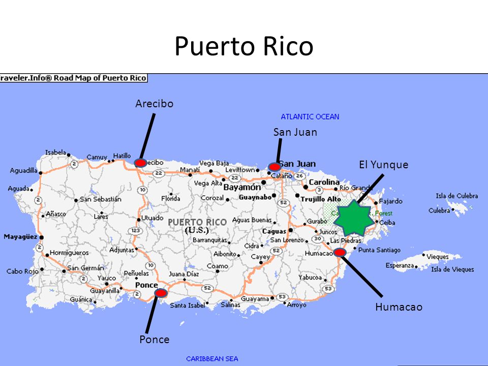 Public lighting and water and sewer service were also installed and more roads were built. The economy was mainly based on planting and processing tobacco.
Today, agriculture has diminished markedly. The economy is mainly based on certain industrial businesses and the service sector.
Symbols
Flag
The flag of Aguas Buenas consists of four triangles. On the left side is a blue triangle with a star in the center. Then follows a yellow triangle and, on the right side, two green ones. The yellow and the green represent agriculture, tropical flora and the commercial and industrial development of the municipality. The blue triangle and the solitary star, like the national flag, represent Puerto Rican nationality. The union of all these symbols and colors demonstrate the virtues and qualities of the Aguas Buenas residents.
Coat of Arms
The figures that make up the coat of arms symbolize the history, tradition and culture of the town. The coat of arms consists of four quarters or sections divided by a white cross in the center, which represents the Christian faith of the town.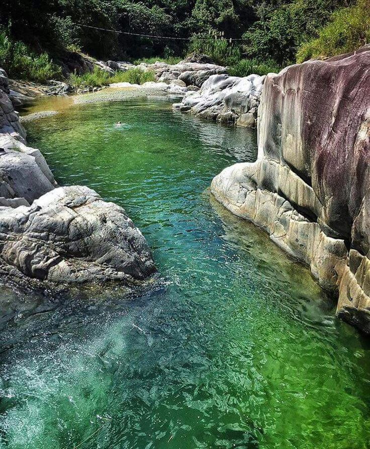 In the upper right quarter, there is a representation of the Virgin of Monserrate, the patron saint of the municipality. In the upper left corner is an image of a Taino Indian, symbolizing the first settlers of the region. In the lower left quarter is a cornucopia or vase in the form of a horn, filled with fruits produced in the territory. It represents abundance.
The last section shows some of the typical Puerto Rican folk music instruments: the guitar, the güiro and maracas. In the center of the cross is an illustration of a circle with a body of water that flows from the mountains, which represents the spring that gave the town its original name of «Aguas Claras.» In the lower part of the coat of arms is a band with the words «Municipality of Aguas Buenas, Puerto Rico.» A walled crowned with three towers, representing Aguas Buenas’ status as a town, finishes the coat of arms.
Text taken from enciclopediapr.org
Video
Ayúdenos a describir todo lo que su municipio ofrece a las Industrías del Turismo y Negocios.
Favor enviar sus textos, fotografías y videos a:
Aguas Buenas, Puerto Rico — Statistics 2022
We present you the most comprehensive, comprehensive and comprehensive statistical information on the place Aguas Buenas, Puerto Rico
FAQ
In which country is Aguas Buenas located?
Aguas Buenas is located in Puerto Rico
What is the population of Aguas Buenas ?
The current population of Aguas Buenas is 25568 people
How many men are there in Aguas Buenas ?
As of today, 9 people live in Aguas Buenas0013 12112 men
How many women are there in Aguas Buenas ?
As of today, there are 13454 women living in Aguas Buenas
What is the average age of an Aguas Buenas resident?
The median age for a person living in Aguas Buenas today is 44 years
How many babies are there in Aguas Buenas ?
Today there are 836 babies in Aguas Buenas. Of these, girls – 406 , boys – 428 . By infants we mean small children up to 4 years of age
How many small children are there in Aguas Buenas?
As of today, Aguas Buenas has 1045 small children. Of these, boys – 538 and girls 507 . These are children from 5 to 9 years old.
How many children are there in Aguas Buenas?
Today there are 1619 children living in Aguas Buenas. Of these, boys – 832 and girls – 787 . These are children between 10 and 14 years old
How many teenagers are there in Aguas Buenas?
Today 9 people live in Aguas Buenas0013 1841 teenagers. These are people from 14 to 19 years old. Of these, girls – 881 , boys – 958 .
How many centenarians are there in Aguas Buenas?
Today in Aguas Buenas 15 centenarians. These are people over 100 years old. Of these, men 3 and women 11 .
details
| 2 1 145 | |
| Santa Clara | 1 138 |
List of the largest cities in Aguas Buenas, Puerto Rico (by population). If you are interested in the answer to the question “What are the largest cities in Aguas Buenas, Puerto Rico?” – you’ve come to the right place!
Exchange rates provided by ExchangesBoard
The population of Aguas Buenas, Puerto Rico is constantly growing, and we estimate the main population milestones in Aguas Buenas, Puerto Rico
- United Nations (UN) statistics for Aguas Buenas, Puerto Rico;
- World Bank statistics for Aguas Buenas, Puerto Rico;
- World Health Organization (WHO) statistics Aguas Buenas, Puerto Rico;
We are constantly updating information about Aguas Buenas, Puerto Rico to provide you with only the most relevant information!
Detailed statistics
Population
- Puerto Rico
- Aguas Buenas
Aguas Buenas is located on is on the western part of Puerto Rica (Aguas Buenas), 23 kilometers on south from the capital San Juan.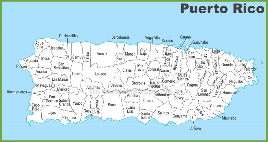 There is a lot to see in the surroundings. On the north (15 kilometers) is Theater Centro de Bellas Artes Luis, Botanical Garden (15 km), Museum of History, Anthropology and Art (17 km), Luis A. Ferre Technopark (18 km), Hiram Bithorn Stadium (18 km). 9Ol000 Hiram Bithorn
TOP 100 attractions in Aguas Buenas, Puerto Rico,
with photos and reviews
.
TOP-100 attractions, Aguas Buenas, Puerto Rico
Theater Centro de Bellas Artes Luis
Theater Centro de Bellas Artes Luis – one of the most important centers of the city of San Juan, Puerto Rico, for the creation of
3. 02
02
14.8km
Botanical Garden
The San Juan Botanical Garden is also known as the University of Puerto Rico Botanical Garden. He is about
3.49
10
15.39km
Museum of History, Anthropology and Art
Museum of History, Anthropology and Art – the first museum in Puerto Rico, which was opened on the basis of
3.49
10
17.27 km
Luis A.
 Ferre Technopark
Technopark Luis A. Ferren – science park of culture and recreation in Bayamón, important landmark
3.49
10
18.03 km
Hiram Bithorn Stadium
Hiram Bithorn Stadium is a baseball stadium located in Puerto Rico, San Juan,
3.49
10
18.19 km
Plaza las Americas shopping center
The mall was opened in 1968 in San Juan, Hato Rey, Puerto Rico. This is the largest trade
3.49
10
18. 79 km
79 km
City Memorial Museum
Mendoza City Memorial Museum – a museum with simulated earthquakes. Inside the museum is located
3.49
3
18.91 km
Arena “Jose Miguel Agrelot Coliseum”
The Jose Miguel agrelot coliseum arena is the world’s largest indoor entertainment arena, which nah
3.49
10
19.65 km
Cultural Center Casa Bacardi
The Bacardi Rum Factory Cultural Center is located in Catania, near the city of San Juan, table
3. 49
49
10
20.47 km
San Juan Central Municipal Park
San Juan Central Municipal Park is a huge 14-hectare park located in
3.49
10
20.52km
Fort San Jeronimo
Fort San Jeronimo is a small fort located at the entrance to the Laguna, at the east hour
3.49
10
20.75 km
Market Square
Market Square is located in Puerto Rico, San Juan.