Highest point in puerto rico: Cerro de Punta | Discover Puerto Rico
Climbing, Hiking & Mountaineering : SummitPost
Page Type: | Mountain/Rock |
|---|---|
Lat/Lon: | 18.16667°N / 66.6°W |
Activities: | Hiking |
Season: | Spring, Summer, Fall, Winter |
Elevation: | 4389 ft / 1338 m |
Sign the Climber’s Log! |
Overview
Cerro de Punta is the highest peak on the island of Puerto Rico. A future state highpoint perhaps?
The Cordillera Central, just east of Cerro de Punta
Getting There
Cerro de Punta is located in the Cordillera Central, a range running east-west across the middle of the island. To reach the peak from San Juan, take Highway 52 (high speed, toll road) about 50 miles to the outskirts of Ponce, then head north into the mountains on Route 10 for approximate 10 miles.
Turn right at the intersection with Route 143, also signed as Ruta Panoramica. This is a very narrow and windy mountain road with some sharp turns, steep drop-offs and even some places where part of the pavement has washed out. Travel east on 143 for 10.4 miles and pull off into a large gravel parking area on the left side of the road (unsigned).
Parking area
There is a one-lane concrete road which leads steeply to the summit. Use your discretion about driving it. If it is rainy, the could be quite treacherous. There are also no pull-outs, so if you happened to meet a vehicle coming the other way you would be forced to back down an extremely steep grade around blind corners. The road is only .6 miles, so it is best and most enjoyable to walk it.
Concrete road to summit.
The road passes through a forest of thick, lush vegetation and leads to three different tower installations very near the summit.
Rainforest vegetation near the summit
The road ends at the third set of towers and the last 50 yards leads up a set of concrete steps to the summit, which is marked only by a concrete monument. If anything official was ever printed on the monument, it is no longer visible. There is now spray-painted grafitti.
Summit marker
There are 360 degree views from the top of Cerro de Punta. To the south you can see the Caribbean Sea (10 miles away) and the city of Ponce (to the SW).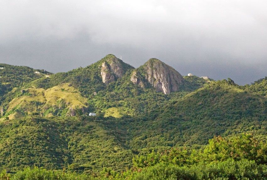 In every other direction you have views of the tight valleys and steep mountains of the Cordillera Central.
View looking SW from the summit
Return via the same route.
Red Tape
There are several tower installations in the immediate vicinity of the summit. They are protected by razor wire and are posted “Keep out.” I have heard the U.S. Navy owns or at least operates these facilities, but as far as I can tell, the road and the summit are open to the public.
Camping
No camping that I know of in the area.
External Links
America’s Roof Page on Cerro de Punta
Images
View Cerro de Punta Image Gallery – 13 Images
Table of Contents
- Overview
- Getting There
- Red Tape
- Camping
- External Links
- Images
11 Best Puerto Rico Mountains to Explore (By a Local)
Planning a day (or many) in the beautiful Puerto Rico mountains is guaranteed to be a highlight of your island trip.
The central mountain range is home to the Cordillera Central region, a line of mountains that goes from west to east and encompasses over 15 towns. Of course, driving in the Puerto Rico mountains is not for the faint-hearted, but it’ll be a great adventure.
As a Puerto Rico local, I can ensure you that the central region boasts some of the best places to see in Puerto Rico. So, if you’re into breathtaking views, challenging hikes, and finding new places, then you can’t miss these 11 mountains in Puerto Rico.
Let’s dive in!
Table of Contents
- 11 Best Puerto Rico Mountains
- Cerro de Punta
- Cerro Mime
- Cañon San Cristóbal
- Cerro El Rodadero
- Monte Guilarte
- El Toro Peak
- Cerro de Los Cielos
- Cerro Las Tetas
- Cerro Doña Juana
- Tres Picachos
- Cerro Morales
- FAQs About Mountains in Puerto Rico
- What are the major mountains in Puerto Rico?
- What part of Puerto Rico has mountains?
- Is Puerto Rico an underwater mountain?
Disclosure: Travel Lemming is an independent reader-supported blog.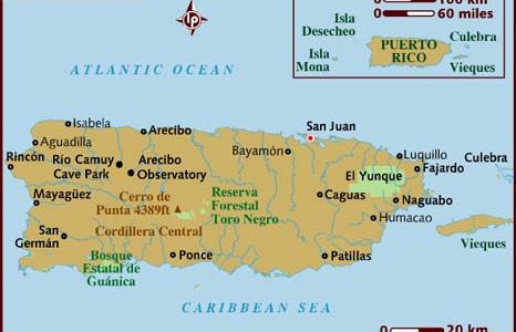 You can support us by purchasing via the affiliate links on this page, which may earn us commissions. Thank you!
11 Best Puerto Rico Mountains
Cerro de Punta
Elevation: 4,389.7 ft
🥾 Moderate | 📍 Google Maps | Costs: Free
Cerro de Punta is Puerto Rico’s highest peak and is located in the municipality of Jayuya. The Jayuya town is also located in Cordillera Central where the roads are mostly thin and curvy, adapting to the geography of the place.
If you try to reach the peak of Cerro Punta driving, then you’ll need a 4×4 vehicle as it’s steep and there are a lot of potholes. Most visitors decide to park on the main road and then hike for 45 minutes uphill but, to be honest, the road to Cerro de Punta is not for anxious and nervous people.
👉 Did you know? Jayuya and other cities in the central region are known for their coffee production. Coffee plantations in Puerto Rico became popular after the Spanish conquest, becoming part of the history and culture of Puerto Rico. If you’re visiting Jayuya, Lares, Ponce, or Adjuntas don’t miss the chance to get a taste of fresh ground coffee at a coffee farm.
Cerro Mime
Elevation: 2,080.05 ft
🥾 Difficult | 📍 Google Maps | Costs: $5 for parking
Cerro Mime is one of the more popular peaks in Orocovis, a city located in Cordillera Central. The first part of the trail is easy, but as you continue to advance, the grass is somewhat outgrown, there are a lot of insects, and you might find cows and bulls on the way. However, the view is a delight for photographers and outdoor enthusiasts.
The drive to the mountain is challenging as the roads are curvy and narrow – depending on the route you take, you might even need a 4×4. But the view of the Cordillera from this mountain is one of the popular attractions of Orocovis.
📚 Related Reading: 11 Best Towns in Puerto Rico
Cañon San Cristóbal
Elevation: 2,140 ft
🥾 Difficult/Expert | 📍 Google Maps | Website | Costs: Depends on the tour
Cañon San Cristobal, located between Aibonito and Barranquitas, is one of the most unique sights in Puerto Rico.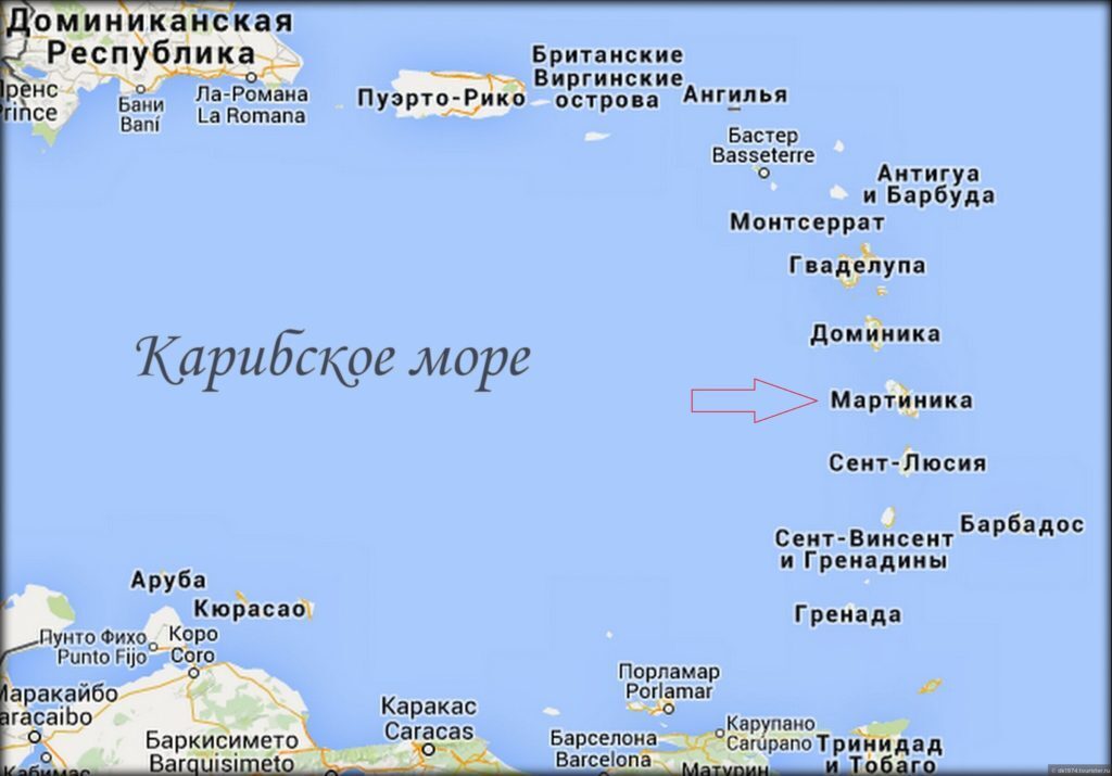 While the land is protected by a non-profit organization, it’s possible to visit with reservations and private tours.
Once a dumpsite, the San Cristobal Canyon now boasts beautiful scenery with multiple waterfalls, a river, and forests with flora and fauna that nature lovers will love.
Keep in mind that the city of Aibonito holds the record for the lowest temperature in Puerto Rico. If you’re visiting in the winter, then prepare to experience a colder climate and limited visibility due to the fog. Rainfall in Cordillera Central is also common, so drive carefully through the curvy roads.
Cerro El Rodadero
Elevation: 2,864.17 ft
The view from the mountains of Yauco
🥾 Difficult | 📍 Google Maps | Costs: free
Located in the mountain region of Yauco, Cerro El Rodadero is one of the most popular stops for Puerto Rico’s adventurous types. This famous mountain features a rock that thrill-seekers can climb to feel at the edge of the world.
The view from the south coast, west coast, Caribbean sea, and the foothills of the mountains are picture-perfect. You can also see Lago Lucchetti from this spot. Although the hike is about 20 minutes, the route is strenuous because of the inclination and the heat.
👉 Pro Tip: If you’re visiting Cerro El Rodadero, then keep in mind that once you exit PR-2, the mountainous roads are curvy, lack guardrails, have deep drop-offs, and are so small, you will have to stop sometimes to let other cars pass. Always pay attention to the road and drive with precaution. The reception is poor, so download your maps offline before visiting.
Monte Guilarte
Elevation: 3,950 ft
🥾 Moderate | 📍 Google Maps | Costs: free
Monte Guilarte is located in Adjuntas, one of the coldest cities inside the Cordillera Central Mountains of Puerto Rico. Classified as one of the highest peaks on the island, Monte Guilarte, also known as Monte Guaraguo, takes its name after a Spanish conqueror.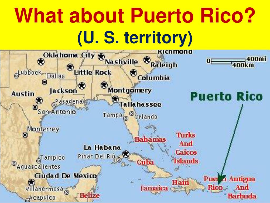
The hike to the peak from inside the Guilarte State Forest takes around an hour. The trail is of moderate difficulty, but it can get muddy and slippery with rain, which is not uncommon in Adjuntas for the altitude. You should bring along hiking poles such as the TrailBuddy trekking poles. They are lightweight, adjustable, and collapsible so you can fix them in your backpack.
🚗 How to Get There: There isn’t any direct public transportation from the San Juan airport to the towns in central Puerto Rico. The easiest way to visit any location in the mountains is by renting a car in Puerto Rico. You can use Discover Cars to find 4×4 vehicles that can conquest even the steepest streets in the region.
El Toro Peak
Elevation: 3,533 ft
🥾 Expert | 📍 Google Maps | Website | Costs: free
Located in El Yunque National Rainforest, El Toro Peak is the highest point of the rainforest. The hike to the peak is only for hardcore adventurers, as the round trip takes between 4 and 6 hours among trees, high grass, and knee-high mud.
Once at the top, you’ll see both the north and east coastline. In comparison with other mountainous areas in Puerto Rico, it’s easier to drive to this area of El Yunque, but PR 189 road is still narrow and curvy, so you should take precautions while driving.
👉 Pro Tip: Whenever you visit El Yunque or any of the mountains in the Cordillera Central region, Sierra de Cayey, or Sierra de Luquillo, start your visit early to avoid getting caught in the afternoon showers.
Cerro de Los Cielos
Elevation: 1,860 ft
View of Salinas mountains
🥾 Difficult | 📍 Google Maps | Costs: $5 for parking
Cerro de Los Cielos is located on the mountainous side of Salinas and it boasts a picturesque view of the highway and the mountains of Salinas and Cayey. The trail is known as El Arbol Solitario for the lonely tree with a Puerto Rico flag next to the trail.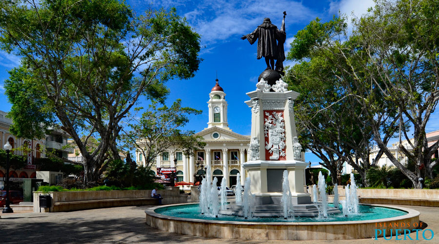
Although short, getting to the peak of Cerro de Los Cielos is challenging as it has a steep incline and there isn’t much shade along the way. Since the trailhead is difficult to find, park at Hacienda Los Maldonado and ask for directions.
📚 Related Reading: Puerto Rico’s 15 Best Hiking Trails
Cerro Las Tetas
Elevation: 2,759 ft
(photo: Euri Rivera / Shutterstock)
🥾 Easy | 📍 Google Maps | Costs: free
Cerro Las Tetas de Cayey is a popular two-peak mountain located in the Sierra de Cayey in Salinas. These mountains are popular for their unique shape and they have multiple attractions around them including rock climbing companies, fincas, and restaurants.
While you don’t have to walk more than 5 minutes from the main road to Cerro Las Tetas, and so the trail is family-friendly, you will have to transit many small and curvy roads to get there.
📚 Related Reading: My Guide to Driving in Puerto Rico
Cerro Doña Juana
Elevation: 3,471 ft
Toro Negro State Forest
🥾 Moderate | 📍 Google Maps | Costs: free
The city of Orocovis is home to a beautiful forest, waterfalls, and rivers, but it’s also difficult to explore if you’re driving in the central mountains for the first time.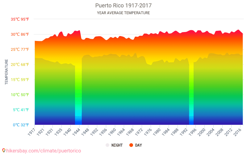 If you’re up to the challenge and like the peace of remote nature locations, then I recommend driving to Cerro Doña Juan inside the Toro Negro State Forest.
The hike to Cerro Doña Juana takes about 2 hours at a slow pace and, while the journey itself doesn’t feature much scenery, it’s great for seeing birds and enjoying the quiet solitude. At the top, visitors will find a viewing tower with a view of the surrounding towns and valley.
👉 Pro Tip: After visiting Cerro Doña Juana and exiting the Toro Negro State Forest, make a stop at Doña Juana Waterfall, one of Puerto Rico’s top waterfalls.
Tres Picachos
Elevation: 3,894 ft
🥾 Expert | 📍 Google Maps | Costs: free
If you’re an experienced hiker looking for something more challenging, then Tres Picachos in Ciales is for you. Like many of the mountains in Cordillera Central, Tres Picachos boasts a hiking trail, except this one feels more like climbing.
The route is so steep and muddy that there are ropes installed on the trail to get through it, but you’ll have the best view of Puerto Rico’s natural beauty in the region.
While Tres Picachos is in Ciales, you’ll have to access the trailhead through the city of Jayuya, which is one of the most difficult central Puerto Rican cities to move around in. The streets are steep, curvy, and can easily make anyone car sick.
👉 Pro Tip: If you’re climbing Tres Picachos, make sure to bring along gloves. These Vinsguir gloves will protect your hands from calluses, and they have a breathable fabric with a strong grip.
Cerro Morales
Elevation: 3,214 feet
Mountains of Utuado
🥾 Difficult | 📍 Google Maps | Costs: free
Hiking Cerro Morales is one of the most fun things to do in Utuado and is the highest peak of the city. Known for coffee, agriculture, rivers, and nature, Utuado is one of the top cities for people seeking to connect with nature in a remote location.
The hike to Cerro Morales takes about one hour but the natural beauty and the mix of curves and colors seen from the top is the perfect reward for hiking lovers.
👉 Pro Tip: Finding the trail to Cerro Morales is hard for people that’s never been there before. If you have a hard time asking for directions, then it’s best to book a tour with Puerto Rico Natura.
FAQs About Mountains in Puerto Rico
What are the major mountains in Puerto Rico?
The Cordillera Central mountain range is home to the five major mountains of Puerto Rico including Cerro de Punta, Monte Jayuya, Cerro Rosa, Cerro Maravilla, and Los Tres Picachos.
What part of Puerto Rico has mountains?
The center of Puerto Rico is home to a limestone mountain range known as Cordillera Central that encompasses 15 municipalities out of the 78 cities of Puerto Rico. These include Cidra, Comerío, Corozal, Naranjito, Orocovis, Barranquitas, Cayey, Ciales, Adjuntas, Aguas Buenas, Aibonito, Florida, Jayuya, Morovis, and Utuado.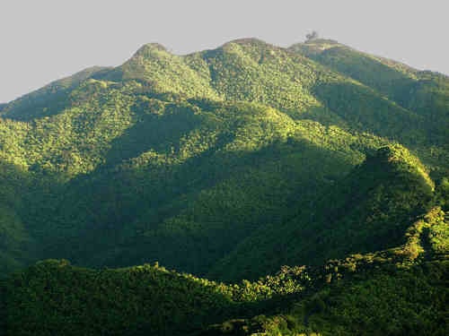
Is Puerto Rico an underwater mountain?
Puerto Rico is the result of millions of years of volcanic eruptions and activity. By definition, it’s a volcanic island that is now extinct.
***
Thanks for reading my guide to Puerto Rico’s best mountains! The Cordillera Central in particular is home to the best, as has many things on offer.
For more great things to do, check out this epic list of fun activities in Puerto Rico.
Enjoy the Puerto Rico mountains!
How useful was this post?
Click on a star to rate (you can leave feedback after clicking submit)
Help us help you travel better!
Your feedback really helps …
What did you like about this post? Or how can we improve it to help you travel better?
Puerto Rico Trench – the deepest place in the Atlantic Ocean: description and photo
Since the last century, oceanologists have been puzzled by the question of what is the deepest depth in the World Ocean. The search led them to numerous depressions, many of which already have detailed descriptions. The deepest points of the ocean floor are mapped, they allow you to better understand the processes that took place millions of years ago. Also, thanks to them, it is possible to predict the future of the Earth’s geology. One of the most interesting depths is in the Atlantic Ocean, the Puerto Rico Trench, which is the deepest point in the Atlantic Ocean. nine0003
The Puerto Rico Trench is the deepest place in the Atlantic
The ocean trench has a depth of 8742 m. At the same time, the average depth is 3736 m. If we compare the Atlantic by this indicator, then it is in 2nd place after the Pacific Ocean. At the same time, the World Ocean has an average depth of 3711 m.
The location of the Puerto Rico trench falls on the border of 2 tectonic plates, they move along a trajectory as close as possible to a horizontal one. The local area is complex in terms of geology. The location of the movement of the Caribbean and North American plates at this depth is characterized by high seismic activity.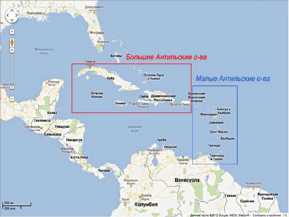 Moreover, the island arc in the southeast of Puerto Rico is characterized by increased volcanic activity. All this creates a risk for residents of nearby settlements. nine0003
Puerto Rico Trough Area Hazard
Due to the discovery of a high frequency of earthquakes, since 1988 local residents have been regularly informed about possible earthquakes. One of the most destructive natural phenomena caught the inhabitants of the coastal regions of the Indian Ocean. The 2004 tsunami was a direct consequence of oceanic plate movement in the Puerto Rico Trench region.
The earthquakes of 1918 and 1953 brought powerful destruction. The latter affected the coastal region of Santo Domingo. The island of Puerto Rico itself and its inhabitants are regularly affected by earthquakes. Over the past decades, the earthquake of 2010 became the most destructive, the average magnitude of which stopped at around 7.
The movement of the Caribbean and North American lithospheric plates caused an earthquake, which became one of the largest in the history of mankind.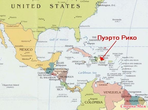 It destroyed thousands of residential buildings, the infrastructure of the city of Port-au-Prince, claimed the lives of millions of people. Dozens of states dealt with the consequences. Rescue work is considered one of the most difficult in the history of earthquake observations. The maximum possible death toll was 500 thousand people. Scientists claim that in 1787 there was an even more powerful earthquake, the average magnitude of which was kept at 8.1. That is why it is necessary to explore the deepest place in the Atlantic Ocean, since the trench can reveal many details of the features of tectonic activity. nine0003
Volcanic activity in the deepest part of the Atlantic Ocean
There are many volcanoes in the Atlantic, many of which are active. In 2004, the result of volcanic activity, the epicenter of which fell on the Puerto Rico Trench, was a huge tsunami that brought the greatest destruction to states located along the coast of the Indian Ocean. Local volcanoes are closely related to the volcanic system of the Caribbean.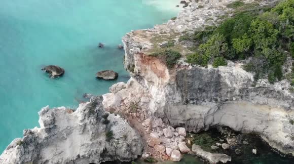 Located at great depths, they are characterized by unstable flanks, which are capable of bringing destruction on a massive scale. The study of oceanic volcanoes along with the Puerto Rico Trench can help in the study of terrestrial volcanoes located on the islands of Martinique, Montserrat, St. Vincent and others. nine0003
Other deep trenches in the World Ocean
There are many deep trenches in the world. The Puerto Rico Trench of the Atlantic Ocean is one of the deepest trenches in the world, but it occupies almost the last place in the world list. Only the Japanese Trench yields to it, and the study of its depth is still ongoing. During measurements, it turned out that the average length of the Japan Trench exceeds 1000 km. The last depth measurement was taken in 2008. Then scientists found out that it is approximately 8,400 m. The maximum figure is still a mystery. nine0003
The Kuril-Kamchatka Trench is of no less interest to oceanologists. Its maximum depth is 9,717 m. The greatest width is only 59 km, which is considered a rather modest figure. This deep place in the ocean has valleys and canyons, is characterized by an uneven bottom, many depressions, detailed studies have not yet been carried out.
In the Pacific Ocean, the Izu-Bonina Trench is notable for its considerable depth. This deep place in the Pacific Ocean was discovered at the turn of 19and 20 centuries. The greatest depth here exceeds 9,800 m. The gutter served for laying a telephone cable, and at first the greatest depth was determined incorrectly, and 8,500 m was chosen from all measurements. Then, in the course of detailed studies, it was established that the place had a much greater depth.
The Kermadec Trench is famous not only for being a deep place, but also for being one of the largest crustaceans. The average size of each inhabitant of the Kermadec trench exceeds 30 cm in length. During the research, it was possible to establish that the maximum depth exceeds 10 thousand meters.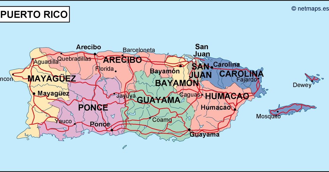 Surprisingly, the gutter became a habitat for other marine creatures, some of which are even unknown to science. nine0003 Kuril-Kamchatsky Trench
The Philippine Trench has a maximum depth of 10,540 m. It is located in the Pacific Ocean. Detailed studies have not been carried out, the deep place is of the greatest interest for geological study.
The situation is quite different with the Tonga Trench, which is considered one of the most important objects of study of the ocean floor. Its depth exceeds 10,880 m, which is almost the maximum figure, which only the famous Mariana Trench managed to surpass. The average speed of plate movement is more than 25 cm per year. Scientists also studied a small island located in the area. The average island movement speed was also 25 cm. This directly indicates that the lithospheric plates have one of the highest activities. The Tonga Trench became famous for the Apollo 13 stage stuck in it. This Pacific Ocean location has also adopted a plutonium-fueled power source. There is an opinion that with the decay of plutonium, which will end by 2060, a real environmental disaster can happen. Finally, it is worth considering the place that has the greatest depth in the oceans. We are talking about the Mariana Trench. nine0003
There is no deeper place in the world than the Mariana Trench. Its maximum depth exceeds 11 thousand meters. The average is 10,994 m. The study of the depression began in 1960. The US Navy sent an expedition of 2 people in a bathyscaphe, who managed to reach the maximum possible depth (10,918 m). The unknown was the greatest danger, and given the lack of modern technology, intrepid travelers exposed themselves to significant threats. Nevertheless, they managed to return safe and sound and reported that even the deepest place has its inhabitants. Alas, there is still no evidence other than their words. However, the National Geographic channel sent James Cameron himself to explore the Mariana Trench. The brilliant director said that on the basis of the video materials he received, he would make a film about the miracle of nature.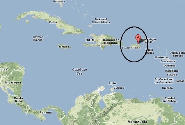 It is already known that the ocean floor has mountains, the average height of which exceeds 2 km, and the highest – 2.5 km. nine0003
Other deep depressions of the Atlantic Ocean
It is now established that there are 4 depressions near the Atlantic Ocean:
- Puerto Rican;
- Yuzhno-Sandvicheva;
- Romansh;
- Kaimanov.
The South Sandwich Trench occupies not only part of the Atlantic Ocean, but also part of the South. Its average length is 1,380 km and its maximum depth is 8,264 m.
The Romanche Basin is a trough near the equator. The average value of depth measurements shows that the Romansh has an indicator of 7,758 m. The Kaimanov depression is considered one of the most interesting. It is ranked among the zones with the greatest geological complexity. The Cayman Trench influences the formation of the tectonic boundary (Caribbean and North American plates). The maximum depth of the trench is 7,686 m. The Cayman Trench has a unique ecosystem, recently special volcanoes have been discovered in it. Oceanographers from the UK have found unique hydrothermal vents that are below the 5,000 m mark.
It is the study of the Cayman Basin that helps to determine how great the geological activity of the plates is. So far, it has been established that the average value of the speed of movement exceeds 10 mm per year for this section of the Atlantic Ocean. It is because of the movement of the plates that faults appear and volcanoes are formed that constantly erupt magma (lava). Volcanoes discovered at a considerable depth are called very interestingly – “black smokers”. They are formed due to the infiltration of cold sea water along the cracks of the ridges. A long process of formation leads to a decrease in the permeability of rocks, volcanic ash raises the ambient temperature to 360 ° C and, together with pressure, leads to a reaction in which water interacts with rocks. As a result, powerful jets of water quickly break out, and the black color is due to the high content of sulfides and sulfates, together with metal oxides.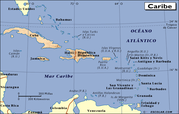 nine0003
Most of the deep sea trenches are located in the Pacific Ocean. However, the Atlantic also managed to acquire a couple of interesting depressions. All gutters are characterized by a narrow width, steep slopes, and length over considerable distances exceeding hundreds of kilometers. The Puerto Rican trench is of greatest interest as an important geological feature that allows a better understanding and prediction of seismic activity. It is now known that, like other depressions, the Puerto Rican Trench of the Atlantic Ocean repeats the island arc. The discovery of new ecosystems in various deep-water areas of the Atlantic and other oceans allows us to talk about the possibility of life in incredible conditions from the point of view of the layman. Despite all the menacingness associated with the evidence of the formation of huge faults, these sites can reveal amazing secrets that people could not even guess about before. However, due to the complexity of research, such places remain a mystery.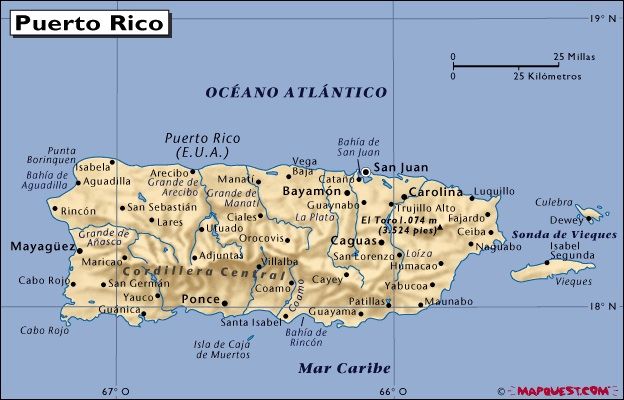 nine0003
Filed under: Puerto Rico | TravelWorld
Puerto Rico means “Rich Port” in Spanish. It is not surprising that the United States cannot simply take and give up a territory with such and such a name. Therefore, the legal status of Puerto Rico today is quite complicated: it is a so-called unincorporated organized territory that enjoys the American dollar, American sovereignty, American defense forces and part of the American Constitution. However, Puerto Rico has its own legislative, executive, judicial powers, as well as local self-government. And Puerto Ricans are secretly envied by the whole world! Still: officially considered US citizens, but do not pay US taxes. Perhaps someday Puerto Rico will either become the 52nd state of America, or finally separate from it. Or maybe everything will remain as it is now. Time will show. nine0003
More than here
As of 2009, there were about four million Puerto Ricans living in Puerto Rico. And in the US there were more than 4. 4 million. The flight from the country is not surprising: 50% of Puerto Ricans are below the poverty line. In the 19th century, the situation was exactly the opposite – Spaniards, Cubans, Argentines, Colombians, French, Libyans and even the Chinese fled to Puerto Rico – I can’t even remember everyone.
Puerto Ricans are a very heterogeneous nation. A person who calls himself a Puerto Rican may turn out to be mostly European, and African, and Asian, and Indian. Today around 90% of the country’s population calls themselves Puerto Ricans and does not delve into this issue.
About 500 thousand people live in the capital of Puerto Rico, the city of San Juan. There are more Puerto Ricans in New York – well, in fact, as well as in America as a whole. 95% of the country’s population are Christians, but almost all of them are somehow connected with national mystical cults.
Ministerial Island
Puerto Rico is an island nation that consists of the main island of the same name and several small islands, most of which have no permanent population.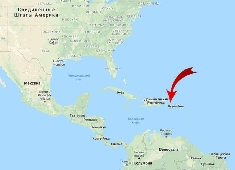 So, for example, on the island of Monet there are only ministers. But this is not a resort – this is their job: they monitor the state of national resources. nine0003
75% of Puerto Rican territory is mountains, mountains and more mountains, and the rest is valleys, forests, beautiful beaches and labyrinths of curious caves. So this country is suitable for tourists with a variety of inclinations. Coastal waters are fenced off by coral reefs, so they are safe from the point of view of bloodthirsty inhabitants, but at the same time treacherous because of their unpredictable currents.
Puerto Rico has long been based on agriculture, so many of the island’s forests have been cut down. Today, forests are under protection, and the country is actively developing tourism, so we can hope that in the future the forest cover will not suffer so much. nine0003
Puerto Rican Huracan
Prior to colonization, Puerto Rico was inhabited by the Taíno Indian tribe, who had an evil god called Huracan.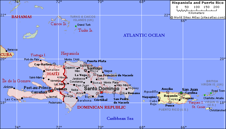 He was responsible for all the evil that happened in the country, including hurricanes. Some say that they were named after him: in Puerto Rico they occur so often that they are no longer something out of the ordinary.
Therefore, it is recommended to visit Puerto Rico in December-April. At this time, it is relatively cool here – about + 24˚С, but dry. nine0003
Interesting
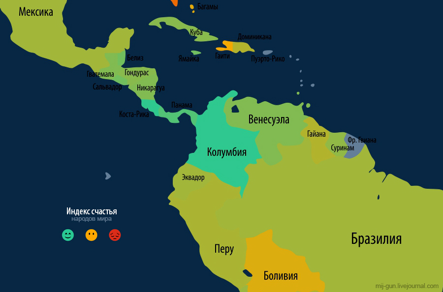
- To the west of Puerto Rico is the Dominican Republic, to the northeast is the British Virgin Islands. Puerto Rico is bordered by the Atlantic Ocean to the north and the Caribbean Sea to the south.
- The highest point in Puerto Rico is Mount Cerro de Punta (1338 meters).
- Puerto Rico has two official languages, English and Spanish. Periodically, only one remains – Spanish: if the island is ruled by a governor aimed at separation from the United States, English loses its official status, if an Americanophile governor comes to power, it gets it back.