Las tinajas puerto rico: Cool Off at Charco Frio or Get Crazy at Las Tinajas
Las Tinajas Waterfall & Charco Frio
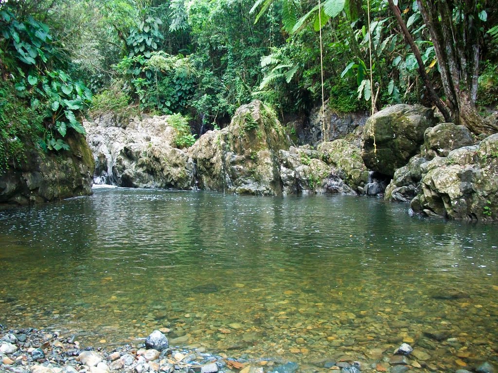
Las Tinajas Waterfall struck me as one of those really fun swimming hole waterfalls featuring a deep pool that can accommodate a high rope swing as well as cliff jumps.
If anything, I think of this waterfall as really a backdrop to the swimming hole commotion, especially after the muddy and muggy hike it took for us to get there.
Las Tinajas Waterfall
…And we took the easy way to reach Las Tinajas (which I’ll explain shortly)!
By the way, there could be more waterfalls and natural water slides further upstream from Las Tinajas Waterfall pictured above.
However, with all the tour groups occupying the scrambling paths during our April 2022 visit (which took place on Good Friday), I didn’t pursue those paths to prolong our visit.
This was especially since afternoon thunderstorms had already popped up and started dumping buckets of on-and-off rain during our visit.
Context of the commotion on the RÃo Fajardo before Las Tinajas Waterfall
Finally, I’ve seen this place associated with the place name “Charco Frío” (Cold Pool), which actually caused me a bit of confusion concerning what exactly this pool is and whether it’s the same spot as the Las Tinajas Waterfall.
I’ll unpack this confusion (on my part at least), which actually caused me to do the two different approaches to access Las Tinajas Waterfall from the car parks at the start (see directions below).
What’s Up With This Easy Way Versus Hard Way?
What I’m calling the “easy way” to access Las Tinajas Waterfall is basically a wide but muddy 4wd track through someone’s property that ultimately reaches the swimming hole and falls after about 3/4-mile or so.
It took us roughly about 45 minutes to an hour in each direction, but most of that time was spent trying to avoid the deep mud patches along this trail as well as the slippery, rooty descent down to the Río Fajardo.
Tahia and Julie trying to avoid the slippery and messy mud puddles and patches along the easy access trail leading to Las Tinajas
By the way, that river defines the border between the municipalities of Ceiba to the south and Fajardo to the north.
I learned that most of the political boundaries throughout Puerto Rico are defined by these rivers, which makes sense since natural landmarks are easier to identify than the imaginary ones (e. g. the state line between California and Nevada).
Anyways, in order to get started on this hike, there are two ways you can go about doing this.
First, you can try to approach the private property gate with the access road leading directly to the falls.
The Fajardo River scramble to access Las Tinajas without going through the nearest private property is considerably rockier, muddier, and slower going, but it does pass by some small swimming holes and cascades
Alternatively, you can park in a large grassy area at a different property (i.e. a different owner) and then either walk up to the gated entrance for the property owner with the easy access or try to bypass his property by hiking along the river itself.
As of our April 2022 visit, the owner with the easy access charged us $10 for the vehicle and $2 per person (so $16 total for the three of us).
We were lucky apparently with our visit because he accommodated us even though there were tours who have contractual agreements with the landowner to occupy most (if not all) of his parking space behind the gate.
Now if this parking area is closed or full, then you can backtrack to the owner with the large grassy area, where he charged $5 per vehicle.
The large parking area a bit before the gate leading to the property with the most convenient access to Las Tinajas Waterfall
From there, it’s up to you to decide whether to walk to the gate and landowner with the easy access and pay $2 per person, or whether you’d want to scramble up the river to eventually reach the Las Tinajas Waterfall.
Just to give you an idea of how hard the “hard way” is, it involves a very muddy (even muddier than the “easy way”) and rocky river scramble where the trail is not always defined.
If I had to guess, it would take perhaps twice as long to reach Las Tinajas via the hard way as compared to the easy way.
Trail Description Of the Easy Way
From the car park area within the property with the easy access, we basically just followed the main 4wd road uphill for roughly 45 minutes or so.
Julie and Tahia walking through a typical Puerto Rican jungle flanked by a mix of native and non-native vegetation, including these bamboo stalks
The “road” passed through a fairly typical Puerto Rican jungle with some non-native bamboo, non-native tall grass, and some other interesting vegetation rich with wildlife (we saw a giant snail clinging to one of the leaves).
Along the way, there were at least two or three gates, which seemed kind of superfluous until I realized after the fact that they were there to deter visitors from trespassing through his property should they enter from the river (bypassing the first gate).
We encountered one such intermediate river access route that seemed well-worn about a quarter-mile from the start of the hike.
Although the trail was pretty straightforward to follow, we were slowed down by not only trying to avoid the most slippery and messiest parts of the mud, but we also had to wait for tour groups to pass by in the more narrower sections.
We didn’t know this at the time, but apparently several tour groups take paying customers to visit Las Tinajas Waterfall
Towards the end of the hike, we noticed a narrow gully to the right that dropped directly down to the river, but we also noticed a more well-used trail that involved going on muddy rocks and roots as it went around a large tree down to the river.
Both approaches were slippery and messy, but I’d imagine you might have a harder time climbing up out of the narrower path on the way out given the lack of footholds.
In order to start seeing the Las Tinajas Waterfall, we had to wade out towards the far side of the Fajardo River, where we caught a distance look at the narrow chute waterfall spilling into the deepest parts of the plunge pool.
I did see tour groups climbing up to the cliffs and rope swings for cliff jumps, but I also saw some of the more adventurous tours go even further upstream towards water slides and other aspects of the waterfall (which I didn’t pursue).
A narrow, slippery, and muddy gully leading down to the Fajardo River though I found it easier to just continue following the main trail and taking the rooty approach around a big tree down to the river as there were more footholds there as opposed to this path
Overall, our visit would only take less than 90 minutes for just doing the out-and-back hike in this manner without spending even more time swimming and cliff jumping like a lot of the tour participants did here.
However, I did extend my visit because I needed to better understand what the Charco Frío was all about, which I had assumed were swimming holes closer to the trailhead.
The Charco Frío Confusion & The Hard Way
In my confusion, I actually decided to do another hike within the Fajardo River from the larger parking area thinking that there ought to be more obvious “cold swimming holes” (as per the “Charco Frío” place name).
However, after about an hour of pretty fruitless scrambling in the river and discovering a muddy trail that seemed to parallel the northern banks of the river, I concluded that it got way too rough and that there was really nothing there.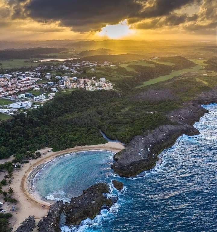
Charco Frio could very well refer to the countless series of minor cascades and pools within the Fajardo River, but after doing this hike, I now think it really pertains to the deep pool before Las Tinajas Waterfall
According to my GPS logs, I had only gone about 1/3 of the way upstream to Las Tinajas Waterfall, and I suspected that it would have taken me twice as long to reach Las Tinajas Waterfall doing it this way instead of the easy way.
So I apparently concluded that my initial assumptions about what Charco Frío were wrong, and all I had to show for my efforts were just smaller miscellaneous cascades and swimming holes on the Fajardo River along the way.
This was confirmed when I spoke to a guide who explained to me that Charco Frío was just a generic term for a cold pool, and that the real target of this adventure was the Las Tinajas Waterfall itself.
Thus, I could have also concluded that Charco Frío was really that deep pool fronting the main waterfall!
When my river scramble degenerated into this slosh through endless muck, that was when I aborted my river scramble and returned to the car park concluding that there was nothing significant about the river scramble leading up to the Las Tinajas Waterfall
Anyways, the main takeaway from this experience was that you can access Las Tinajas without going through the property owner with the most convenient access (whether you don’t want to pay or it’s just not available).
However, doing it in this manner is way more involved and will likely take twice as long while assuming a lot more risk in the process.
Authorities
Las Tinajas Waterfall resides on the Río Fajardo separating the municipalities of Fajardo and Ceiba, Puerto Rico. Parking and access is through private property.
According to the helpful Puerto Rico Day Trips website, the owner of the property with the most convenient access is named Mr. Basilio, and his number as of March 2019 is (787) 342-2415. You may want to consult that website for the latest information since it is run by Americans who have moved from New Jersey to Río Grande. Thus, they can reconn or have connections to locals and can provide updates to the latest conditions and ownership situations.
Route to this Waterfall
The way we accessed Las Tinajas Waterfall was from the north, where the most straightforward approach would be to take the PR-3 towards Fajardo, and then turn onto the PR-976 to the PR-971.
Note that staying with the PR-976 and going onto the PR-971 looks easy on say Google Maps, but in practice, there are actually a myriad of turns at stop signs on seemingly small or residential streets.
We had to deal with traffic at the Luquillo Kiosks so when we decided to drive to Las Paylas, we had to make it to the next traffic light to do a U-turn to go east towards the PR-992
So we really had to pay attention to our GPS tracking while correlating where we were on the map relative to what we were seeing in reality.
Anyways by the time we were on the PR-971, there were signs pointing the way to Las Tinajas, and then we turned right just after the bridge over the Fajardo River onto a narrow access road leading to the car parks for Las Tinajas.
The drive from Fajardo to Las Tinajas would take around 20 minutes to do the 11km depending on the traffic.
We didn’t take the southern approach from the Toll Highway Route 53 (though we could have when we came back to Fajardo from Cayey at the end of the trip), and that would involve leaving the highway at Naguabo then accessing PR-571 from the PR-31.
Looking back at the gate blocking the property with the most convenient access to Las Tinajas Waterfall
Overall, Fajardo is about 9km (about 15 minutes drive depending on traffic) east of Luquillo, about 8km (about 10 minutes drive) north of Ceiba, and about 60km (over over an hour drive depending on traffic while also using the toll PR-66) east of San Juan.
Find A Place To Stay
Booking.com
Fun video showing lots of people jumping and rope swinging in front of Las Tinajas
Back and forth sweep showing the ambience of the area at the end of the Las Tinajas Trail
Tagged with: charco frio, water slide, rope swing, rio arriba, pr-971, fajardo, ceiba, swimming hole, puerto rico
Visitor Reviews of this Waterfall:
If you have a waterfall story or write-up that you’d like to share, feel free to click the button below and fill out the form. ..
..
No users have submitted a write-up/review of this waterfall
Have you been to a waterfall? Submit a write-up/review and share your experiences or impressions
Review A Waterfall
Nearest Waterfalls
The Waterfaller Newsletter
The Waterfaller Newsletter is where we curate the wealth of information on the World of Waterfalls website and deliver it to you in bite-sized chunks in your email inbox. You’ll also get exclusive content like…
- Waterfall Wednesdays
- Insider Tips
- User-submitted Waterfall Write-up of the Month
- and the latest news and updates both within the website as well as around the wonderful world of waterfalls
Río Fajardo y Las Tinajas | Map, Guide – East Region, Puerto Rico
Head out on this 2.3-km out-and-back trail near Ceiba, East Region.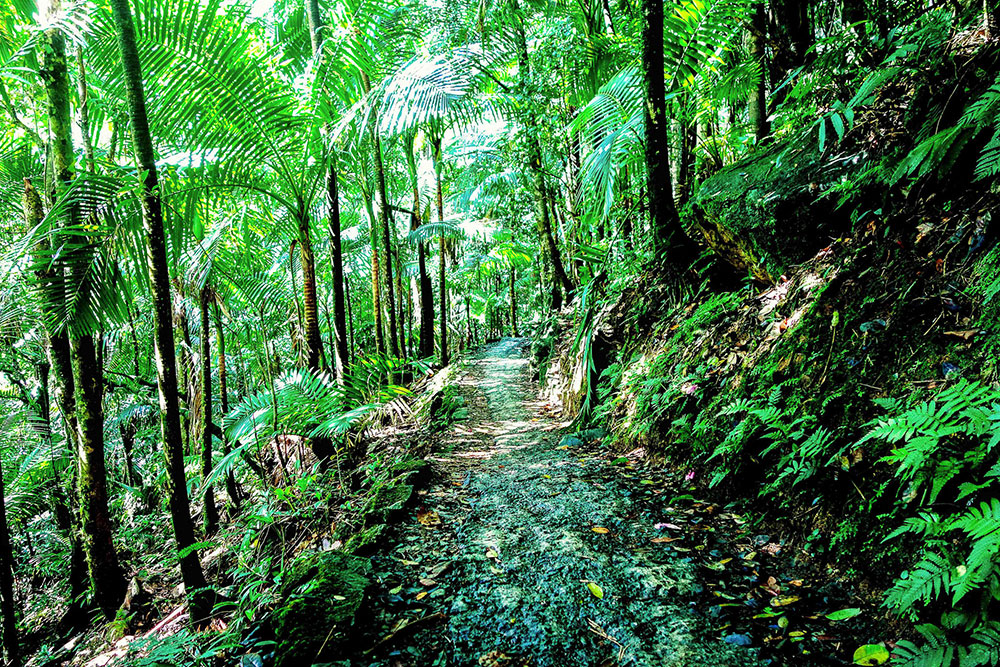 Generally considered a moderately challenging route, it takes an average of 38 min to complete. This is a popular trail for birding, hiking, and walking, but you can still enjoy some solitude during quieter times of day.
Length3.3 kmElevation gain71 mRoute typeOut & back
HikingWalkingBird watchingForestRiverViewsWildflowersWildlifeRocky
Sort by:
Sort byAllTrails SortNewest FirstOldest FirstHighest RatedLowest Rated
CB Nuc
November 21, 2022•Hiking
Difficult to stay on trail
Madeline Cunnings
September 1, 2022•Hiking
The access to go up the bank was tricky to find. There’s two paths up/down and they are very muddy and tough to maneuver. I ran into a guide who told me there’s also the option of walking through the upper path the whole time, you just pay a dollar at the gate. Otherwise nice, but was full of tour groups in the afternoon.
Joshua Bedell
August 13, 2022•Hiking
get there at 7:30am and you should have the trails to yourself!
Enid De Jesus
August 11, 2022•Hiking
My husband love it!!!
Conditions: Muddy
Danyka Byrnes
June 26, 2022•Hiking
The trail is very easy for anyone with good mobility and hiking experience. Anyone searching for all trails, as opposed to booking a tour company, is likely fit enough to do it.
Lots of people but very nice swimming hole. Rope swing for those who like that. You can move a little bit down the river and get some tranquility because the waterfall blocks out most of the noise.
Also, pick up some trash when you come out.
Two options for parking. 5$ to suppose locals or park on the street (I didn’t get ticketed so I assume it was ok).
I wore hiking boots because there is a bit of scrambling on muddy trails. But bring water shoes or sandals for when you are swimming.
Sarah O’Neill
June 4, 2022•Hiking
Definitely very steep and slick mud through quite a bit of the trail. Absolutely loved the waterfall, and swimming area. Could do without the large tourist groups hustled in and out of there. But, great places should be shared.
Alicia Bodoia
June 4, 2022•Hiking
Great
Shelby B
April 23, 2022•Bird watching
Hiked this pre-covid in feb 2020 and did other trails the same day. The path is full or mud and clay which makes it hard. Go in proper hiking boots and take them off to swim and go down the slides bc otherwise bad footwear will not make this fun. Amazing part of el yunque though – do this and other trails!
Conditions: Muddy, Great!
John Nowak
March 27, 2022•Hiking
Worth the trip and visit to this local natural wonder.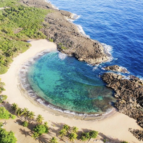 Keep driving past the seemingly public parking lot in the grass (though that is a nice part of the River for a snack or swim). Park in a local driveway/lot for $5. Bring cash. It’s obvious where to park.
The hike to the slide and rope swing/swimming pool is about 25-45 minutes depending on your pacing. Very muddy, so bring water shoes or good hiking boots you don’t mind getting dirty. Surrender to the mud. It’s worth it.
If a man named Bebo is there- introduce yourself and accept any help he offers- he lives on the property and relies on the eco-tourism for income. He’ll take you down the path he cut himself with a machete, show you how to climb the rocks to get to the slide, and even take your picture for you. He has lived there his whole life and is happy to share the land with others. Tip him well and enjoy his stories.
Apparently lots of tours go through there, but we had the place to ourselves around 4-5pm. Just make sure you’re out before dark around 6:30.
Conditions: Muddy
Tressa Mortensen
March 23, 2022•Hiking
This trail was enjoyable but extremely muddy. There are many fun things to do by the river, such as a water slide, jumps into it from different heights, and a rope swing. We had a lot of fun!
Conditions: Muddy, Rocky, Great!
Taylor Fronczak
March 10, 2022•Rock climbing
This area now attracts companies to do tours here… therefore you’ll be surrounded by 100 random people in a small quaint area. This area is no longer enjoyable for locals. There are two parking lots, one on the right when you pull down the street and one at the end of the street. Both will charge you to park. The area is beautiful for natural water slides/ climbing/ jumping off cliffs but with the crazy amount of people, you will wait in line to move anywhere as if it’s a tourist attraction. The walk to the water is all wet mud and slippery clay. You will be covered in mud- don’t try to avoid it!
Conditions: Fee, Muddy, Private property, Rocky
Andrew Finch-Craver
August 13, 2021•Hiking
Amazing pool jumping, muddy as heck.
August 13, 2021
This is accessed via private property ranging from a few bucks to $15+ depending on the trail you take and who is at the gate. Past the chained gate is parking and access along the river to the natural swimming pool, rope jump, and water slide. We went via a tour guide and went along the river. This route requires traversing through the river on rocky river bed and climbing a hillside with footholds. During rainy times it is extremely muddy, but there are ropes to help get up the more steep inclines. Another muddy path with fascinating vegetation and then you have to slide down another muddy crevice to the tinajas. Here you can swim, jump off a 5 ft, 15ft, or 20ft cliff or swing from a rope into the water. From here you can do some light to moderate boulder climbing to a water slide or 30ft cliff jump.
From what our guide said there is another easier path that can be taken through a private property owners land to the tinajas. The parking area is also private but the path itself is supposedly on public land. This used to be a much less traversed area, but once COVID hit and the national forest was closed there was a boom to access this path and many gigantic tour groups now access it.
Daniel Sampiero
August 7, 2021
super fun, nice swim. go early.
Victor De Jesus
July 8, 2021•Hiking
Not an easy trail but is worth
Kristen brennan
June 25, 2021•Hiking
A few things.. if you start in the river and go up the hill it’s very challenging. If you choose to go to the top of the falls, again challenging. If you just take the road and walk to the river and don’t go any further it would be considered easy. Lots of options here. If you choose to, there is a rope swing, swimming hole and 2 natural water slides. Stick to the first water slide, as the second one has quite a current and we saw several people who were stuck in the current and had to be helped by one of the guides of a tour. A bit scary. Beware…there were about 3 tours going on while we were there, so it was super crowded (but we learned a lot from the guides :)). We hiked with teenagers and adults and the teenagers loved it!!!
Lipi Thaker
April 29, 2021
I have 2 tickets for Friday, 4/30 12-3p and need 2 more if anyone has extra! Will buy off of you
Alicia Hunt-Welch
April 16, 2021•Hiking
Guy at the gate wanted $14 to let us in and park. Trail to river point where people jump off rocks into water and swing from a rope. Lots of boulders in the water. First part of trail is blacktop, then clay/ground/small rock/bamboo shreds, then slick clay. A few muddy spots today. The descent down the the river is precarious slick clay eroded between giant tree roots and rocks. Some significant step up/downs; those with bad knees may have trouble.
Conditions: Muddy, Private property, Scramble
Charlie Galik
April 2, 2021•Hiking
So fun! $3 to park with the guy by the chain. Stop there and pay him and then tons of parking. great BBQ spot at the parking lot. Lots of tours going on which can make it a busy trial. Super muddy and even hard difficulty at times. Ends at rope swing and even higher for a cliff jump. Highly recommended!!
Yamila Irizarry-Gerould
February 22, 2021•Hiking
A muddy adventure!! Precioso y súper fun. Bring shoes and clothes that you don’t mind getting dirty. Be wary of rising river and rocks you can’t see under waterfalls.
Conditions: Muddy
Kyle Martineau
February 20, 2021•Hiking
Great place, highly recommend! The trail is very muddy but, once you accept that you’ll be covered in it the hike goes by quick and easy. Make sure you pay for parking. The sign says it’s $3, we parked down the road in a little grass field with about 6 other cars and came back to a very expensive parking ticket. 

Conditions: Muddy, Great!
Crystal Simmons
January 20, 2021•Hiking
I definitely wouldn’t have rated this trail “easy” but we enjoyed it!! It’s impossible to not end up covered in mud, and we didn’t find the trail to be easily marked, so we wound up going through the water for a while. Once we got to the waterfall, though, it was very enjoyable!
Conditions: Fee, Muddy
Jovan Martinez
December 28, 2020•Hiking
Esta bueno. Tiene muchas piedras para tirarse. Amplia piscina. Altamente recomendado.
Conditions: Great!
Arnoldo Gomez
July 6, 2020•Hiking
Good trail, well marked. Get out and Hike!
Conditions: Muddy, Over grown, Rocky
Rochelle Cox
June 17, 2020•Hiking
Great trail scenic and ends in a cool stream
Conditions: Muddy, Private property
David Beach
December 31, 2019
A real pretty site with natural water slides and rapids.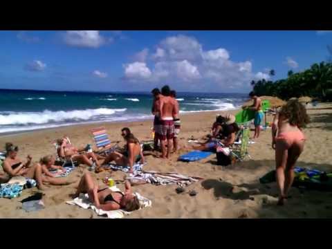 Parking for us was $10 and there’s a trail that will follow along the stream. I recommend wearing water shoes and walk upstream. The water slides and rope swings were full of guided tours and by the time we made it there, there had to be 50 plus people in life vests and helmets on tours. So if that’s your thing……..
Conditions: Muddy
Jarrett Parker
September 21, 2019•Hiking
First to review
You need to pay to park which can be three to four dollars depending on which private lot you use.
There are two different ways to get there but the easiest to find is there is a short trail on the left aide of the river at the parking lot that upon exiting look directly across the river to the path on the right side you take this until it crosses the river one more time.
You hit charco frío first with a rope swing and some small jumps off the rocks. Go up the backside on the right of the rope swing to continue the trail to las tinajas which is amazing natural water slides.
There are two sets of water slide areas. One is higher up and has two slides next to each other that drop you into a small pool. The left one is bumpier but both are fine as long as you don’t stay at the bottom. The second set is right below the first and dumps into a large pool for swimming. DO NOT GO DOWN THE RIGHT SIDE! The left side has a a great really long slide that shoots you into the pool. The right is not a safe slide. If you feel super adventurous you can jump off a high rock dive into that pool also.
You can see from the recoding we spent a lot of time in the pool areas. These are well trafficked paths with tourist groups and locals who put on some amazing cliff diving shows.
You will need to do some rock bouldering and be in relative good shape to complete this hike. Balance is key as a lot of it is near slippery river rocks.
The only reason it doesn’t get five stars is due to this not being a naturalist trail and I hate paying for any part of hiking but I know some people in our group thought it was the best trail on island. No matter what it is a do not miss experience in Puerto Rico!
Conditions: Muddy, Private property, Rocky, Scramble
Lora Coonce
October 2, 2022•Hiking
Eilatan Rackham
September 8, 2022•Hiking
Zak Mcbride
August 30, 2022•Hiking
Showing results 1 – 30 of 88
Weather in Anyatuya today, weather forecast for today Anyatuya, Province of Santiago del Estero, Argentina
GISMETEO: Weather in Anyatuya today, weather forecast for Anyatuya today, Province of Santiago del Estero, Argentina
Switch to mobile version
Now
4:47
+20 67
Pension +20 67
SB, 3 Dec
Today
9000 +1966
+38100
Sun, 4 Dec
Tomorrow
+2272
+41106
0 00
3 00
6 00
00
12 00 9000
15 00 29
9 00 00 9000 21 00
+2373
+2068
+1966
+2984
+3697
+38100
+38100
+2882 +2882
Wind speed, m/cm/h
2-3 7 2-3 7 2-3 7 2-3 7 2-3 7 2-3 7 2-3 7 2-3 7 2-3 7 2-3 7 2-3 7 2-3 7 2-3 7 2-3 7 2-3 7 2-3 7 2-3 7 2-3 7 2-3 7 7 7 -11
0-2 0-7
0-2 0-7
precipitation, mm
Print . ..
..
Wind, m/h
SB, 3 Dec, today
Sun, 4
0 00
3 00
6 00
9,0002
12 00
15 00 3
18
21 00
000 9000 9000 9000 9000 9000 9000 9000 9000 9000 9000 9000 . hPa
Sat, Dec 3, today
Sun, 4
0 00
3 00
6 00
00 2
00
15 00 9000 9000 9000 9000 9000 9000 9000 9000 9000 9000 9000 9000 9000 9000 9000 9000 9000 9000 9000 9000 9000 9000 9000 9000 00
748997
747996
747996
748997
747996
744992
7439990
7439
3
Sun, 4
0 00
3 00
6 00
00 2
00
15 00 9000 9000 9000 9000 9000 9000 9000 9000 9000 9000 9000 9000 9000 9000 9000 9000 9000 9000 9000 9000 9000 9000 9000 9000 00
29
33
34
200003
13
11
10
1
Sun and Moon
SB, December 3
Sun, 4 9000 days: 13 h 50 min
Rise – 6:05
Sunset – 19:56
Today is 1 minute longer than yesterday
The moon is growing, 81%
Sunrise – 14:57 (December 2)
Sunset – 3:00
Full Moon-December 8, after 5 days
Geomagnetic activity, KP-index
SB, 3 Dec, today
Sun, 4
0 00 9000 9000 9000
3 00
6 00 00 00 00 00 00 00 00 00 00 00 00 00 00 00 00 00 00 00 00 00
9 00
12 00
15 00
18 00
21 00
precipitation
Wind
Clones
Ikano
Takaniitas
Lugones
Vilelas
Loshuryes
Bandera
Gars
Pinto
Los Telres
Suncho-corral
Villa-Atamski 9Ol000 the airport. Order transfer & taxi
El Dorado International Airport near Bogotá. It has a traffic of 250.09483 hundreds of thousands of passengers per year. You can get to Bogotá using the bus or public transport, but it can be difficult. It is highly likely that if you take the bus, the astobuses stop at many points along the way, so it will take you a long time to get there. There is a high chance that if you go by public transport, yes, it is cheaper than a private transfer and a taxi, but don’t expect any comfort with your luggage. To save time and money, you can use the transfer booking service from Intui, order a transfer now and, do not worry, how to get to the hotel upon arrival, the voucher can be printed or saved to your tablet / phone, and then all the information and instructions will be with you in advance and at hand, you will not need internet roaming if your plans have changed and you can edit the order in your personal account. Have a nice trip!
___ airport El Dorado International Airport is located next to BogotÎ. It has a traffic of 25.009483 million passengers per year. To get to BogotГЎ, you can choose public transport or taxis, but which have their advantages, however, are you willing to tolerate their disadvantages? . Using public transport to travel may seem like a cheap solution in the beginning, until you realize that you have to wait a few hours if you arrive on an overnight flight. There is a high probability that if you are going to choose a taxi, you need to pay in the taxi in local currency. Intui offers you a fast checkout and a comfortable trip: you know the exact cost of the trip in advance. Have a nice trip! ###
Advance
We will send you landing instructions for El Dorado International Airport, contact details of the local transport company, the name and phone number of the driver.
Individual and group transfers
Personal transfer and meeting with a sign or group transfer by shuttle bus
Professional Services
All transportation is carried out by licensed carrier companies and with passenger insurance.
Range of vehicle makes and models
Select your car by make, model, number of passengers, luggage types
Necessary additional services
You can book a child seat, baby booster, additional hours for the trip
Door to door
You can order a transfer from El Dorado International Airport to a hotel, from a hotel to a hotel, between cities in Colombia
Caring for your trip
If your flight is delayed, we will wait
No hidden fees
Prices for El Dorado International Airport transfers are complete and final
Everything is done online
Free order change in the Personal Account
Auto selection
Transfers El Dorado International Airport according to customer reviews
El Dorado International Airport is located at the following geo-coordinates: longitude 4. 700972 , latitude -74.146097.
The time zone of El Dorado International Airport is UTC -5 hours, which is very important when booking a transfer from / to El Dorado International Airport. Book in advance!
You can order a transfer from El Dorado International Airport to 1565 cities and regions.
You can book a transfer from El Dorado International Airport and a transfer to El Dorado International Airport.
On the Intui website, prices are final, without hidden fees, payment by credit card or other available methods from 42 options.
HOW TO BOOK A TRANSFER El Dorado International Airport ?
To continue, or select a city/area from the list on the page. Or use the search form. In the search form, specify in the Where field: Name of the city or district or the name of the hotel or the address of the villa or apartment.
Next, you will be offered cars to choose from, for transporting from 1 to 150 passengers and their luggage. You can order an individual transfer from / to El Dorado International Airport or a shuttle bus transfer from El Dorado International Airport.