Puerto rico provinces: Regions – Puerto Rico Tourism Company
full list of cities and towns
Puerto Rico
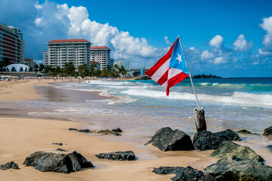
Puerto Rico is an island situated in the northeastern Caribbean Sea, its northern shore facing the Atlantic Ocean. Two small islands off the east coast, Vieques and Culebra, are administratively parts of Puerto Rico, as is Mona Island to the west. It lies approximately 50 miles east of the Dominican Republic, 40 miles west of the Virgin Islands, and 1,000 miles southeast of the U.S. state of Florida. Its governor is Pedro Pierluisi.
Puerto Rico, officially Commonwealth of Puerto Rico (or Estado Libre Asociado de Puerto Rico in Spanish), is a self-governing island commonwealth of the West Indies associated with the USA.
Puerto Rico has a tropical climate with little seasonal variation, although local conditions vary according to elevation and exposure to rain-bearing winds. Plant life is abundant and varied. Tropical rainforests cover parts of the north side of the island. Puerto Rico has more than 200 species of birds, but land animals are mostly confined to nonpoisonous snakes, lizards, mongooses, and the coquí -a frog whose name is onomatopoeic with its call (“co-kee!”) and which has become a kind of national mascot.
In the early 16th century, Spanish explorers founded San Juan. The United States took possession of the island in 1898 until the mid-20th century. Puerto Ricans have been U.S. citizens since 1917, and can move freely between the island and the mainland; however, as residents of an unincorporated territory, American citizens in Puerto Rico are disenfranchised at the national level, do not vote for the president or vice president, and generally do not pay federal income tax.
Beginning in the mid 20th century, the U.S. government, together with the Puerto Rico Industrial Development Company, launched a series of economic projects to develop Puerto Rico into an industrial high-income economy.
Check below a list of all the cities of Puerto Rico, classified according to their number of inhabitants.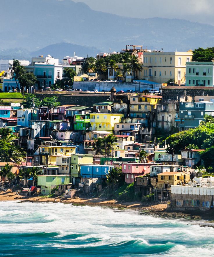 You can click on the area you want to know more about, or look for it using the search bar:
San Juan has a website
Locality of -500 000 inhabitants
Bayamón has a website
Locality of -250 000 inhabitants
Carolina has a website
Locality of -200 000 inhabitants
Ponce has a website
Locality of -200 000 inhabitants
Caguas has a website
Locality of -100 000 inhabitants
Guaynabo has a website
Locality of -100 000 inhabitants
Mayagüez has a website
Locality of -100 000 inhabitants
Trujillo Alto has a website
Locality of -75 000 inhabitants
Arecibo can be contacted by phone
Locality of -50 000 inhabitants
This city or town has an email address and a website
Locality of -50 000 inhabitants
Fajardo has a website
Locality of -40 000 inhabitants
Cataño can be contacted by phone
Locality of -40 000 inhabitants
Vega Baja can be contacted by phone
Locality of -30 000 inhabitants
Guayama has a postal address
Locality of -30 000 inhabitants
Humacao can be contacted by phone
Locality of -30 000 inhabitants
6 Regions in Puerto Rico to Know Before Visiting
For an island spanning just over 9,000 square kilometers (3,500 sq. miles), Puerto Rico packs a punch. The island’s six unique regions comprise diverse topography and mesmerizing natural wonders that provide the exhilarating backdrop for once-in-a-lifetime adventures. Within just a few hours’ drive from vibrant San Juan, you can hike in a mystical cloud forest, surf the best waves in the Caribbean, experience rare bioluminescence, wander Taíno ruins and snorkel right offshore at some of the world’s best beaches. Fascinating cities engage history buffs and art lovers with beautifully restored colonial and neoclassical architecture, acclaimed museums and stirring street art.
Viejo, Old San Juan / Discover Puerto Rico
Metro
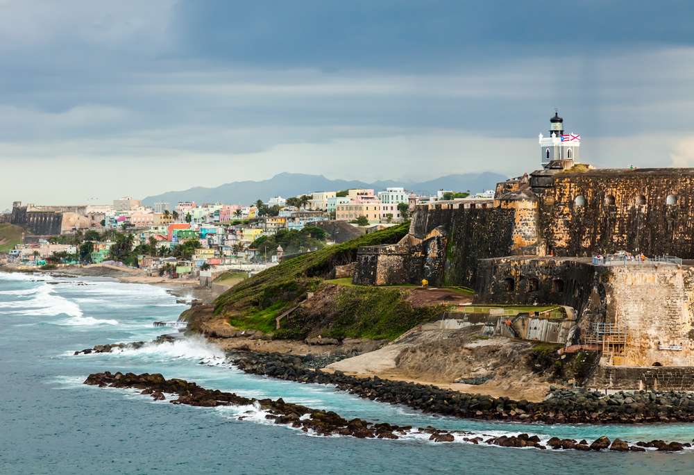
Founded in 1521 by Spanish settlers, Old San Juan showcases the best-preserved Spanish colonial architecture in the Caribbean. The oldest capital city in the U.S., two fortresses—Castillo San Felipe del Morro and Castillo de San Cristóbal—and evocative stone ramparts testify to 400 years of Spanish colonial rule.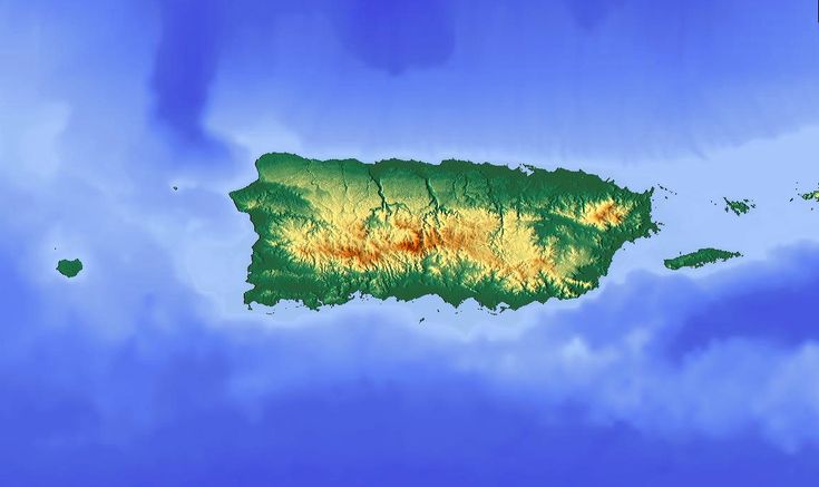 Along cobblestone streets, brightly painted colonial buildings and centuries-old landmarks nudge up against gourmet restaurants, hip art galleries, world-class museums and storied dance halls. Eclectic neighborhoods, palm-fringed beaches, and famed hospitality, San Juan always leaves visitors wanting more. To make sure to not miss out on the best parts this city has to offer, read our guide on best things to do in Old San Juan.
Playa Mar Chiquita / Chase Walker / Discover Puerto Rico
North
Defined by the jungle-cloaked limestone hills and caves of the Karst Region, the wild, rugged North Coast stretches from the white sand beaches of Dorado, just west of San Juan. Just south of the bustline city of Arecibo lies the region’s major crowd pleaser: Las Cavernas del Río Camuy, a gorgeous cave park featuring hikes through gigantic caverns. Between San Juan and Arecibo, there are two glorious beaches—Balneario Cerro Gordo (Vega Alta) and Playa Mar Chiquita (Manatí).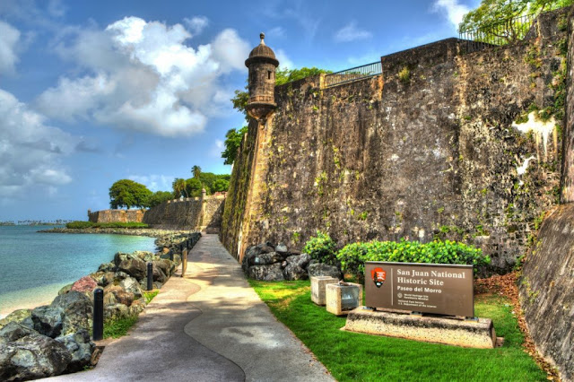 In Utuado, you can explore one of the Antilles’ most important Taíno cultural sites, the Centro Ceremonial Indígena Caguana. At the northwest corner, Isabela’s white sand beaches, framed by dramatic rock formations and lush mountains, draw avid surfers, golfers, hikers and equestrians.
Yunque Rainforest / Discover Puerto Rico
East
The East Coast region is a perfect distillation of Puerto Rico’s natural wonders. Within a short drive you can experience seven of the island’s most important ecosystems. El Yunque rainforest offers extensive hiking trails, breathtaking views, cascading waterfalls and rare, endemic flora and fauna. The lesser known Las Cabezas Nature Reserve features mangrove swamp, offshore cays, coral reefs, freshwater lagoons and a rare bioluminescent bay. The Northeast Ecological Corridor preserves one of the largest leatherback turtle nesting sites in the U.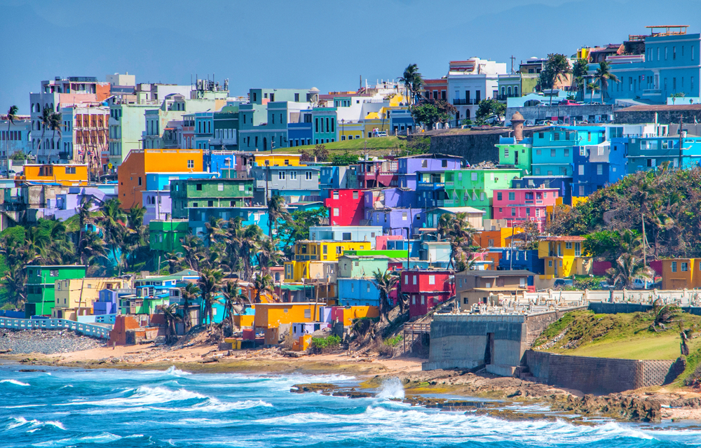 S.. Unassuming Fajardo is the launchpad for superb sailing and snorkeling with a vibrant coral reef hosting a fantastical array of marine life. Offshore, Culebra and Vieques fulfill the tropical island fantasy with gorgeous beaches, calm azure waters and captivating interiors.
Isla de Mona / Omark Reyes / Discover Puerto Rico
West
Puerto Rico’s Northwest region draws sun seekers, nature lovers and watersports enthusiasts to its balmy beaches and surreal landscapes. The charming colonial cities of San Germán and Mayagüez are great bases for exploring the region with secluded beaches to the north and south and a handful of worthy cultural attractions. Fun-loving Aguadilla is the regional nexus with an international airport, family-friendly amenities and well-developed infrastructure. Low-key Rincón is famous for its surfing, holistic vibe and organic foodie culture.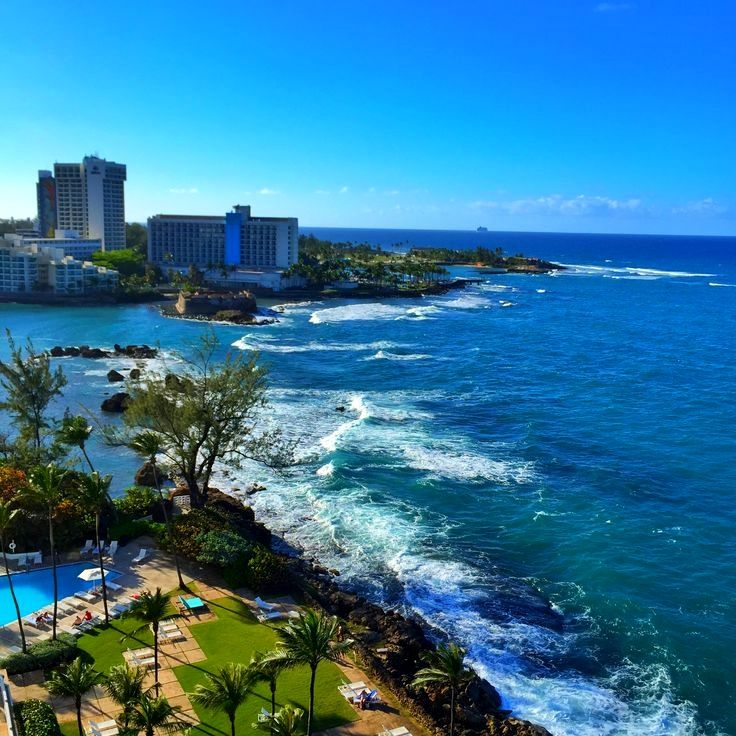 Isla Mona, some 80km (50 miles) offshore, is known as the Galápagos of the Caribbean.
Los Morrillos Lighthouse Cabo Rojo / Beautiful Destinations / Discover Puerto Rico
South
The Southwest region of Puerto Rico combines indigenous history, a wealth of cultural attractions and bewitching natural wonders. As Puerto Rico’s second-largest city, Ponce lives up to its moniker as the “Pearl of the South.” Horse-drawn carriages clip clop along gas-lit streets lined with elegant neoclassical buildings. Home to the exceptional Museo de Arte de Ponce—the best art museum in the Caribbean—the city is a magnet for art lovers. Just outside Ponce, the Tibes Indigenous Ceremonial Center is the largest Taíno site in the Caribbean. Stretching from Guánica through Cabo Rojo are some of the island’s most alluring beaches, including Balneario de Boquerón, one of Puerto Rico’s prettiest public balnearios.
The main appeal of the Southwest Coast is the tranquil waters that allow for swimming and snorkeling right off the beach. The quiet coastal town of Parguera is best known for its bioluminescent bay where billions of luminescent plankton sparkle when they are disturbed by motion in the water.
Cordillera Central moutain range / Beautiful Destinations / Discover Puerto Rico
Cordillera Central
Puerto Rico’s largest mountain range, the Cordillera Central is a wonderland of dense jungle, soaring peaks, magical waterfalls, caves and canyons. An hour’s drive south of the capital, this central region is the epicenter for some of the Caribbean’s most unique adventure activities; hiking, rappelling, spelunking and ziplining. With coffee plantations, colonial haciendas and beautiful views, Jajuya shouldn’t be missed. In Guavate, La Ruta del Lechón provides the perfect initiation into one of Puerto Rico’s beloved national dishes, lechón, or roast suckling pig. La Ruta Panorámica is a well-traveled scenic tour through the region’s dramatic topography. At the center of the region, Bosque Estatal de Toro Negro features the island’s highest peak.
Coronavirus in Puerto Rico | Coronavirus COVID-19 Bulletin
Coronavirus in Puerto Rico | Herald of coronavirus COVID-19
- Beginning
Statistics
Recovery diagram
Indicators
New cases by day
Data by day
Growth rate by day
Values per capita
Table
Cumulative 7-day index
Cumulative 14-day index
Vaccinated population
Mortality rate
Weekly level
Crude death rateDependence on life expectancy
World
World map
Numbers around the world
Review
World excluding ChinaContinents
Africa
Asia
Europe
North America
South America
Oceania
Distribution by continentCountries
List of countries
Coverage by country
Country Comparison
Countries by coverage per capita
Countries compared to China
Distribution by country
Country contributions over timeChina
Total data
Provinces of China
World without China
China excluding Hubei
Countries compared to China
Province comparison
Sorted provinces
Regional distributionRussia
Total data
Regions
Comparison of regions
Regional distributionUSA
Total data
US states
State Comparison
US states by enrollment per capita
State distributionProject
Project News
Project Information
Data sources
Tech BlogLanguage
English
Russian (beta)
Affected population
0 %
This is part of the infected number of people out of a total population of 3 million
All alive
Recovery Chart
The entire chart reflects the total number of confirmed cases in Puerto Rico.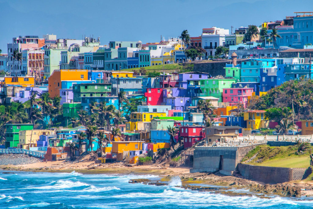
active0007
Daily data
The height of a single column is the total number of people with confirmed coronavirus cases in Puerto Rico. It includes three parts: the number of people who have recovered and those who have died, and the number of people who are in the active phase of the disease.
Logarithmic scale
New cases
The graph shows the number of new cases by day. The light blue bars are the number of new cases reported on that day.
Logarithmic scale
Daily Growth Rate
This shows the change in Growth Rate (as a percentage) in Puerto Rico. The parameter marked on the graph is the number of confirmed cases.
Logarithmic scale
Note. If the rate is positive, then the number of cases is increasing from day to day. If the line as a whole is down, then the speed is decreasing, and although there may be more cases compared to the previous day, the overall trend is down.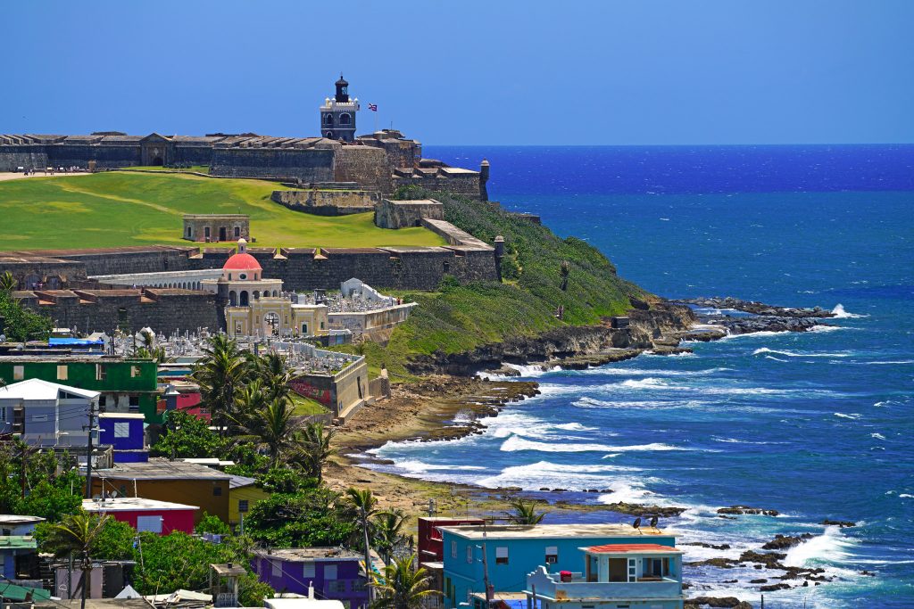 If the rate is negative, then fewer cases were recorded on that day than on the previous one.
Cumulative 7-day index
This and the following graph show the indices that some countries use for setting travel restrictions. The value is the number of new confirmed cases for the last 7 days per 100,000 of population.
Logarithmic scale
Cumulative 14-day index
The value is the number of new confirmed cases for the last 14 days per 100.000 of population.
Logarithmic scale
Values per capita
This shows the number of deaths per 1000 population in Puerto Rico. This parameter is convenient in that it can be directly compared across countries.
Logarithmic scale
Download as CSV | XLS
| Date | Confirmed cases | Daily increase, % | Recovered | Fatal cases | Active cases | Recovery rate , % | Mortality rate , % | Population covered , % | Confirmed per 1000 | Died per 1000 |
|---|
Statistics by continent
The whole world
Africa
Asia
Europe
North America
Oceania
South America
Statistics according to countries
Australia ▲
Austria △
Azerbaijan ▲
ALS
Angilla
Angola
Andorra ▽
Antigua and Barbuda
Argentina ▽
Armenia ▽
Aruba ▽
Afghanistan ▲
Bagama ▼
Bangladesh △
Barbados ▽
Bahrain △
Belarus
Belize ▽
Belgium △
Benin ▽
Bulgaria △
Bolivia △
Bolivia ▼
Boin $
. and Saba ▽
Bosnia and Herzegovina ▽
Botswana
Brazil △
Brunes-Daroussals ▽
Burkina-Faso
Burundi ▽
Budan ▽
Vanuatu
Vatican
Great Britain ▽
Hungary ▽
Venezuela ▼
Virgin Islands (Great Britain)
Eastern Timmor △
Vietnam ▲
GAITI △
GAMBIA 9000 9000 9000 9000 9000 9000 9000 9000 9000 ▽
Guadelup ▽
Guatemala ▲
Guinea ▽
Gvinea-Bisau
Germany ▲
Gibraltar ▽
Honduras ▽
Grenadies ▽
Greenland
Greece ▽
Georgia
GUAM
Denmark ▽
Dzhabuti
Dominica
Dominican Republic ▽
Egypt
Israeli △
Israeli Isravy △
Isravy △
Israel
Jordan
Iraq ▽
Iran ▲
Ireland ▽
Iceland
Spain ▽
Yemen
0006 Cabostrude ▽
Kazakhstan ▽
Cambodia ▽
Cameroon
Canada ▲
Catar △
Kenya ▽
Cyprus ▽
Kyrgyzstan ▽
9000 ▽
▽
9000 9000 9000 9000 9000 9000 9000 9000 9000 9000 9000 9000 9000 9000 9000 9000 9000 9000
Congo-Brazzavil △
Congo-Kinshasa ▽
Kosovo ▼
Costa ▽
Cuba ▼
Kuwait ▽
Curasao ▽
Laos ▲
Latvia ▽
Lesoto
Liberia ▽
Lebanon ▼
Libya ▽
Lithuania ▲
Liechtenstein ▼
Luxembourg ▽
Mauritan ▽
9000 ▽
△
Majvota ▽
) Malaysia △
Mali ▼
Maldives ▽
Malta △
Morocco ▲
Martinics ▽
Marshalls of the island
Mexico ▽
Mozambik ▽
Moldova ▽
Monaco △
Mongolia △
Montserrat
Myanmar (Birma) ▽
Namibia
Nauru ▽
Nepal ▼
Nigeria ▽
9000 Zealand ▽
New Caledonia ▽
Norway ▲
OAE ▼
Oman ▽
Island of Mena
Kaiman Island ▽
Terks and Kaikos
Pakistan ▽
Palau ▽
Palestinian territories
Panama ▽
Papua-New Guinea △
Paraguay ▽
Peru ▼
Poland ▲▲
Portugal ▽
Puerto-RICO
Korea △
Ryunson
Russia ▲
Rwanda ▽
Romania ▲
Salvador
Sam
San Marino ▽
San Tome and Principi
Saudi Arabia ▽
Northern Macedonia
Seychelles
Saint-Barteli ▽
Saint-Pierre and Michelon ▽
Senegal ▼
Saint-Kits and Nevis ▽
Saint-Lucia ▽
Serbia △
Singapore △
Sint-Marten ▽ Marten
Syria ▽
Slovakia ▲
Slovenia ▲
The United States of America ▲
Solomon Island ▽
Somali
Sudan ▽
Surinam
Sierra Leone ▽
Tajikistan
007
Thailand ▽
Taiwan △
Tanzania ▽
TO ▼
TUGA
Trinidad and Tobago ▽
Tuvalu ▽
Tunisa ▽
Turkish
Uganda ▽
9000 9000 △ 9000 △ 9000 △ △ 9000 △ △ 9000 △ △ 9000 △ △ 9000 △,000 Uruguay ▽
Faroe Islands
Federated States of Micronesia
Fiji △
Philippines △
Finland △
Falkland Islands
9000 France0007
French Guviana ▽
French Polynesia ▽
Croatia ▲
Central African Republic
Polo ▽
Montenegro △
Czech Republic ▲
Switzerland ▽
Sweden
Svet △
Ecuador
Equatorial Guinea ▽
Eritrea
Esvatini ▽
Estonia ▽
Ethiopia ▲
South African Republic ▽
Southern Sudan ▽
Jamaica ▽
Japan △
Green and red arrows next to country names show the trend in new confirmed cases over the past week.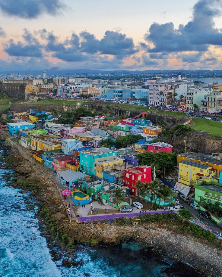
Tweet
Share
Send
Send
Based on data collected by the Johns Hopkins University Center for Systems Science and Engineering.
This site shows the same public data in a less dramatic light than the original Johns Hopkins dashboard. Updated around 9-10 am Moscow time.
Read the tech blog. Source code: GitHub. Raku programming language.
Site created by Andrey Shitov. Twitter: @andrewshitov. Communication by e-mail.
Visit Puerto Rico | Tourist information
Visiting Puerto Rico | Tourist information
PUERTO RICO
Visit and discover Puerto Rico sleep away and feel at ease
Puerto Rico in Spanish means Wealthy Port is officially known as the Commonwealth of Puerto Rico. This is the largest island territory that belongs to the United States and is located in the northeastern province of the Caribbean. San Juan is the capital and popular city and has Spanish as its official language along with English.
The islands cultural, physical and ethnic took on a major transformation during the Spanish rule, which lasted for four centuries. United States after the Spanish-American War in 18
history
The history of the island of Puerto Rico began with the resolution of the same archipelago by the Ortoiroid culture between 2000 and 3000BC. In 1492, when Christopher Columbus arrived on the island, the Taínos had a culture. Puerto Rico formed the bulk of the Spanish empire as it is located in the northeastern Caribbean. Cuba and Puerto Rico were the last two Spanish colonies in the New World. The first years of the 20th century are remembered for the struggle and war to win democratic rights from the US.
Population
The entire population of Puerto Rico was formed by Indians confinement, colonization of Europe, especially during the Spanish Empire, economic migration, and slavery. The inhabitants of the island before the first European contacts belonged to the Arawak group of Amerindians. Most of the immigrants included Catholics who came from France, Italy and Ireland.
climate
Puerto Rico has a tropical climate with moderate temperatures all year round. The trade winds from the East pass through the islands all year round and the rainy season extends from April – November. The mountains of the Cordillera cause significant changes in precipitation and temperature, as well as variations in wind speed and direction. About a quarter of Puerto Rico’s precipitation occurs during tropical cyclones.
Italian
Cosi Come Sei
Barranco Agua de la Perra | Mall Waves, 35130 Puerto Rico, Gran Canaria, Spain
+34 928 56 22 22
http://restaurantecosicomesi.com/
Mediterranean Sea
+34 928 56 20 44
http://www.